Toggle navigation
LMEC Home
Exhibitions
Georeferencing
Tools for Teachers
Collections
My Favorites
Sign Up / Log In
Search
Search the map portal
Map Collection
Map Collection
Map Sets
Search
Search
Search for
Search In
All Fields
Creator
Title
Subject
Place
Search All Digital Collections
Advanced Search
8565 Results
My Search
Start Over
More Like
commonwealth:wd376390t
Remove constraint More Like: commonwealth:wd376390t
Filter your Search
Place
North and Central America
5,859
United States
4,783
Massachusetts
2,056
Europe
1,359
Suffolk (county)
1,038
Boston
1,011
Canada
448
Asia
422
more
Place
»
Topic
Boston (Mass.)--Maps
580
United States--Maps
278
Real property--Massachusetts--Boston--Maps
175
Massachusetts--Maps
160
Landowners--Massachusetts--Boston--Maps
133
North America--Maps--Early works to 1800
103
New England--Maps
101
Europe--Maps
78
more
Topic
»
Date
Date range begin
–
Date range end
Current results range from
1482
to
2023
View distribution
Creator
United States. Hydrographic Office
594
O.H. Bailey & Co
147
Des Barres, Joseph F. W. (Joseph Frederick Wallet), 1722-1824
123
United States. Post Office Dept
120
Ptolemy, 2nd cent
100
Walling, Henry Francis, 1825-1888
94
Geological Survey (U.S.)
86
Jefferys, Thomas, -1771
85
more
Creator
»
Format
Maps/Atlases
8,506
Manuscripts
215
Prints
56
Books
36
Objects/Artifacts
10
Drawings/Illustrations
8
Posters
4
Georeferenced
Yes
869
No
7,696
Collection
Norman B. Leventhal Map & Education Center Collection
8,565
Boston and New England Maps
2,209
Urban Maps
1,939
Maritime Charts and Atlases
1,081
American Revolutionary War-Era Maps
616
Boston Redevelopment Authority Collection
87
Available to use
No known restrictions
8,424
Creative Commons license
46
Search Constraints
Sort by relevance
relevance
title
date (asc)
date (desc)
Number of results to display per page
20 per page
10
per page
20
per page
50
per page
100
per page
View results as:
grid view
map view
Search Results
1961.
Dominia anglorum in præcipuis insulis Americæ ut sunt insula : S. Christophori, Antegoa, Iamaica, Barbados : nec non insulae...
1962.
Dominica
1963.
Dominica from an actual survey compleated in the year 1773
1964.
Dominican Republic road map 1:250,000
1965.
Dominio Fiorentino
1966.
Dominion of Canada
1967.
Dominion of Canada, Cape Breton Island, Saint Anne Harbor and Great Bras d'Or : from British surveys in 1848-57
1968.
Dominion of Canada, Cape Breton Island, Scatari Island and Menadou Passage : from a British survey in 1850
1969.
Dominion of Canada, Cape Breton Island, Sydney Harbor : from a British survey in 1849
1970.
The Dominion of Canada from the latest surveys and data
1971.
Dominion of Canada, Gulf of Saint Lawrence, Amet Sound and anchorages (Nova Scotia) : from a British survey in 1841
1972.
Dominion of Canada, Gulf of Saint Lawrence, Amherst Harbor (Magdalen Islands) : from a British survey in 1833 ; Dominion of...
1973.
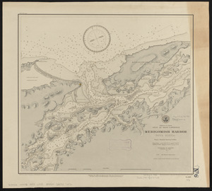
Dominion of Canada, Gulf of Saint Lawrence, Merigomish Harbor (Nova Scotia) : from a British survey in 1842
1974.
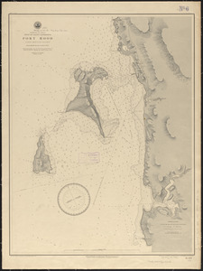
Dominion of Canada, Gulf of Saint Lawrence, Port Hood (Cape Breton Island) : from British surveys in 1847 & 1873
1975.
Dominion of Canada, Gulf of Saint Lawrence, Shediac Bay and Harbor (New Brunswick) : from a British survey in 1885
1976.
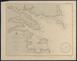
Dominion of Canada, Gulf of St. Lawrence, Cardigan Bay (Prince Edward Island) : from a British survey in 1844
1977.
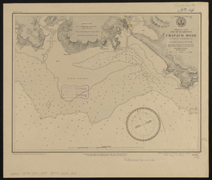
Dominion of Canada, Gulf of St. Lawrence, Crapaud Road (Prince Edward I.) : from British surveys in 1842 & 1882
1978.
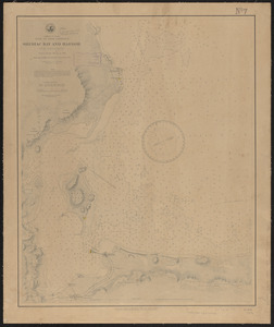
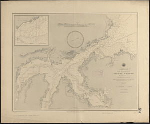
Dominion of Canada, Gulf of St. Lawrence, Pictou Harbor (Nova Scotia) : from British surveys in 1843 & 80
1979.
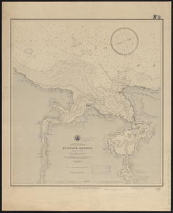
Dominion of Canada, Gulf of St. Lawrence, Pugwash Harbor (Nova Scotia) : from a British survey in 1840
1980.
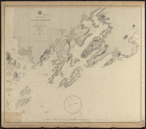
Dominion of Canada, New Brunswick, L'Etang Harbor (Bay of Fundy) : from a British survey in 1847
‹ Prev
Next ›
1
2
…
95
96
97
98
99
100
101
102
103
…
428
429