Toggle navigation
LMEC Home
Exhibitions
Georeferencing
Tools for Teachers
Collections
My Favorites
Sign Up / Log In
Search
Search the map portal
Map Collection
Map Collection
Map Sets
Search
Search
Search for
Search In
All Fields
Creator
Title
Subject
Place
Search All Digital Collections
Advanced Search
8763 Results
My Search
Start Over
More Like
commonwealth:wd3763069
Remove constraint More Like: commonwealth:wd3763069
Filter your Search
Place
North and Central America
5,994
United States
4,904
Massachusetts
2,082
Europe
1,396
Suffolk (county)
1,045
Boston
1,018
Canada
463
Asia
438
more
Place
»
Topic
Boston (Mass.)--Maps
586
United States--Maps
282
Real property--Massachusetts--Boston--Maps
175
Massachusetts--Maps
162
Landowners--Massachusetts--Boston--Maps
133
North America--Maps--Early works to 1800
108
New England--Maps
102
New England--Maps--Early works to 1800
97
more
Topic
»
Date
Date range begin
–
Date range end
Current results range from
1482
to
2023
View distribution
Creator
United States. Hydrographic Office
595
O.H. Bailey & Co
148
Des Barres, Joseph F. W. (Joseph Frederick Wallet), 1722-1824
123
United States. Post Office Dept
120
Ptolemy, 2nd cent
100
Walling, Henry Francis, 1825-1888
94
Jefferys, Thomas, -1771
89
Geological Survey (U.S.)
86
more
Creator
»
Format
Maps/Atlases
8,703
Manuscripts
217
Prints
56
Books
36
Objects/Artifacts
10
Drawings/Illustrations
8
Posters
5
Georeferenced
Yes
875
No
7,888
Collection
Norman B. Leventhal Map & Education Center Collection
8,721
Boston and New England Maps
2,242
Urban Maps
2,023
Maritime Charts and Atlases
1,086
American Revolutionary War-Era Maps
652
Boston Redevelopment Authority Collection
87
Mapping Boston Collection
26
Sidney R. Knafel Map Collection at Phillips Academy
15
more
Collection
»
Available to use
No known restrictions
8,554
Creative Commons license
87
Search Constraints
Sort by relevance
relevance
title
date (asc)
date (desc)
Number of results to display per page
20 per page
10
per page
20
per page
50
per page
100
per page
View results as:
grid view
map view
Search Results
101.
A mapp of New England
102.
A new and accurate map of the present seat of war in North America : from a late survey
103.
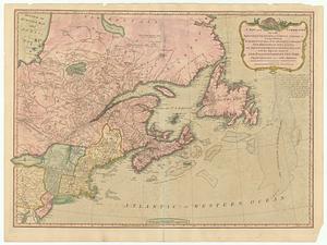
A new and correct map of the British colonies in North America : comprehending eastern Canada with the province of Quebec, New...
104.
New England : the most remarqueable parts thus named by the high and mighty Prince Charles, prince of great Britaine
105.
New England : the most remarqueable parts thus named by the high and mighty Prince Charles, nowe King of great Britaine
106.
New England and New York
107.
New England and New York
108.
New France, New Englande, New Scotlande, and New Foundlande
109.
A new map of New England, New York, New Iarsey, Pensilvania, Maryland and Virginia
110.
A new map of Nova Scotia and Cape Breton Island : with the adjacent parts of New England and Canada composed from a great...
111.
A new map of Nova Scotia, and Cape Britain : with the adjacent parts of New England and Canada, composed from a great number of...
112.
A new map of the most considerable plantations of the English in America
113.
A new mapp of New England and Annapolis and the countrys adjacent
114.
Noua Anglia, Nouum Belgium, et Virginia
115.
Nouvelle Angleterre et Nouvel York
116.
Nouvelle Hollande (à présent Nouvelle-York), Nouvelle-Angleterre, et une partie de la Virginie
117.
Nova Belgica et Anglia Nova
118.
Novi Belgii, Novaeque Angliae nec non partis Virginiae tabula
119.
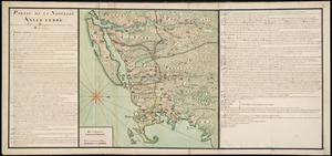
Partie de la Novvelle Angleterre contenant les villes, les bourgs, et le commerce des habitans
120.
Partie septentrionale des possessions Angloise en Amerique : pour servire d'intelligence à la guerre présente entre les...
‹ Prev
Next ›
1
2
3
4
5
6
7
8
9
10
…
438
439