Toggle navigation
LMEC Home
Exhibitions
Georeferencing
Tools for Teachers
Collections
My Favorites
Sign Up / Log In
Search
Search the map portal
Map Collection
Map Collection
Map Sets
Search
Search
Search for
Search In
All Fields
Creator
Title
Subject
Place
Search All Digital Collections
Advanced Search
8878 Results
My Search
Start Over
More Like
commonwealth:wd376217m
Remove constraint More Like: commonwealth:wd376217m
Filter your Search
Place
North and Central America
6,109
United States
5,025
Massachusetts
2,147
Europe
1,396
Suffolk (county)
1,214
Boston
1,187
Canada
449
Asia
438
more
Place
»
Topic
Boston (Mass.)--Maps
752
United States--Maps
282
Real property--Massachusetts--Boston--Maps
195
Massachusetts--Maps
166
City planning--Massachusetts--Boston--Maps
160
Landowners--Massachusetts--Boston--Maps
142
New England--Maps
104
North America--Maps--Early works to 1800
103
more
Topic
»
Date
Date range begin
–
Date range end
Current results range from
1482
to
2023
View distribution
Creator
United States. Hydrographic Office
595
Boston Redevelopment Authority
164
O.H. Bailey & Co
148
Des Barres, Joseph F. W. (Joseph Frederick Wallet), 1722-1824
124
United States. Post Office Dept
120
Ptolemy, 2nd cent
100
Walling, Henry Francis, 1825-1888
94
Geological Survey (U.S.)
87
more
Creator
»
Format
Maps/Atlases
8,818
Manuscripts
215
Prints
56
Books
36
Objects/Artifacts
10
Drawings/Illustrations
8
Posters
6
Georeferenced
Yes
885
No
7,993
Collection
Norman B. Leventhal Map & Education Center Collection
8,731
Boston and New England Maps
2,368
Urban Maps
2,144
Maritime Charts and Atlases
1,087
American Revolutionary War-Era Maps
644
Boston Redevelopment Authority Collection
194
Mapping Boston Collection
27
William L. Clements Library Collection
15
more
Collection
»
Available to use
No known restrictions
8,668
Creative Commons license
78
Search Constraints
Sort by relevance
relevance
title
date (asc)
date (desc)
Number of results to display per page
20 per page
10
per page
20
per page
50
per page
100
per page
View results as:
grid view
map view
Search Results
421.
New map of Boston from latest surveys
422.
New map of Boston giving all points of interest : with every railway & steamboat terminus, prominent hotels, theatres & public...
423.
New map of Boston giving all points of interest : with every railway & steamboat terminus, prominent hotels, theatres & public...
424.
New map of Boston giving all points of interest : with every railway & steamboat terminus, prominent hotels, theatres & public...
425.
New map of the central portion of Boston
426.
New map of the vicinity of Boston, with the dates of settlement and distance from the capital
427.
New map of the vicinity of Boston, with the dates of settlement and distance from the capital
428.
New map of the vicinity of Boston, with the dates of settlement, population in 1840, and distance from the capital
429.
A new plan of Boston : drawn from the best authorities with the latest improvements, additionas and corrections
430.
Official map of Boston
431.
Old Boston, compiled from the Book of possessions
432.
One way streets, metered block faces, parking restriction areas and signal locations within the Boston regional core
433.
Open space 2017
434.
Outline map of Boston
435.
Outline plan showing the growth of Boston
436.
Panoramic view of Boston centered on the Prudential Tower
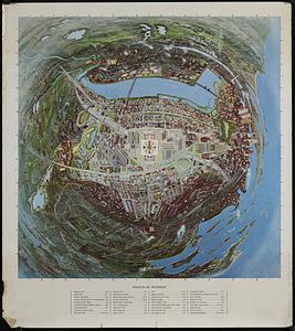
437.
Panoramic view of Boston showing golden semicircle
438.
Percent foreign-born
439.
Peremptory sale : this valuable property will positively be sold at public auction on Saturday the 29th day of April current at...
440.
Pianta della città di Boston
‹ Prev
Next ›
1
2
…
18
19
20
21
22
23
24
25
26
…
443
444