Toggle navigation
LMEC Home
Exhibitions
Georeferencing
Tools for Teachers
Collections
My Favorites
Sign Up / Log In
Search
Search the map portal
Map Collection
Map Collection
Map Sets
Search
Search
Search for
Search In
All Fields
Creator
Title
Subject
Place
Search All Digital Collections
Advanced Search
8848 Results
My Search
Start Over
More Like
commonwealth:tt44pv58g
Remove constraint More Like: commonwealth:tt44pv58g
Filter your Search
Place
North and Central America
6,079
United States
4,997
Massachusetts
2,090
Europe
1,396
Suffolk (county)
1,199
Boston
1,172
Canada
449
Asia
438
more
Place
»
Topic
Boston (Mass.)--Maps
607
United States--Maps
282
Real property--Massachusetts--Boston--Maps
253
City planning--Massachusetts--Boston--Maps
173
Landowners--Massachusetts--Boston--Maps
169
Massachusetts--Maps
162
North America--Maps--Early works to 1800
103
New England--Maps
102
more
Topic
»
Date
Date range begin
–
Date range end
Current results range from
1482
to
2023
View distribution
Creator
United States. Hydrographic Office
595
Boston Redevelopment Authority
174
O.H. Bailey & Co
148
Des Barres, Joseph F. W. (Joseph Frederick Wallet), 1722-1824
123
United States. Post Office Dept
120
Ptolemy, 2nd cent
100
Walling, Henry Francis, 1825-1888
94
Geological Survey (U.S.)
86
more
Creator
»
Format
Maps/Atlases
8,788
Manuscripts
215
Prints
56
Books
36
Objects/Artifacts
10
Drawings/Illustrations
8
Posters
5
Georeferenced
Yes
871
No
7,977
Collection
Norman B. Leventhal Map & Education Center Collection
8,697
Boston and New England Maps
2,351
Urban Maps
2,140
Maritime Charts and Atlases
1,083
American Revolutionary War-Era Maps
616
Boston Redevelopment Authority Collection
203
Massachusetts Real Estate Atlases
35
Applied Geographics, Inc. Records
2
more
Collection
»
Available to use
No known restrictions
8,670
Creative Commons license
48
Search Constraints
Sort by relevance
relevance
title
date (asc)
date (desc)
Number of results to display per page
20 per page
10
per page
20
per page
50
per page
100
per page
View results as:
grid view
map view
Search Results
7281.
Richards standard atlas of the city of Lynn and the towns of Swampscott, Saugus and Nahant, Massachusetts : from official...
7282.
Richards standard atlas of the city of Springfield and the town of Longmeadow, Massachusetts
7283.
Richards standard atlas of the city of Springfield and the town of Longmeadow, Massachusetts [plate 1]
7284.
Richards standard atlas of the city of Springfield and the town of Longmeadow, Massachusetts [plate 10]
7285.
Richards standard atlas of the city of Springfield and the town of Longmeadow, Massachusetts [plate 9]
7286.
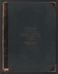
Richards standard atlas of the City of Worcester Massachusetts : containing thirty-one double page maps in colors, covering the...
7287.
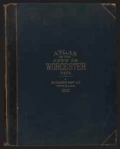
Richards standard atlas of the City of Worcester Massachusetts : containing thirty-one double page maps in colors, covering the...
7288.
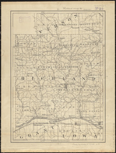
Richland County, Wis.
7289.
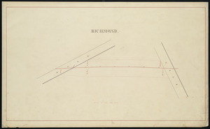
Richmond
7290.
Richmond and its defences : constructed and engraved to illustrate "The war with the South"
7291.
Richmond Petersburg and vicinity
7292.
Richmond Petersburg and vicinity
7293.
The River & Gulf of St. Lawrence, Newfoundland, Nova Scotia, and the banks adjacent : from the British Admiralty, French Marine...
7294.
River S Claire
7295.
The River St. John
7296.
La Riviere de la Garomne et la Dordogne et le pays aux environs de Bordeaux
7297.
R.L. Polk & Co.'s map of Bay City, and Essexville Mich
7298.
R.L. Polk & Co's map of greater Battle Creek and suburbs
7299.
R.L. Polk & Co's map of Memphis, Tenn : from official records and original plats
7300.
Road map, drawn & engraved expressly for Road book of Boston & vicinity
‹ Prev
Next ›
1
2
…
361
362
363
364
365
366
367
368
369
…
442
443


![Richards standard atlas of the city of Springfield and the town of Longmeadow, Massachusetts [plate 1]](https://bpldcassets.blob.core.windows.net/derivatives/images/commonwealth:3f463814r/image_thumbnail_300.jpg)
![Richards standard atlas of the city of Springfield and the town of Longmeadow, Massachusetts [plate 10]](https://bpldcassets.blob.core.windows.net/derivatives/images/commonwealth:3f463818v/image_thumbnail_300.jpg)
![Richards standard atlas of the city of Springfield and the town of Longmeadow, Massachusetts [plate 9]](https://bpldcassets.blob.core.windows.net/derivatives/images/commonwealth:3f4638169/image_thumbnail_300.jpg)