Toggle navigation
LMEC Home
Exhibitions
Georeferencing
Tools for Teachers
Collections
My Favorites
Sign Up / Log In
Search
Search the map portal
Map Collection
Map Collection
Map Sets
Search
Search
Search for
Search In
All Fields
Creator
Title
Subject
Place
Search All Digital Collections
Advanced Search
8792 Results
My Search
Start Over
More Like
commonwealth:tt44pv58g
Remove constraint More Like: commonwealth:tt44pv58g
Filter your Search
Place
North and Central America
6,036
United States
4,956
Massachusetts
2,076
Europe
1,388
Suffolk (county)
1,193
Boston
1,166
Canada
449
Asia
436
more
Place
»
Topic
Boston (Mass.)--Maps
602
United States--Maps
279
Real property--Massachusetts--Boston--Maps
253
City planning--Massachusetts--Boston--Maps
172
Landowners--Massachusetts--Boston--Maps
169
Massachusetts--Maps
161
North America--Maps--Early works to 1800
103
New England--Maps
101
more
Topic
»
Date
Date range begin
–
Date range end
Current results range from
1482
to
2023
View distribution
Creator
United States. Hydrographic Office
595
Boston Redevelopment Authority
174
O.H. Bailey & Co
148
Des Barres, Joseph F. W. (Joseph Frederick Wallet), 1722-1824
123
United States. Post Office Dept
120
Ptolemy, 2nd cent
100
Walling, Henry Francis, 1825-1888
94
Geological Survey (U.S.)
86
more
Creator
»
Format
Maps/Atlases
8,733
Manuscripts
215
Prints
56
Books
36
Objects/Artifacts
10
Drawings/Illustrations
8
Posters
4
Georeferenced
Yes
871
No
7,921
Collection
Norman B. Leventhal Map & Education Center Collection
8,641
Boston and New England Maps
2,338
Urban Maps
2,102
Maritime Charts and Atlases
1,083
American Revolutionary War-Era Maps
616
Boston Redevelopment Authority Collection
203
Massachusetts Real Estate Atlases
35
Applied Geographics, Inc. Records
2
more
Collection
»
Available to use
No known restrictions
8,614
Creative Commons license
48
Search Constraints
Sort by relevance
relevance
title
date (asc)
date (desc)
Number of results to display per page
20 per page
10
per page
20
per page
50
per page
100
per page
View results as:
grid view
map view
Search Results
3701.
Map of Boston, comprising the whole city, with the new boundaries of the wards
3702.
A map of Boston, county of Suffolk and the adjacent towns
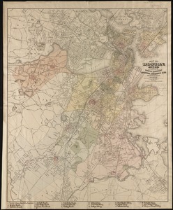
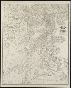
3703.
Map of Boston for 1874
3704.
Map of Boston, for 1874
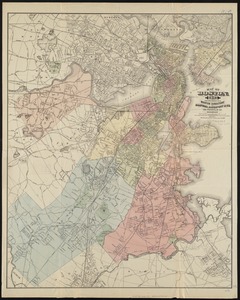
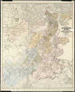
3705.
Map of Boston, for 1875
3706.
Map of Boston, for 1876
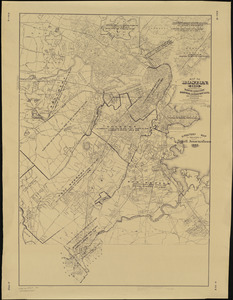
3707.
Map of Boston, for 1877
3708.
Map of Boston, for 1878
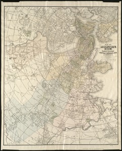
3709.
Map of Boston, for 1879
3710.
Map of Boston for 1880
3711.
Map of Boston, for 1881
3712.
Map of Boston, for 1881
3713.
Map of Boston, for 1882
3714.
Map of Boston, for 1883
3715.
Map of Boston, for 1883
3716.
Map of Boston, for 1884
3717.
Map of Boston, for 1885
3718.
Map of Boston, for 1886
3719.
Map of Boston, for 1887
3720.
Map of Boston, for 1888
‹ Prev
Next ›
1
2
…
182
183
184
185
186
187
188
189
190
…
439
440