Toggle navigation
LMEC Home
Exhibitions
Georeferencing
Tools for Teachers
Collections
My Favorites
Sign Up / Log In
Search
Search the map portal
Map Collection
Map Collection
Map Sets
Search
Search
Search for
Search In
All Fields
Creator
Title
Subject
Place
Search All Digital Collections
Advanced Search
9020 Results
My Search
Start Over
More Like
commonwealth:tq57t2387
Remove constraint More Like: commonwealth:tq57t2387
Filter your Search
Place
North and Central America
6,247
United States
5,130
Massachusetts
2,098
Europe
1,396
Suffolk (county)
1,066
Boston
1,034
Canada
463
Asia
438
more
Place
»
Topic
Boston (Mass.)--Maps
594
United States--History--Revolution, 1775-1783--Maps
330
United States--Maps
283
Real property--Massachusetts--Boston--Maps
175
Massachusetts--Maps
163
Landowners--Massachusetts--Boston--Maps
133
New England--Maps
103
North America--Maps--Early works to 1800
103
more
Topic
»
Date
Date range begin
–
Date range end
Current results range from
1482
to
2023
View distribution
Creator
United States. Hydrographic Office
595
O.H. Bailey & Co
148
Des Barres, Joseph F. W. (Joseph Frederick Wallet), 1722-1824
124
United States. Post Office Dept
120
Ptolemy, 2nd cent
100
Walling, Henry Francis, 1825-1888
94
Jefferys, Thomas, -1771
87
Geological Survey (U.S.)
86
more
Creator
»
Format
Maps/Atlases
8,955
Manuscripts
219
Prints
56
Books
36
Drawings/Illustrations
13
Objects/Artifacts
10
Posters
5
Georeferenced
Yes
871
No
8,149
Collection
Norman B. Leventhal Map & Education Center Collection
8,695
Boston and New England Maps
2,233
Urban Maps
2,023
Maritime Charts and Atlases
1,083
American Revolutionary War-Era Maps
942
William L. Clements Library Collection
305
Boston Redevelopment Authority Collection
87
Maps from AAS
7
more
Collection
»
Available to use
No known restrictions
8,555
Creative Commons license
52
Search Constraints
Sort by relevance
relevance
title
date (asc)
date (desc)
Number of results to display per page
20 per page
10
per page
20
per page
50
per page
100
per page
View results as:
grid view
map view
Search Results
301.
Southern New York and northern New Jersey
302.
St. Eustatia topographically drawn & humbly dedicated to his excellency John Vaughan commander in chief of his majestys forces...
303.
Stony Point
304.
Sullivans Island
305.
A survey of Lake Champlain, including Lake George, Crown Point and St. John : surveyed by order of his excellency Major-General...
306.
A survey of the defile and that part of York Island adjacent to Fort Knyphausen
307.
A survey of the peninsula of Charles Town shewing the three posts now garrison'd by his majesty's troops for the winter : 10th...
308.
The theatre of war in North America, with the roads and a table of the distances
309.
Thirty-miles round Boston
310.
This sketch represents nearly the figure and proportions of the work in front of the dock yard at Hallifax as it was traced and...
311.
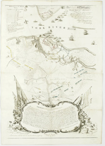
To his e[xcellency] G. Washington commander in chief of the armies of the United States of America this plan of the investment...
312.
To His Excellency Genl. Washington, Commander in Chief of the armies of the United States of America : this plan of the...
313.
A topographical chart of the bay of Narraganset in the province of New England, with all the isles contained therein, among...
314.
The United States of America laid down from the best authorities, agreeable to the peace of 1783
315.
Valley of the Hudson River from Fishkill to Teller's Point
316.
Verplanks
317.
Verplanks Point
318.
View from the blockhouse : Dorchester Neck
319.
View of Dorchester Neck from Enoch Brown's
320.
View of Dorchester Neck, from the mess house on Fort Hill
‹ Prev
Next ›
1
2
…
12
13
14
15
16
17
18
19
20
…
450
451


![To his e[xcellency] G. Washington commander in chief of the armies of the United States of America this plan of the investment of York and Goucester [sic] has been surveyed and laid down, and is most humbly dedicated](https://bpldcassets.blob.core.windows.net/derivatives/metadata/commonwealth-oai:9g552g940/image_thumbnail_300.jpg)