Toggle navigation
LMEC Home
Exhibitions
Georeferencing
Tools for Teachers
Collections
My Favorites
Sign Up / Log In
Search
Search the map portal
Map Collection
Map Collection
Map Sets
Search
Search
Search for
Search In
All Fields
Creator
Title
Subject
Place
Search All Digital Collections
Advanced Search
8991 Results
My Search
Start Over
More Like
commonwealth:tq57r795j
Remove constraint More Like: commonwealth:tq57r795j
Filter your Search
Place
North and Central America
6,235
United States
5,155
Massachusetts
2,136
Suffolk (county)
1,392
Europe
1,388
Boston
1,365
Canada
449
Asia
436
more
Place
»
Topic
Boston (Mass.)--Maps
671
City planning--Massachusetts--Boston--Maps
417
United States--Maps
279
Urban renewal--Massachusetts--Boston--Maps
253
Real property--Massachusetts--Boston--Maps
216
Massachusetts--Maps
161
Landowners--Massachusetts--Boston--Maps
135
North America--Maps--Early works to 1800
103
more
Topic
»
Date
Date range begin
–
Date range end
Current results range from
1482
to
2023
View distribution
Creator
United States. Hydrographic Office
595
Boston Redevelopment Authority
391
O.H. Bailey & Co
148
Des Barres, Joseph F. W. (Joseph Frederick Wallet), 1722-1824
123
United States. Post Office Dept
120
Ptolemy, 2nd cent
100
Walling, Henry Francis, 1825-1888
94
Geological Survey (U.S.)
86
more
Creator
»
Format
Maps/Atlases
8,932
Manuscripts
215
Prints
56
Books
36
Objects/Artifacts
10
Drawings/Illustrations
8
Posters
4
Georeferenced
Yes
869
No
8,122
Collection
Norman B. Leventhal Map & Education Center Collection
8,638
Boston and New England Maps
2,572
Urban Maps
2,335
Maritime Charts and Atlases
1,083
American Revolutionary War-Era Maps
616
Boston Redevelopment Authority Collection
439
Available to use
No known restrictions
8,849
Creative Commons license
47
Search Constraints
Sort by relevance
relevance
title
date (asc)
date (desc)
Number of results to display per page
20 per page
10
per page
20
per page
50
per page
100
per page
View results as:
grid view
map view
Search Results
261.
General plan : Government Center - Boston - 1959
262.
General plan of Franklin Park
263.
Government Center parcel 8 office tower competition program
264.
Government Center project Mass. r-35 : parcel 7 & subway structure topographic map
265.
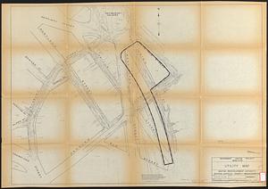
Government Center project Mass. r-35 : utility map
266.
Government Center project Mass. r-35 : property line map
267.
Government Center project no. Mass. r-35 : building deficiencies map
268.
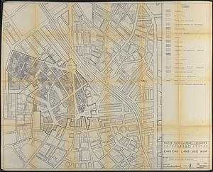
Government Center project no. Mass. r-35 : existing land use map
269.
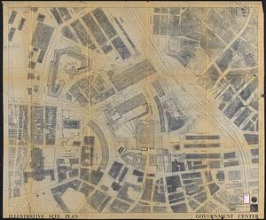
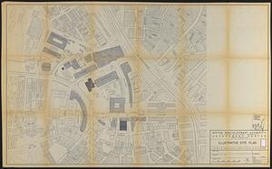
Government Center project no. Mass. r-35 : illustrative site plan
270.
Government Center project no. Mass. r-35 : disposition parcel map
271.
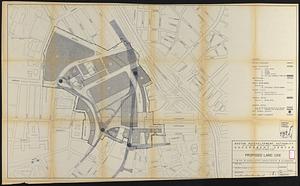
Government Center project no. Mass. r-35 : proposed land use
272.
Government Center project no. Mass. r-35 : proposed land use map
273.
Government Center project no. Mass. r-35 : subway adjustments plan
274.
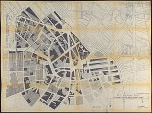
Government Center redevelopment project : land use map
275.
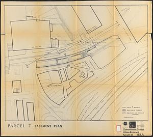
Government Center urban renewal area r-35 : parcel-7 easement plan
276.
Government Center urban renewal area r-35 parcel-7 : site section 1
277.
Government Center urban renewal area r-35 parcel-7 : site section 2
278.
Hancock Woods : as of right plan
279.
Hancock Woods EGA
280.
The Harbor Park system
‹ Prev
Next ›
1
2
…
10
11
12
13
14
15
16
17
18
…
449
450