Toggle navigation
LMEC Home
Exhibitions
Georeferencing
Tools for Teachers
Collections
My Favorites
Sign Up / Log In
Search
Search the map portal
Map Collection
Map Collection
Map Sets
Search
Search
Search for
Search In
All Fields
Creator
Title
Subject
Place
Search All Digital Collections
Advanced Search
8736 Results
My Search
Start Over
More Like
commonwealth:st74cw92q
Remove constraint More Like: commonwealth:st74cw92q
Filter your Search
Place
North and Central America
5,967
United States
4,865
Massachusetts
2,078
Europe
1,396
Suffolk (county)
1,045
Boston
1,018
Canada
450
Asia
438
more
Place
»
Topic
Boston (Mass.)--Maps
586
United States--Maps
282
Real property--Massachusetts--Boston--Maps
175
Massachusetts--Maps
162
Landowners--Massachusetts--Boston--Maps
133
North America--Maps--Early works to 1800
105
New England--Maps
102
Europe--Maps
79
more
Topic
»
Date
Date range begin
–
Date range end
Current results range from
1482
to
2023
View distribution
Creator
United States. Hydrographic Office
595
O.H. Bailey & Co
148
Des Barres, Joseph F. W. (Joseph Frederick Wallet), 1722-1824
126
United States. Post Office Dept
120
Ptolemy, 2nd cent
100
Walling, Henry Francis, 1825-1888
94
Jefferys, Thomas, -1771
90
Geological Survey (U.S.)
86
more
Creator
»
Format
Maps/Atlases
8,676
Manuscripts
220
Prints
56
Books
36
Objects/Artifacts
10
Drawings/Illustrations
8
Posters
5
Georeferenced
Yes
871
No
7,865
Collection
Norman B. Leventhal Map & Education Center Collection
8,694
Boston and New England Maps
2,232
Urban Maps
2,023
Maritime Charts and Atlases
1,088
American Revolutionary War-Era Maps
656
Boston Redevelopment Authority Collection
87
MacLean Collection Map Library
17
Richard H. Brown Revolutionary War Map Collection at Mount Vernon
9
more
Collection
»
Available to use
No known restrictions
8,553
Creative Commons license
70
Search Constraints
Sort by relevance
relevance
title
date (asc)
date (desc)
Number of results to display per page
20 per page
10
per page
20
per page
50
per page
100
per page
View results as:
grid view
map view
Search Results
61.
A new and correct chart of the coast of East Florida, and part of West Florida and Gulf of Mexico, Gulf of Florida or Cannel of...
62.
Il paese de' selvaggi Outauacesi, e Kilistinesi intorno al Lago Superiore
63.
Special chart of Cape Florida belonging to the 13th section
64.
Special chart of Muskito Inlet
65.
Gli Stati Uniti dell' America delineati fulle ultime offervazioni : quinto foglio che comprende la Georgia, e parte della...
66.
[Chart of the coast of Georgia]
67.
[Chart of the coast of Georgia]
68.
[The coasts, rivers and inlets of the province of Georgia]
69.
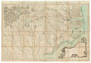
A compleat map of North Carolina from an actual survey
70.
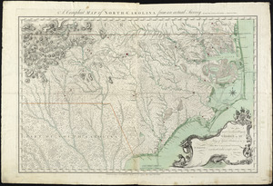
A compleat map of North-Carolina from an actual survey
71.
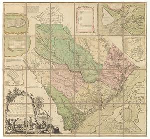
A map of the province of South Carolina with all the rivers, creeks, bays, inletts, islands, inland navigation, soundings, time...
72.
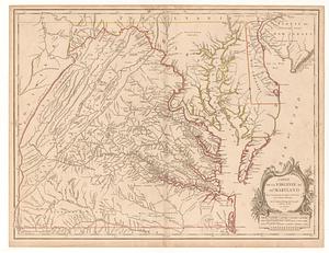
Carte de la Virginie et du Maryland
73.
Carte des environs du Fort Pitt et de la nouvelle province Indiana : dediée a M. Franklin
74.
A general map of the Middle British Colonies in America viz. Virginia, Maryland, Delaware, Pensilvania, New-Jersey New York,...
75.
A map of the country between Albemarle Sound, and Lake Erie, comprehending the whole of Virginia, Maryland, Delaware and...
76.
A map of the country between Will's Creek & Monongahela River shewing the rout and encampments of the English army in 1755
77.
A map of the most inhabited part of Virginia containing the whole province of Maryland : with part of Pensilvania, New Jersey...
78.
A map of the most inhabited part of Virginia containing the whole province of Maryland with part of Pensilvania, New Jersey and...
79.
Map of the western parts of the colony of Virginia
80.
Map of the western parts of the colony of Virginia, as far as the Mississipi
‹ Prev
Next ›
1
2
3
4
5
6
7
8
…
436
437


![[Chart of the coast of Georgia]](https://bpldcassets.blob.core.windows.net/derivatives/images/commonwealth:z603vv33t/image_thumbnail_300.jpg)
![[Chart of the coast of Georgia]](https://bpldcassets.blob.core.windows.net/derivatives/images/commonwealth:z603vv35c/image_thumbnail_300.jpg)
![[The coasts, rivers and inlets of the province of Georgia]](https://bpldcassets.blob.core.windows.net/derivatives/images/commonwealth:z603vv37x/image_thumbnail_300.jpg)