Toggle navigation
LMEC Home
Exhibitions
Georeferencing
Tools for Teachers
Collections
My Favorites
Sign Up / Log In
Search
Search the map portal
Map Collection
Map Collection
Map Sets
Search
Search
Search for
Search In
All Fields
Creator
Title
Subject
Place
Search All Digital Collections
Advanced Search
498 Results
My Search
Start Over
More Like
commonwealth:q524nb37t
Remove constraint More Like: commonwealth:q524nb37t
Filter your Search
Place
North and Central America
437
United States
311
New York
40
Philadelphia
26
Philadelphia (county)
26
Florida
19
Pennsylvania
18
Canada
17
more
Place
»
Topic
Manuscript maps--Early works to 1800
92
Manuscript maps
21
Philadelphia (Pa.)--Maps--Early works to 1800
21
Gulf Coast (U.S.)--Maps, Manuscript--Early works to 1800
12
Fortification--New York (State)--New York--Maps--Early works to 1800
11
New York (N.Y.)--Buildings, structures, etc--Maps, Manuscript--Early works to 1800
9
New York (N.Y.)--Maps, Manuscript--Early works to 1800
8
Saratoga Campaign, N.Y., 1777--Maps, Manuscript--Early works to 1800
8
more
Topic
»
Date
Date range begin
–
Date range end
Current results range from
1689
to
1899
View distribution
Creator
Hills, John, (Surveyor)
19
Montrésor, John, 1736-1799
16
Bingham, William, 1752-1804
12
Adlum, John, 1759-1836
10
Washington, George, 1732-1799
9
Faden, William, 1749-1836
8
Morgan, Benjamin, (Draftsman)
7
Wangenheim, Friedrich Adam Julius von
7
more
Creator
»
Format
Maps/Atlases
496
Manuscripts
476
Objects/Artifacts
2
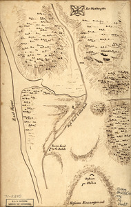
Georeferenced
Yes
7
No
491
Collection
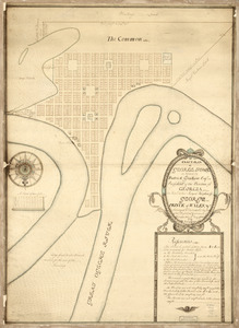
American Revolutionary War-Era Maps
496
Library of Congress Collection
480
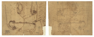
Maritime Charts and Atlases
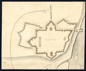
32
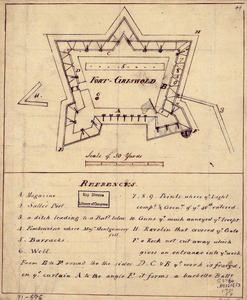
Urban Maps
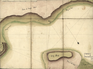
19
Norman B. Leventhal Map & Education Center Collection
6
MacLean Collection Map Library
4
Richard H. Brown Revolutionary War Map Collection at Mount Vernon
4
New York Public Library Collection
3
more
Collection
»
Available to use
Creative Commons license
488
No known restrictions
6
Search Constraints
Sort by relevance
relevance
title
date (asc)
date (desc)
Number of results to display per page
20 per page
10
per page
20
per page
50
per page
100
per page
View results as:
grid view
map view
Search Results
101.
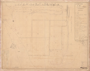
Draft of the lands disputed by Philipse Patent against Beekmans & Rambaults
102.
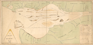
A draught of Delaware Bay
103.
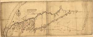
A draught of Lake George, and part of Hudson's River taken September 1756
104.
Dto de Baton Rouge
105.
E. Sugar Creek, Bradford Co
106.
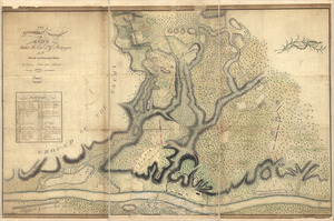
Eight survey tracts along the Kanawha River, W.Va : showing land granted to George Washington and others
107.
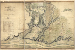
The encampment & position of the army under His Excy. Lt. Gl: Burgoyne : at Swords's and Freeman's Farms on Hudsons River near...
108.
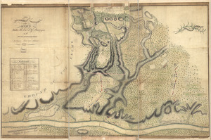
The encampment & position of the army under His Excy. Lt. Gl: Burgoyne : at Swords's and Freeman's Farms on Hudsons River near...
109.
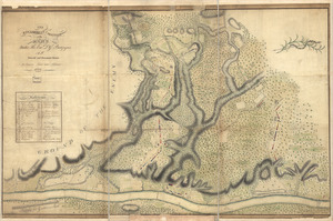
The encampment & position of the army under His Excy. Lt. Gl: Burgoyne : at Swords's and Freeman's Farms on Hudsons River near...
110.
The encampment & position of the army under His Excy. Lt. Gl: Burgoyne : at Swords's and Freeman's Farms on Hudsons River near...
111.
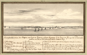
L'escadre françoise entrant dans Newport sous le feu des batteries et forcant le passage le 8 Aoust 1778 : jour que les...
112.
Esquisse du plan de la ville du Mole à St. Domingue
113.
An exact-plan of George-Town : so named by Patrick Graham, Esqr., President of the Province of Georgia, in honr. to His Royal...
114.
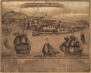
't Eÿland Curacao, anno 1800
115.
Fort Edward to Crown Point
116.
Fort La Fayette on Verplancks Point, with British and Hessian troop positions
117.
Fort Provost in 1782
118.
Fort Washington & vicinity
119.
Fort-Griswold
120.
Frog's Point avec batteries de Partie de Longue Island
‹ Prev
Next ›
1
2
3
4
5
6
7
8
9
10
…
24
25