Toggle navigation
LMEC Home
Exhibitions
Georeferencing
Tools for Teachers
Collections
My Favorites
Sign Up / Log In
Search
Search the map portal
Map Collection
Map Collection
Map Sets
Search
Search
Search for
Search In
All Fields
Creator
Title
Subject
Place
Search All Digital Collections
Advanced Search
8737 Results
My Search
Start Over
More Like
commonwealth:q524n477j
Remove constraint More Like: commonwealth:q524n477j
Filter your Search
Place
North and Central America
5,965
United States
4,872
Massachusetts
2,080
Europe
1,396
Suffolk (county)
1,046
Boston
1,019
Canada
459
Asia
438
more
Place
»
Topic
Boston (Mass.)--Maps
586
United States--Maps
282
Real property--Massachusetts--Boston--Maps
175
Massachusetts--Maps
162
Landowners--Massachusetts--Boston--Maps
133
North America--Maps--Early works to 1800
107
New England--Maps
102
Europe--Maps
79
more
Topic
»
Date
Date range begin
–
Date range end
Current results range from
1482
to
2023
View distribution
Creator
United States. Hydrographic Office
595
O.H. Bailey & Co
148
Des Barres, Joseph F. W. (Joseph Frederick Wallet), 1722-1824
123
United States. Post Office Dept
120
Ptolemy, 2nd cent
100
Walling, Henry Francis, 1825-1888
94
Geological Survey (U.S.)
86
Jefferys, Thomas, -1771
85
more
Creator
»
Format
Maps/Atlases
8,677
Manuscripts
218
Prints
56
Books
36
Objects/Artifacts
10
Drawings/Illustrations
8
Posters
5
Georeferenced
Yes
869
No
7,868
Collection
Norman B. Leventhal Map & Education Center Collection
8,701
Boston and New England Maps
2,233
Urban Maps
2,023
Maritime Charts and Atlases
1,086
American Revolutionary War-Era Maps
652
Boston Redevelopment Authority Collection
87
MacLean Collection Map Library
13
New York Public Library Collection
10
more
Collection
»
Available to use
No known restrictions
8,555
Creative Commons license
70
Search Constraints
Sort by relevance
relevance
title
date (asc)
date (desc)
Number of results to display per page
20 per page
10
per page
20
per page
50
per page
100
per page
View results as:
grid view
map view
Search Results
8261.
USAF cloth chart, Western Mediterranean
8262.
U.S.S. George Washington Dec. 4, 1917 - Dec. 23, 1918
8263.
Utah Gidex Utah
8264.
Utriusque Alsatiae, ducatus Dupontii, et Spirensis Episcopatus novissima descriptio
8265.
Utriusque Burgundiae, tum ducatus tum comitatus, descriptio
8266.
Uxbridge, Mass : 1880
8267.
Valatie, N.Y : 1881
8268.
Vallée de l'Amazone de Faro a Alemquer, Rio Trombetas - Rio Ariramba
8269.
Valley Forge, Pa. 1890
8270.
Valley of Blackstone River within the state of Mass
8271.
Van Loon's map of the United States : enlivened by thumbnail sketches of American history
8272.
A variation chart
8273.
Vdrone Irlandiæ in Catherlagh Baronia
8274.
Veduta d'Italia
8275.
Venango railroad and its connections, air line from New York to Cleveland, Toledo & Chicago
8276.
Venezuela cum parte Australi Novae Andalusiae
8277.
Venezuela, cum partie Australi Novae Andalusiae
8278.
Venezuela with Trinidad and part of West Indies and British Guiana
8279.
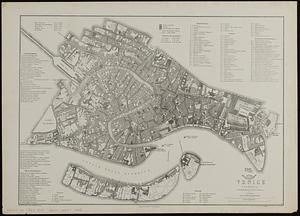
Venice (Venezia)
8280.
Vera-Cruz dans le Golfe du Méxique [and] Isle St. Juan, Fort de St. Jean d'Ulloa
‹ Prev
Next ›
1
2
…
410
411
412
413
414
415
416
417
418
…
436
437


![Vera-Cruz dans le Golfe du Méxique [and] Isle St. Juan, Fort de St. Jean d'Ulloa](https://bpldcassets.blob.core.windows.net/derivatives/images/commonwealth:cj82kx24p/image_thumbnail_300.jpg)