Toggle navigation
LMEC Home
Exhibitions
Georeferencing
Tools for Teachers
Collections
My Favorites
Sign Up / Log In
Search
Search the map portal
Map Collection
Map Collection
Map Sets
Search
Search
Search for
Search In
All Fields
Creator
Title
Subject
Place
Search All Digital Collections
Advanced Search
8704 Results
My Search
Start Over
More Like
commonwealth:q524n3673
Remove constraint More Like: commonwealth:q524n3673
Filter your Search
Place
North and Central America
5,927
United States
4,845
Massachusetts
2,079
Europe
1,396
Suffolk (county)
1,047
Boston
1,020
Canada
449
Asia
438
more
Place
»
Topic
Boston (Mass.)--Maps
587
United States--Maps
282
Real property--Massachusetts--Boston--Maps
175
Massachusetts--Maps
162
Landowners--Massachusetts--Boston--Maps
133
North America--Maps--Early works to 1800
103
New England--Maps
102
World maps
82
more
Topic
»
Date
Date range begin
–
Date range end
Current results range from
1482
to
2023
View distribution
Creator
United States. Hydrographic Office
595
O.H. Bailey & Co
148
Des Barres, Joseph F. W. (Joseph Frederick Wallet), 1722-1824
123
United States. Post Office Dept
120
Ptolemy, 2nd cent
100
Walling, Henry Francis, 1825-1888
94
Geological Survey (U.S.)
86
Jefferys, Thomas, -1771
85
more
Creator
»
Format
Maps/Atlases
8,644
Manuscripts
218
Prints
56
Books
36
Objects/Artifacts
10
Drawings/Illustrations
8
Posters
5
Georeferenced
Yes
868
No
7,836
Collection
Norman B. Leventhal Map & Education Center Collection
8,701
Boston and New England Maps
2,235
Urban Maps
2,024
Maritime Charts and Atlases
1,083
American Revolutionary War-Era Maps
616
Boston Redevelopment Authority Collection
88
Sidney R. Knafel Map Collection at Phillips Academy
2
Available to use
No known restrictions
8,555
Creative Commons license
50
Search Constraints
Sort by relevance
relevance
title
date (asc)
date (desc)
Number of results to display per page
20 per page
10
per page
20
per page
50
per page
100
per page
View results as:
grid view
map view
Search Results
3181.
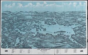
Lake Winnipesaukee, New Hampshire
3182.
Lake Winnipesaukee, New Hampshire
3183.
Lancaster, Ohio : 1885
3184.
Lancastria palatinatus Anglis Lancaster & Lancas Shire
3185.
[Land division survey of Duxbury and Pembroke, MA]
3186.
Land measures illustrated ; percentage illustrated ; phonic analysis
3187.
The land of make believe
3188.
Land utilization in Korea
3189.
Landing facilities and proposed airway system in the United States, 1923
3190.
Landing facilities and proposed airway system in the United States, 1924
3191.
Lands End, Rockport, Mass
3192.
Landscaping plan of City Hall Plaza, Boston
3193.
Langley's new map of Essex
3194.
Languedoc
3195.
Lansdale : Pennsylvania
3196.
A large and particular plan of Shegnekto Bay, and the circumjacent country, with the forts and settlements of the French 'till...
3197.
A large and particular plan of Shegnekto Bay, and the circumjacent country, with the forts and settlements of the French 'till...
3198.
A large draft of the island Antegua
3199.
Large scale map of Russia in Europe
3200.
Last sale of real estate in Bostonville, at public auction : on Monday next Oct. 10, 1853, at 1 o'clock, p.m
‹ Prev
Next ›
1
2
…
156
157
158
159
160
161
162
163
164
…
435
436


![[Land division survey of Duxbury and Pembroke, MA]](https://bpldcassets.blob.core.windows.net/derivatives/images/commonwealth:wd376285r/image_thumbnail_300.jpg)


