Toggle navigation
LMEC Home
Exhibitions
Georeferencing
Tools for Teachers
Collections
My Favorites
Sign Up / Log In
Search
Search the map portal
Map Collection
Map Collection
Map Sets
Search
Search
Search for
Search In
All Fields
Creator
Title
Subject
Place
Search All Digital Collections
Advanced Search
307 Results
My Search
Start Over
More Like
commonwealth:q524mv45f
Remove constraint More Like: commonwealth:q524mv45f
Filter your Search
Place
North and Central America
240
United States
175
New York
31
Suffolk (county)
31
Canada
30
North America
30
Boston
29
Charleston (county)
10
more
Place
»
Topic
North America--Maps--Early works to 1800
21
United States--History--French and Indian War, 1754-1763--Maps--Early works to 1800
17
Boston (Mass.)--History--Revolution, 1775-1783--Maps--Early works to 1800
16
Vues d'optique
10
Gibraltar--History--Siege, 1779-1783--Maps--Early works to 1800
9
New York (N.Y.)--Pictorial works--Early works to 1800
9
Tactics--Maps--Early works to 1800
9
United States--Maps--Early works to 1800
9
more
Topic
»
Date
Date range begin
–
Date range end
Current results range from
1740
to
1799
View distribution
Creator
Faden, William, 1749-1836
33
Jefferys, Thomas, -1771
32
Le Rouge, Georges-Louis
23
Des Barres, Joseph F. W. (Joseph Frederick Wallet), 1722-1824
21
Sayer, Robert, 1725-1794
21
Korn, Christoph Heinrich, 1726-1783
11
Orme, Robert, -1781
11
Raspe, Gabriel Nicolaus, 1712-1785
11
more
Creator
»
Format
Maps/Atlases
264
Prints
32
Manuscripts
24
Drawings/Illustrations
9
Books
2
Georeferenced
Yes
12
No
295
Collection
American Revolutionary War-Era Maps
306
Richard H. Brown Revolutionary War Map Collection at Mount Vernon
293
Norman B. Leventhal Map & Education Center Collection
10
Boston and New England Maps
4
MacLean Collection Map Library
2
Maritime Charts and Atlases
2
Urban Maps
2
Library of Congress Collection
1
more
Collection
»
Available to use
Creative Commons license
294
No known restrictions
11
Search Constraints
Sort by relevance
relevance
title
date (asc)
date (desc)
Number of results to display per page
20 per page
10
per page
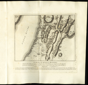
20
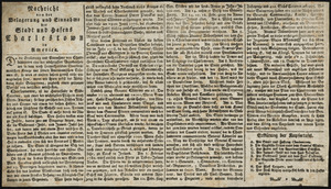
per page
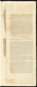
50
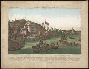
per page
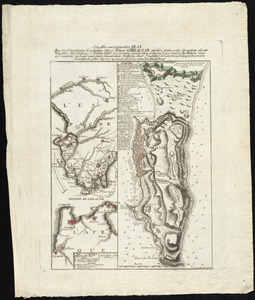
100
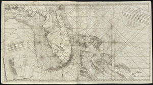
per page
View results as:
grid view
map view
Search Results
141.
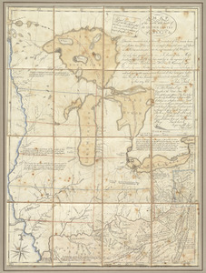
[Map of the Allegheny and Ohio Rivers] ; Franzosische see kusten von Provence zwischen Marseille und Toulon = : Cotes maritimes...
142.
A map of the British and French dominions in North America with the roads, distances, limits, and extent of the settlements,...
143.
A map of the inhabited part of Canada from the French surveys : with the frontiers of New York and New England from the large...
144.
A map of the most inhabited part of New England : containing the provinces of Massachusets Bay and New Hampshire, with the...
145.
A map of the most inhabited part of Virginia containing the whole province of Maryland with part of Pensilvania, New Jersey and...
146.
A map of the north west parts of the United States of America
147.
A map of the Province of New-York : reduc'd from the large drawing of that province, compiled from actual surveys by order of...
148.
[Map of the Siege of Mud Island Fort]
149.
A map of the United States of N. America
150.
Map of the western parts of the colony of Virginia, as far as the Mississipi
151.
March of the Queens Rangers : Emmericks Corps, the Cavalry of the Legion under Lt. Col. Tarleton, and a detachment of the...
152.
Nachricht von der belagerung und einnahme der stadt und hafens Charlestown in America
153.
Nautical directions to sail into the harbour of New-York, &c.
154.
Neu Yorck = : La Nouvelle Yorck
155.
Neuester und acurater plan der weltberuhmten Englischen berg festung Gibraltar auf der Spitze von Spanien : derer wercher...
156.
A new and correct chart of the coast of East Florida, and part of West Florida and Gulf of Mexico, Gulf of Florida or Cannel of...
157.
A new and correct map of North America, with the West India Islands : divided according to the last Treaty of Peace, concluded...
158.
A new chart of the coast of New England, Nova Scotia, and the islands of St. John, Cape Breton, Sable, the banks of St. Peters,...
159.
A new map of North America wherein the British Dominions in the continent of North America : and on the islands of the West...
160.
A new map of Nova Scotia, and Cape Britain : with the adjacent parts of New England and Canada, composed from a great number of...
‹ Prev
Next ›
1
2
…
4
5
6
7
8
9
10
11
12
…
15
16
![[Map of the Allegheny and Ohio Rivers] ; Franzosische see kusten von Provence zwischen Marseille und Toulon =](https://bpldcassets.blob.core.windows.net/derivatives/images/commonwealth:z603vr31n/image_thumbnail_300.jpg)


![[Map of the Siege of Mud Island Fort]](https://bpldcassets.blob.core.windows.net/derivatives/images/commonwealth:z603vr43f/image_thumbnail_300.jpg)