Toggle navigation
LMEC Home
Exhibitions
Georeferencing
Tools for Teachers
Collections
My Favorites
Sign Up / Log In
Search
Search the map portal
Map Collection
Map Collection
Map Sets
Search
Search
Search for
Search In
All Fields
Creator
Title
Subject
Place
Search All Digital Collections
Advanced Search
8867 Results
My Search
Start Over
More Like
commonwealth:pc28d1639
Remove constraint More Like: commonwealth:pc28d1639
Filter your Search
Place
North and Central America
6,098
United States
5,014
Massachusetts
2,127
Europe
1,396
Suffolk (county)
1,213
Boston
1,186
Canada
449
Asia
438
more
Place
»
Topic
Boston (Mass.)--Maps
752
United States--Maps
282
Real property--Massachusetts--Boston--Maps
195
Massachusetts--Maps
166
City planning--Massachusetts--Boston--Maps
163
Landowners--Massachusetts--Boston--Maps
142
New England--Maps
104
North America--Maps--Early works to 1800
103
more
Topic
»
Date
Date range begin
–
Date range end
Current results range from
1482
to
2023
View distribution
Creator
United States. Hydrographic Office
595
Boston Redevelopment Authority
166
O.H. Bailey & Co
148
Des Barres, Joseph F. W. (Joseph Frederick Wallet), 1722-1824
124
United States. Post Office Dept
120
Ptolemy, 2nd cent
100
Walling, Henry Francis, 1825-1888
94
Geological Survey (U.S.)
87
more
Creator
»
Format
Maps/Atlases
8,807
Manuscripts
215
Prints
56
Books
36
Objects/Artifacts
10
Drawings/Illustrations
8
Posters
5
Georeferenced
Yes
885
No
7,982
Collection
Norman B. Leventhal Map & Education Center Collection
8,723
Boston and New England Maps
2,363
Urban Maps
2,148
Maritime Charts and Atlases
1,083
American Revolutionary War-Era Maps
638
Boston Redevelopment Authority Collection
197
Mapping Boston Collection
20
Massachusetts Real Estate Atlases
12
more
Collection
»
Available to use
No known restrictions
8,670
Creative Commons license
70
Search Constraints
Sort by relevance
relevance
title
date (asc)
date (desc)
Number of results to display per page
20 per page
10
per page
20
per page
50
per page
100
per page
View results as:
grid view
map view
Search Results
41.
Boston Elevated Railway system route map
42.
Boston Elevated Railway system route map
43.
Boston Elevated Railway system route map
44.
Boston Elevated Railway system route map
45.
Boston Elevated Railway system route map
46.
Bus routes Boston Elevated Railway 1931 July 18
47.
Fenway urban renewal area : major thoroughfares
48.
Map of Commonwealth Avenue Street Railway Company, and connecting lines : showing route to Norumbega Park
49.
Back Bay project no. Mass. R-47 : police signal system, fire alarm system and M.T.A. facilities
50.
Government Center project no. Mass. r-35 : proposed land use map
51.
Government Center project no. Mass. r-35 : subway adjustments plan
52.
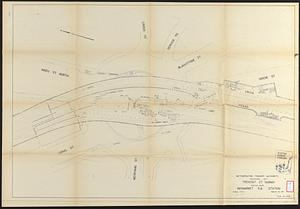
Tremont St. subway Boston, Mass. Haymarket Sq. Station
53.
Annexation map
54.
Atlas of the city of Boston : Boston proper : from actual surveys and official plans
55.
Atlas of the city of Boston : Boston proper and Back Bay : from actual surveys and official plans
56.
Atlas of the city of Boston : Boston proper and Back Bay : from actual surveys and official plans
57.
Atlas of the city of Boston : Boston proper and Back Bay : from actual surveys and official plans
58.
Atlas of the city of Boston : Boston proper and Back Bay : from actual surveys and official plans
59.
Atlas of the city of Boston : Boston proper and Back Bay : from actual surveys and official plans
60.
Atlas of the city of Boston : Boston proper and Back Bay : from actual surveys and official plans
‹ Prev
Next ›
1
2
3
4
5
6
7
…
443
444