Toggle navigation
LMEC Home
Exhibitions
Georeferencing
Tools for Teachers
Collections
My Favorites
Sign Up / Log In
Search
Search the map portal
Map Collection
Map Collection
Map Sets
Search
Search
Search for
Search In
All Fields
Creator
Title
Subject
Place
Search All Digital Collections
Advanced Search
244 Results
My Search
Start Over
More Like
commonwealth:p8418t713
Remove constraint More Like: commonwealth:p8418t713
Filter your Search
Place
United States
239
North and Central America
231
New England
97
Boston
80
Suffolk (county)
80
Massachusetts
75
Boston Harbor
40
Canada
26
more
Place
»
Topic
New England--Maps--Early works to 1800
97
Boston (Mass.)--Maps--Early works to 1800
48
Boston Harbor (Mass.)--Maps--Early works to 1800
39
United States--History--Revolution, 1775-1783--Maps--Early works to 1800
38
Boston (Mass.)--History--Revolution, 1775-1783--Maps--Early works to 1800
29
Bunker Hill, Battle of, Boston, Mass., 1775--Maps--Early works to 1800
20
Middle Atlantic States--Maps--Early works to 1800
20
Fortification--Massachusetts--Boston--Maps--Early works to 1800
14
more
Topic
»
Date
Date range begin
–
Date range end
Current results range from
1617
to
1999
View distribution
Creator
Page, Thomas Hyde, Sir, 1746-1821
12
Faden, William, 1749-1836
11
Jefferys, Thomas, d. 1771
9
Robert Sayer and John Bennett (Firm)
8
Bellin, Jacques Nicolas, 1703-1772
7
Jefferys, Thomas, -1771
6
Lattré, Jean
6
Bowles, Carington, 1724-1793
5
more
Creator
»
Format
Maps/Atlases
242
Manuscripts
20
Drawings/Illustrations
2
Georeferenced
Yes
18
No
226
Collection
American Revolutionary War-Era Maps
183
Norman B. Leventhal Map & Education Center Collection
136
Boston and New England Maps
89
Mapping Boston Collection
47
Richard H. Brown Revolutionary War Map Collection at Mount Vernon
29
Urban Maps
26
New-York Historical Society Collection
24
Maritime Charts and Atlases
22
more
Collection
»
Available to use
No known restrictions
115
Creative Commons license
101
Search Constraints
Sort by relevance
relevance
title
date (asc)
date (desc)
Number of results to display per page
20 per page
10
per page
20
per page
50
per page
100
per page
View results as:
grid view
map view
Search Results
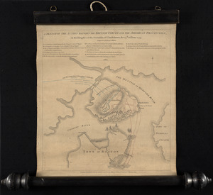
41.
A plan of the town of Boston, with the intrenchments &c. of His Majestys forces in 1775 : from the observations of Lieut. Page...
42.
A plan of the town of Boston, with the intrenchments &c. of His Majestys forces in 1775 : from the observations of Lieut. Page...
43.
[The burnt ruins of Charlestown from across the Charles River]
44.
[Troops on parade, the Charles River and Castle Island]
45.
[Battle of Bunker Hill]
46.
A plan of the action at Breeds Hill, on the 17th of June 1775 : between the American forces and the British troops :...
47.
A plan of the action at Bunkers Hill, on the 17th. of June, 1775 : between His Majesty's troops under the command of Major...
48.
A plan of the action at Bunkers Hill, on the 17th. of June, 1775 : between His Majesty's troops under the command of Major...
49.
A plan of the action at Bunkers Hill, on the 17th. of June, 1775 : between His Majesty's troops under the command of Major...
50.
A plan of the action at Bunkers Hill on the 17th of June 1775 between His Majesty's troops, under the command of Major General...
51.
A plan of the action at Bunkers Hill on the 17th of June 1775 between His Majesty's troops, under the command of Major General...
52.
A plan of the action at Bunkers Hill on the 17th of June 1775 between His Majesty's troops, under the command of Major General...
53.
Plan of the battle, on Bunker's Hill : fought on the 17th of June 1775
54.
Plan of the battle, on Bunker's Hill : fought on the 17th of June 1775
55.
Plan of the town of Boston with the attack on Bunkers-Hill in the peninsula of Charlestown the 17th of June 1775
56.
Situations plan der Englischen Armée vor und um Boston nebst der stellung der Americaner
57.
A sketch of the action between the British forces and the American provincials, on the heights of the peninsula of Charlestown,...
58.
A sketch of the action between the British forces and the American provincials, on the heights of the peninsula of Charlestown,...
59.
Carte de l'Amérique Septle. pour servir à l'intelligence de la guerre entre les Anglois et les insurgents
60.
Carte de l'Amerique Sept.le pour servir à l'intelligence de la guerre entre les anglois et les insurgents : dédiée à M.gr de...
‹ Prev
Next ›
1
2
3
4
5
6
7
…
12
13


![[The burnt ruins of Charlestown from across the Charles River]](https://bpldcassets.blob.core.windows.net/derivatives/images/commonwealth:dz010v71m/image_thumbnail_300.jpg)
![[Troops on parade, the Charles River and Castle Island]](https://bpldcassets.blob.core.windows.net/derivatives/images/commonwealth:dz010v69k/image_thumbnail_300.jpg)
![[Battle of Bunker Hill]](https://bpldcassets.blob.core.windows.net/derivatives/images/commonwealth:z603vj11x/image_thumbnail_300.jpg)