Toggle navigation
LMEC Home
Exhibitions
Georeferencing
Tools for Teachers
Collections
My Favorites
Sign Up / Log In
Search
Search the map portal
Map Collection
Map Collection
Map Sets
Search
Search
Search for
Search In
All Fields
Creator
Title
Subject
Place
Search All Digital Collections
Advanced Search
303 Results
My Search
Start Over
More Like
commonwealth:p8418t692
Remove constraint More Like: commonwealth:p8418t692
Filter your Search
Place
North and Central America
239
North America
231
United States
60
Canada
39
Atlantic Ocean
14
New York
13
Nova Scotia
12
Louisbourg
11
more
Place
»
Topic
North America--Maps--Early works to 1800
240
Great Britain--Colonies--America--Maps--Early works to 1800
18
United States--History--French and Indian War, 1754-1763--Maps--Early works to 1800
17
United States--Maps--Early works to 1800
14
Atlantic Ocean--Maps
12
Canada--Maps--Early works to 1800
11
British--America--Maps--Early works to 1800
10
South America--Maps--Early works to 1800
8
more
Topic
»
Date
Date range begin
–
Date range end
Current results range from
1528
to
1990
View distribution
Creator
Jefferys, Thomas, -1771
20
Sayer, Robert, 1725-1794
20
Mitchell, John, 1711-1768
18
Gibson, J. (John), active 1750-1792
14
Bowen, Emanuel, 1693 or 1694-1767
11
Moll, Herman, d. 1732
11
Anville, Jean Baptiste Bourguignon d', 1697-1782
10
Palairet, Jean, 1697-1774
8
more
Creator
»
Format
Maps/Atlases
303
Manuscripts
15
Georeferenced
Yes
5
No
298
Collection
American Revolutionary War-Era Maps
236
Norman B. Leventhal Map & Education Center Collection
128
MacLean Collection Map Library
65
New York Public Library Collection
32
Richard H. Brown Revolutionary War Map Collection at Mount Vernon
28
New-York Historical Society Collection
24
Mapping Boston Collection
10
Sidney R. Knafel Map Collection at Phillips Academy
9
more
Collection
»
Available to use
No known restrictions
143
Creative Commons license
75
Search Constraints
Sort by relevance
relevance
title
date (asc)
date (desc)
Number of results to display per page
20 per page
10
per page
20
per page
50
per page
100
per page
View results as:
grid view
map view
Search Results
121.
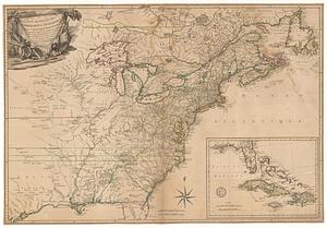
Carte des possessions angloises dans l'Amerique Septentrionale pour servir d'intelligence à la guerre presente traduite de...
122.
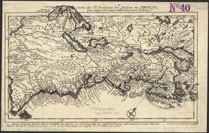
Carte des possessions des Anglois en Amerique, par rapport à leurs differends avec la France
123.
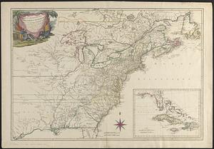
Carte detaillé des possessions angloises dans l'Amerique Septentrionale : construite d'après les derniéres relations et les...
124.
Carte detaillée des possessions angloises dans l'Amerique Septentrionale : construite d'après les dernieres relations et les...
125.
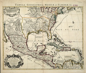
Carte du Mexique et de la Florida : des terres angloises et des Isles Antilles, du cours et des environs de la Riviere de...
126.
Carte du théatre de la guerre actuel entre les anglais et les Treize Colonies Unies de l'Amerique Septentrionale
127.
Carte d'un partie de l'Amerique Septentrionale : ou est tracée notre route d'Halifax à New York, par Quebec, Montreal, le Lac...
128.
Carte d'une partie de l'Amérique Septentrionale
129.
Carte d'une partie de l'Amérique Septentrionale pour servir à l'intelligence du mémoire sur les prétentions des Anglois au...
130.
Carte générale de l'Amérique séptentrionale : avec les posséssions Angloises dans cette partie du nouveau monde
131.
Carte générale de l'Amérique séptentrionale avec les posséssions angloises dans cette partie du nouveau monde
132.
Carte générale du Canada, de la Louisiane, de la Floride, de la Caroline, de la Virginie, de la Nouvelle Angleterre etc
133.
Carte geographique de la Nouvelle Franse
134.
Carte nouvelle de l'Amérique Angloise contenant tout ce que les Anglois possédent sur le continent de l'Amérique...
135.
Carte tres curieuse de la Mer du Sud, contenant des remarques nouvelles et tres utiles non seulement sur les ports et iles de...
136.
Chart of the Atlantic Ocean, with the British, French, & Spanish settlements in North America, and the West Indies : as also on...
137.
Chart of the Atlantic Ocean, with the British, French, & Spanish settlements in North America, and the West Indies : as also on...
138.
Chart of the Atlantic Ocean, with the British, French, & Spanish settlements in North America, and the West Indies : as also on...
139.
Charte über die XIII Vereinigte Staaten von Nord-America = XIII Etats Unis de I'Amerique Septentrionale, d'apres les meilleures...
140.
Le Colonie Unite dell' America Settentr'le di nuova projezione a ss. ee. li signori riformatori dello studio di Padova : con...
‹ Prev
Next ›
1
2
3
4
5
6
7
8
9
10
11
…
15
16