Toggle navigation
LMEC Home
Exhibitions
Georeferencing
Tools for Teachers
Collections
My Favorites
Sign Up / Log In
Search
Search the map portal
Map Collection
Map Collection
Map Sets
Search
Search
Search for
Search In
All Fields
Creator
Title
Subject
Place
Search All Digital Collections
Advanced Search
411 Results
My Search
Start Over
More Like
commonwealth:p8418t55q
Remove constraint More Like: commonwealth:p8418t55q
Filter your Search
Place
North and Central America
404
United States
362
New York
91
Virginia
68
New Jersey
52
York (county)
32
Yorktown
32
South Carolina
30
more
Place
»
Topic
United States--History--Revolution, 1775-1783--Maps
330
Virginia--Maps--Early works to 1800
38
Newport (R.I.)--Maps
24
Yorktown (Va.)--History--Siege, 1781--Maps--Early works to 1800
19
Maryland--Maps--Early works to 1800
17
Charleston (S.C.)--Maps
16
Hudson River (N.Y. and N.J.)--Maps
15
New Jersey--Maps
14
more
Topic
»
Date
Date range begin
–
Date range end
Current results range from
1590
to
1881
View distribution
Creator
Clinton, Henry, Sir, 1738?-1795
17
Hills, John, active 1777-1819
13
Faden, William, 1749-1836
12
André, John, 1751-1780
11
Montrésor, John, 1736-1799
10
Fage, Edward
9
Castries, Charles Eugène Gabriel de La Croix, marquis de, 1727-1801
8
D'Ethy, captain
8
more
Creator
»
Format
Maps/Atlases
405
Manuscripts
18
Drawings/Illustrations
5
Prints
1
Georeferenced
Yes
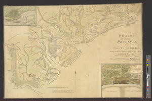
6
No
405
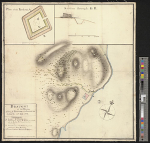
Collection
American Revolutionary War-Era Maps
389
William L. Clements Library Collection
305
Norman B. Leventhal Map & Education Center Collection
31
New-York Historical Society Collection
24
Richard H. Brown Revolutionary War Map Collection at Mount Vernon
14
MacLean Collection Map Library
9
American Antiquarian Society Collection
7
Boston and New England Maps
5
more
Collection
»
Available to use
No known restrictions
54
Creative Commons license
32
Search Constraints
Sort by relevance
relevance
title
date (asc)
date (desc)
Number of results to display per page
20 per page
10
per page
20
per page
50
per page
100
per page
View results as:
grid view
map view
Search Results
101.
A chorographical map of the country round Philadelphia = Carte particuliere des environs de Philadelphia
102.
A compleat plan of part of the province of Pennsylvania East and West Jersey shewing the transactions of the royal army under...
103.
Confluence of the James River, York River, and Chesapeake Bay
104.
Delaware Bay and Chesapeake Bay
105.
Delaware Bay and Chesapeake Bay
106.
Disposition of the British forces before Charleston 1780
107.
Disposition of the British forces on Long Island, Staten Island, and Manhattan Island, under Cornwallis and Knyphausen
108.
Distances North River
109.
Distribution & strength of corps 1780
110.
A draft of the Nerernanset shore from the entrance to the mouth of Potewomet River northward and from the Nererganset Bay to...
111.
Draught of part of the province of South Carolina shewing the march & encampments of the British troops under the command of...
112.
A draught of Rhode Island, 1777
113.
A draught of the towns of Boston & Charles Town & the circumjacent country, shewing the works thrown up by the kings troops, &...
114.
Draught of the watering place & redouts constructed to defend it, 15th: July 1776
115.
Exact plan of General Gage's lines on Boston Neck in America
116.
Flatbush
117.
Fort Germain and neighboring posts
118.
Fort Independence to Slaughter's Landing
119.
Fort Lafayette and Verplank Point
120.
Fort Lee
‹ Prev
Next ›
1
2
3
4
5
6
7
8
9
10
…
20
21