Toggle navigation
LMEC Home
Exhibitions
Georeferencing
Tools for Teachers
Collections
My Favorites
Sign Up / Log In
Search
Search the map portal
Map Collection
Map Collection
Map Sets
Search
Search
Search for
Search In
All Fields
Creator
Title
Subject
Place
Search All Digital Collections
Advanced Search
484 Results
My Search
Start Over
More Like
commonwealth:n8712579m
Remove constraint More Like: commonwealth:n8712579m
Filter your Search
Place
North and Central America
481
United States
478
Suffolk (county)
471
Boston
470
Massachusetts
171
Roxbury
54
Fens
51
South End
49
more
Place
»
Topic
City planning--Massachusetts--Boston--Maps
418
Urban renewal--Massachusetts--Boston--Maps
253
Boston (Mass.)--Maps
123
Land use--Massachusetts--Boston--Maps
101
Buildings--Massachusetts--Boston--Maps
81
Real property--Massachusetts--Boston--Maps
56
Fenway (Boston, Mass.)--Maps
55
Roxbury (Boston, Mass.)--Maps
50
more
Topic
»
Date
Date range begin
–
Date range end
Current results range from
1835
to
2009
View distribution
Creator
Boston Redevelopment Authority
370
Downtown Waterfront Corporation
10
Victor Gruen Associates
10
Boston (Mass.). Parks and Recreation Department
8
Sasaki Associates
6
Boston (Mass.). Department of Parks
5
Boston (Mass.). Water and Sewer Commission
5
Charles A. Maguire and Associates
5
more
Creator
»
Format
Maps/Atlases
483
Drawings/Illustrations
3
Manuscripts
1
Prints
1
Georeferenced
Yes
2
No
482
Collection
Boston and New England Maps
475
Urban Maps
460
Boston Redevelopment Authority Collection
442
Norman B. Leventhal Map & Education Center Collection
98
Available to use
No known restrictions
483
Search Constraints
Sort by relevance
relevance
title
date (asc)
date (desc)
Number of results to display per page
20 per page
10
per page
20
per page
50
per page
100
per page
View results as:
grid view
map view
Search Results
281.
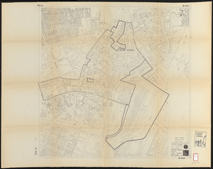
Land ownership maps for land in the Government Center urban renewal project area
282.
South End urban renewal area project Mass. r-56 site preparation contract no. 50 Worcester Square Park reconstruction
283.
Back Bay project no. Mass R-47
284.
Back Bay project no. Mass. R-47 : police signal system, fire alarm system and M.T.A. facilities
285.
Back Bay study
286.
Back Bay study landscape plan
287.
Back Bay zoning district map
288.
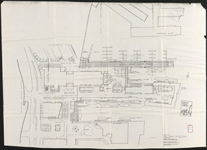
Basement plan of terminal station at Boston, Massachusetts, for the N.Y.N.H & H. and B. & A. railroads
289.
Boston Harbor : challenges and opportunities for the 1980's
290.
Boston thorofare plan existing routes and proposals
291.
Campus High School urban renewal area Massachusetts R-129 : illustrative site plan
292.
Central business district urban renewal area R-82 : sub area boundaries
293.
Charlestown urban renewal area, Massachusetts R-55 : illustrative site plan
294.
Charlestown urban renewal area Massachusetts R-55 : illustrative site plan
295.
City of Boston topographic and planimetric survey
296.
Columbia Point feasibility survey area
297.
Contract documents for the Waterfront Park, Boston, Massachusetts : planting plan
298.
Copley Square : layout and pavement plan with tree numbers added
299.
Cultural facilities conceptual plan
300.
DEM/BRA Long Wharf master plan : schematic'
‹ Prev
Next ›
1
2
…
11
12
13
14
15
16
17
18
19
…
24
25