Toggle navigation
LMEC Home
Exhibitions
Georeferencing
Tools for Teachers
Collections
My Favorites
Sign Up / Log In
Search
Search the map portal
Map Collection
Map Collection
Map Sets
Search
Search
Search for
Search In
All Fields
Creator
Title
Subject
Place
Search All Digital Collections
Advanced Search
8921 Results
My Search
Start Over
More Like
commonwealth:m900rc20s
Remove constraint More Like: commonwealth:m900rc20s
Filter your Search
Place
North and Central America
6,152
United States
5,068
Massachusetts
2,138
Europe
1,396
Suffolk (county)
1,267
Boston
1,240
Canada
449
Asia
438
more
Place
»
Topic
Boston (Mass.)--Maps
753
United States--Maps
282
Real property--Massachusetts--Boston--Maps
254
City planning--Massachusetts--Boston--Maps
187
Landowners--Massachusetts--Boston--Maps
170
Massachusetts--Maps
166
New England--Maps
104
North America--Maps--Early works to 1800
103
more
Topic
»
Date
Date range begin
–
Date range end
Current results range from
1482
to
2023
View distribution
Creator
United States. Hydrographic Office
595
Boston Redevelopment Authority
192
O.H. Bailey & Co
148
Des Barres, Joseph F. W. (Joseph Frederick Wallet), 1722-1824
124
United States. Post Office Dept
120
Ptolemy, 2nd cent
100
Walling, Henry Francis, 1825-1888
94
Geological Survey (U.S.)
87
more
Creator
»
Format
Maps/Atlases
8,861
Manuscripts
215
Prints
56
Books
36
Objects/Artifacts
10
Drawings/Illustrations
8
Posters
5
Georeferenced
Yes
885
No
8,036
Collection
Norman B. Leventhal Map & Education Center Collection
8,725
Boston and New England Maps
2,391
Urban Maps
2,175
Maritime Charts and Atlases
1,083
American Revolutionary War-Era Maps
638
Boston Redevelopment Authority Collection
223
Massachusetts Real Estate Atlases
38
Mapping Boston Collection
20
more
Collection
»
Available to use
No known restrictions
8,698
Creative Commons license
70
Search Constraints
Sort by relevance
relevance
title
date (asc)
date (desc)
Number of results to display per page
20 per page
10
per page
20
per page
50
per page
100
per page
View results as:
grid view
map view
Search Results
4621.
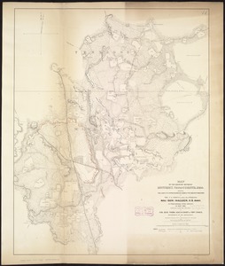
Map of the country between Monterey, Tenn: & Corinth, Miss: showing the lines of entrenchments made & the routes followed by...
4622.
Map of the country between Washington & Pittsburg refering to the contemplated Chesapeake & Ohio Canal and its general route...
4623.
A map of the country between Will's Creek & Monongahela River shewing the rout and encampments of the English army in 1755
4624.
Map of the country copied from Hale's map of N. E. with railroad route from Boston to Lake Champlain : through Keene, N. H
4625.
Map of the country embracing the several routes examined with a view to a national road from Washington to Lake Ontario
4626.
Map of the country in the vicinity of Todds Tavern, with the position of the 2nd Corps Army of the Potomac, May 8th, 1864
4627.
A map of the country on the Ohio and Muskingum Rivers : shewing the situation of the Indian towns with respect to the army...
4628.
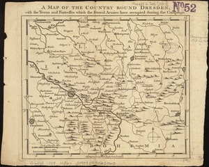
A map of the country round Dresden, with the towns and fortresses which the several armies have occupied during the campaign
4629.
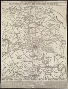
Map of the country within thirty miles of the rebel capital / G. Woolworth Colton, N.Y
4630.
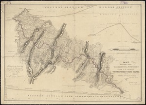
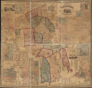
Map of the county of Berkshire, Massachusetts : based upon the trigonometrical survey of the state
4631.
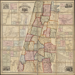
Map of the county of Bristol, Massachusetts : based upon the trigonometrical survey of the state
4632.
Map of the county of Carleton, Canada West : from surveys under the direction of H.F. Walling
4633.
Map of the county of Essex, Vermont
4634.
Map of the county of Hampshire, Massachusetts : based upon the trigonometrical survey of the state
4635.
Map of the County of Middlesex, New Jersey
4636.
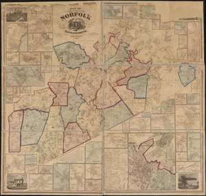
Map of the county of Norfolk, Massachusetts : based upon the trigonometrical survey of the state
4637.
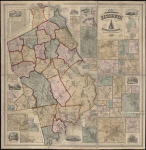
Map of the county of Plymouth, Massachusetts : from actual surveys under the direction of Henry F. Walling
4638.
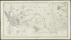
Map of the Department of Dakota including Minnesota, Dakota and Montana
4639.
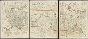
Map of the Department of Dakota including Minnesota, North Dakota, Montana, Yellowstone National Park, and that portion of...
4640.
Map of the Department of the Columbia
‹ Prev
Next ›
1
2
…
228
229
230
231
232
233
234
235
236
…
446
447