Toggle navigation
LMEC Home
Exhibitions
Georeferencing
Tools for Teachers
Collections
My Favorites
Sign Up / Log In
Search
Search the map portal
Map Collection
Map Collection
Map Sets
Search
Search
Search for
Search In
All Fields
Creator
Title
Subject
Place
Search All Digital Collections
Advanced Search
8706 Results
My Search
Start Over
More Like
commonwealth:kk91fr88r
Remove constraint More Like: commonwealth:kk91fr88r
Filter your Search
Place
North and Central America
5,937
United States
4,850
Massachusetts
2,078
Europe
1,396
Suffolk (county)
1,045
Boston
1,018
Canada
449
Asia
438
more
Place
»
Topic
Boston (Mass.)--Maps
586
United States--Maps
282
Real property--Massachusetts--Boston--Maps
175
Massachusetts--Maps
162
Landowners--Massachusetts--Boston--Maps
133
North America--Maps--Early works to 1800
103
New England--Maps
102
Europe--Maps
79
more
Topic
»
Date
Date range begin
–
Date range end
Current results range from
1482
to
2023
View distribution
Creator
United States. Hydrographic Office
595
O.H. Bailey & Co
148
Des Barres, Joseph F. W. (Joseph Frederick Wallet), 1722-1824
123
United States. Post Office Dept
120
Ptolemy, 2nd cent
100
Walling, Henry Francis, 1825-1888
94
Geological Survey (U.S.)
86
Jefferys, Thomas, -1771
86
more
Creator
»
Format
Maps/Atlases
8,646
Manuscripts
215
Prints
56
Books
36
Objects/Artifacts
10
Drawings/Illustrations
8
Posters
5
Georeferenced
Yes
869
No
7,837
Collection
Norman B. Leventhal Map & Education Center Collection
8,693
Boston and New England Maps
2,232
Urban Maps
2,023
Maritime Charts and Atlases
1,083
American Revolutionary War-Era Maps
628
Boston Redevelopment Authority Collection
87
William L. Clements Library Collection
8
American Antiquarian Society Collection
5
Available to use
No known restrictions
8,551
Creative Commons license
47
Search Constraints
Sort by relevance
relevance
title
date (asc)
date (desc)
Number of results to display per page
20 per page
10
per page
20
per page
50
per page
100
per page
View results as:
grid view
map view
Search Results
21.
The new war map of Virginia, Maryland & Pennsylvania
22.
Official map of the state of Virginia : from actual surveys by order of the executive, 1828 & 1859
23.
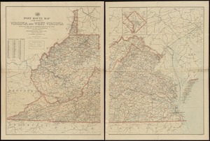
Post route map of the states of Virginia and West Virginia showing post offices with the intermediate distances and mail routes...
24.
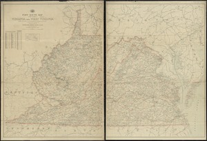
Post route map of the states of Virginia and West Virginia showing post offices with the intermediate distances on mail routes...
25.
Post route map of the states of Virginia and West Virginia showing post offices with the intermediate distances on mail routes...
26.
Post route map of the states of Virginia and West Virginia together with Maryland and Delaware with adjacent parts of...
27.
Scarborough's new county and post office map of Virginia, Maryland, Delaware, and District of Columbia : with complete index...
28.
The seat of war : birds eye view of Virginia, Maryland, Delaware, and the District of Columbia
29.
Seat of war in Virginia and Maryland
30.
Smith's topographical map of Virginia and Maryland
31.
State of Virginia : stations and transmission lines used in public service in 1925 and gaging stations
32.
State of Virginia coal fields and producing districts, September 1919
33.
The state of Virginia from the best authorities
34.
The tourist's pocket map of the state of Virginia : exhibiting its internal improvements, roads, distances &c
35.
Virginia
36.
Carte de la Virginie, : de la Baye Chesapeack, et pays voisins. : Pour servir à l'Histoire générale des voyages. : Tirée...
37.
Confluence of the James River, York River, and Chesapeake Bay
38.
Delaware Bay and Chesapeake Bay
39.
Delaware Bay and Chesapeake Bay
40.
A map of the country between Will's Creek & Monongahela River shewing the rout and encampments of the English army, in 1755
‹ Prev
Next ›
1
2
3
4
5
6
…
435
436