Toggle navigation
LMEC Home
Exhibitions
Georeferencing
Tools for Teachers
Collections
My Favorites
Sign Up / Log In
Search
Search the map portal
Map Collection
Map Collection
Map Sets
Search
Search
Search for
Search In
All Fields
Creator
Title
Subject
Place
Search All Digital Collections
Advanced Search
8654 Results
My Search
Start Over
More Like
commonwealth:kk91fr182
Remove constraint More Like: commonwealth:kk91fr182
Filter your Search
Place
North and Central America
5,893
United States
4,808
Massachusetts
2,068
Europe
1,392
Suffolk (county)
1,041
Boston
1,014
Canada
455
Asia
437
more
Place
»
Topic
Boston (Mass.)--Maps
582
United States--Maps
279
Real property--Massachusetts--Boston--Maps
175
Massachusetts--Maps
161
Landowners--Massachusetts--Boston--Maps
133
North America--Maps--Early works to 1800
103
New England--Maps
101
Europe--Maps
79
more
Topic
»
Date
Date range begin
–
Date range end
Current results range from
1482
to
2023
View distribution
Creator
United States. Hydrographic Office
595
O.H. Bailey & Co
148
Des Barres, Joseph F. W. (Joseph Frederick Wallet), 1722-1824
123
United States. Post Office Dept
120
Ptolemy, 2nd cent
100
Walling, Henry Francis, 1825-1888
94
Jefferys, Thomas, -1771
87
Geological Survey (U.S.)
86
more
Creator
»
Format
Maps/Atlases
8,594
Manuscripts
217
Prints
56
Books
36
Objects/Artifacts
10
Drawings/Illustrations
8
Posters
5
Georeferenced
Yes
869
No
7,785
Collection
Norman B. Leventhal Map & Education Center Collection
8,646
Boston and New England Maps
2,221
Urban Maps
1,992
Maritime Charts and Atlases
1,083
American Revolutionary War-Era Maps
623
Boston Redevelopment Authority Collection
87
MacLean Collection Map Library
3
Newberry Library Collection
2
more
Collection
»
Available to use
No known restrictions
8,504
Creative Commons license
50
Search Constraints
Sort by relevance
relevance
title
date (asc)
date (desc)
Number of results to display per page
20 per page
10
per page
20
per page
50
per page
100
per page
View results as:
grid view
map view
Search Results
1.
An exact chart of the river St. Laurence, from Fort Frontenac to the island of Anticosti shewing the soundings, rocks, shoals...
2.
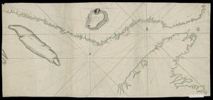
[Bay of Seven Islands]
3.
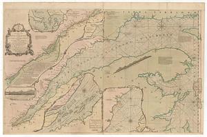
[Chart of the coast of Quebec from the Riviere St. Jean to Grand Hermine Bay]
4.
[Chart of the gulf and river of St. Lawrence]
5.
A plan of Quebec and environs, with its defences and the occasional entrenched camps of the French commanded by Marquis de...
6.
[The St. Lawrence River from the Chaudiere River to Pointe aux Coques]
7.
[Continuation of Plan du detroit de Belle Isle et du Golphe St. Laurent]
8.
Plan du detroit de Belle Isle et du Golphe St. Laurent pour la coste du nord
9.
Carte geographique de la Nouvelle Franse
10.
A new map of Nova Scotia, and Cape Britain : with the adjacent parts of New England and Canada, composed from a great number of...
11.
An authentic plan of the River St. Laurence, from Sillery to the Fall of Montmerenci : with the operations of the Siege of...
12.
An authentic plan of the River St. Laurence, from Sillery to the Fall of Montmorenci : with the operations of the Siege of...
13.
An authentic plan of the River St. Laurence from Sillery to the fall of Montmorenci, with the operations of the siege of Quebec...
14.
A map of the several dispositions of the English Fleet & Army on the River St. Laurence to the taking of Quebec
15.
Pascaerte van Terra Nova Nova Francia Nievw Engeland En de Groote Revier van Canada
16.
A new map of Nova Scotia and Cape Breton Island : with the adjacent parts of New England and Canada composed from a great...
17.
A new map of Nova Scotia, and Cape Britain : with the adjacent parts of New England and Canada, composed from a great number of...
18.
Canada Louisiane et terres angloises
19.
An exact chart of the river S.t Laurence, from Fort Frontenac to the island of Anticosti shewing the soundings, rocks, shoals...
20.
Lauff des flusses St. Laurentzi von Quebec bis an den See Ontario : 2. bladt
‹ Prev
Next ›
1
2
3
4
5
…
432
433

![[Bay of Seven Islands]](https://bpldcassets.blob.core.windows.net/derivatives/images/commonwealth:7h149v48t/image_thumbnail_300.jpg)
![[Chart of the coast of Quebec from the Riviere St. Jean to Grand Hermine Bay]](https://bpldcassets.blob.core.windows.net/derivatives/images/commonwealth:7h149v50v/image_thumbnail_300.jpg)
![[Chart of the gulf and river of St. Lawrence]](https://bpldcassets.blob.core.windows.net/derivatives/images/commonwealth:7h149v39v/image_thumbnail_300.jpg)

![[The St. Lawrence River from the Chaudiere River to Pointe aux Coques]](https://bpldcassets.blob.core.windows.net/derivatives/images/commonwealth:7h149v425/image_thumbnail_300.jpg)
![[Continuation of Plan du detroit de Belle Isle et du Golphe St. Laurent]](https://bpldcassets.blob.core.windows.net/derivatives/images/commonwealth:z603vm96n/image_thumbnail_300.jpg)