Toggle navigation
LMEC Home
Exhibitions
Georeferencing
Tools for Teachers
Collections
My Favorites
Sign Up / Log In
Search
Search the map portal
Map Collection
Map Collection
Map Sets
Search
Search
Search for
Search In
All Fields
Creator
Title
Subject
Place
Search All Digital Collections
Advanced Search
358 Results
My Search
Start Over
More Like
commonwealth:js957749v
Remove constraint More Like: commonwealth:js957749v
Filter your Search
Place
North and Central America
345
United States
340
Canada
25
North America
18
Mexico
10
West Indies
7
Louisiana
4
Massachusetts
4
more
Place
»
Topic
United States--Maps
330
Elections--United States--Maps
36
Railroads--United States--Maps
34
Canada--Maps
22
North America--Maps
15
Population density--United States--Maps
14
Indians of North America--Maps
12
Mexico--Maps
10
more
Topic
»
Date
Date range begin
–
Date range end
Current results range from
1750
to
2023
View distribution
Creator
Paullin, Charles Oscar, 1868 or 1869-1944
70
Wright, John Kirtland, 1891-1969
70
Geological Survey (U.S.)
16
Rand McNally and Company
7
Chase, Ernest Dudley, 1878-1966
5
United States. Office of Indian Affairs
5
Carey, Mathew, 1760-1839
4
Colton, G. Woolworth (George Woolworth), 1827-1901
4
more
Creator
»
Format
Maps/Atlases
353
Prints
5
Manuscripts
4
Books
1
Objects/Artifacts
1
Posters
1
Georeferenced
Yes
72
No
286
Collection
Norman B. Leventhal Map & Education Center Collection
308
American Revolutionary War-Era Maps
50
American Antiquarian Society Collection
20
William L. Clements Library Collection
15
MacLean Collection Map Library
13
David Judkins Weaver Papers
2
Mapping Boston Collection
2
New York Public Library Collection
2
more
Collection
»
Available to use
No known restrictions
230
Creative Commons license
9
Search Constraints
Sort by relevance
relevance
title
date (asc)
date (desc)
Number of results to display per page
20 per page
10
per page
20
per page
50
per page
100
per page
View results as:
grid view
map view
Search Results
301.
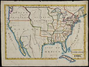
[United States]
302.
The United States : a map showing commercial, educational and travel features
303.
United States
304.
United States
305.
United States
306.
United States
307.
The United States according to the definitive treaty of peace signed at Paris, Septr. 3d, 1783
308.
The United States according to the definitive treaty of peace signed at Paris, Septr. 3d. 1783 ...
309.
The United States as viewed by California (very unofficial)
310.
United States base map
311.
United States bee colonies
312.
United States contour map
313.
United States contour map
314.
United States history and civil government study : being a series of charts and maps giving outlines and pictorial...
315.
United States inlay puzzle
316.
United States of America
317.
The United States of America
318.
The United States of America : laid down from the best authorities agreeable to the peace of 1783. : This map and chart is...
319.
The United States of America : including all its newly acquired territory
320.
United States of America
‹ Prev
Next ›
1
2
…
12
13
14
15
16
17
18
![[United States]](https://bpldcassets.blob.core.windows.net/derivatives/images/commonwealth:7h149x55n/image_thumbnail_300.jpg)