Toggle navigation
LMEC Home
Exhibitions
Georeferencing
Tools for Teachers
Collections
My Favorites
Sign Up / Log In
Search
Search the map portal
Map Collection
Map Collection
Map Sets
Search
Search
Search for
Search In
All Fields
Creator
Title
Subject
Place
Search All Digital Collections
Advanced Search
8721 Results
My Search
Start Over
More Like
commonwealth:js956m10r
Remove constraint More Like: commonwealth:js956m10r
Filter your Search
Place
North and Central America
5,952
United States
4,870
Massachusetts
2,101
Europe
1,396
Suffolk (county)
1,060
Boston
1,033
Canada
449
Asia
438
more
Place
»
Topic
Boston (Mass.)--Maps
597
United States--Maps
282
Real property--Massachusetts--Boston--Maps
175
Massachusetts--Maps
162
Landowners--Massachusetts--Boston--Maps
133
North America--Maps--Early works to 1800
103
New England--Maps
102
Europe--Maps
79
more
Topic
»
Date
Date range begin
–
Date range end
Current results range from
1482
to
2023
View distribution
Creator
United States. Hydrographic Office
595
O.H. Bailey & Co
148
Des Barres, Joseph F. W. (Joseph Frederick Wallet), 1722-1824
124
United States. Post Office Dept
120
Ptolemy, 2nd cent
100
Walling, Henry Francis, 1825-1888
94
Geological Survey (U.S.)
86
Jefferys, Thomas, -1771
85
more
Creator
»
Format
Maps/Atlases
8,661
Manuscripts
215
Prints
56
Books
36
Objects/Artifacts
10
Drawings/Illustrations
8
Posters
6
Georeferenced
Yes
872
No
7,849
Collection
Norman B. Leventhal Map & Education Center Collection
8,706
Boston and New England Maps
2,247
Urban Maps
2,029
Maritime Charts and Atlases
1,087
American Revolutionary War-Era Maps
628
Boston Redevelopment Authority Collection
90
Mapping Boston Collection
11
William L. Clements Library Collection
10
more
Collection
»
Available to use
No known restrictions
8,556
Creative Commons license
59
Search Constraints
Sort by relevance
relevance
title
date (asc)
date (desc)
Number of results to display per page
20 per page
10
per page
20
per page
50
per page
100
per page
View results as:
grid view
map view
Search Results
7281.
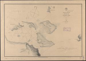
Seagull Harbour, Gretton Bay, Wollaston Island, Tierra del Fuego
7282.
Sears Park conceptual site plan with historic waterway
7283.
The seat of action, between the British and American forces : or an authentic plan of the western part of Long Island, with the...
7284.
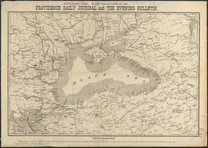
Seat of the Russo-Turkish War
7285.
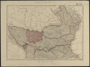
The seat of war
7286.
The seat of war : birds eye view of Virginia, Maryland, Delaware, and the District of Columbia
7287.
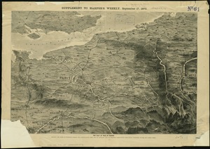
The seat of war in France, showing the scene of M'Mahon's defeat and capitulation, Paris and its environs, and its railroad...
7288.
The seat of war in New England, by an American volunteer : with the marches of the several corps sent by the Colonies towards...
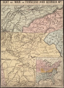
7289.
Seat of war in Tennesse and Georgia : 6D
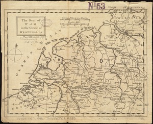
7290.
The seat of war in the circle of Westphalia
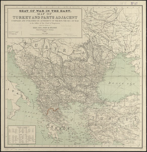
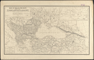
7291.
Seat of war in the east : map of Turkey and parts adjacent
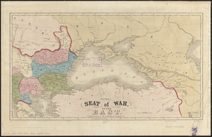
7292.
Seat of war in the east
7293.
Seat of war in the east : map of Turkey and parts adjacent
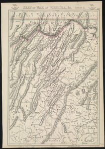
7294.
Seat of war in Virginia
7295.
Seat of war in Virginia and Maryland
7296.
Seat of war in Virginia, &c
7297.
The seat of war in ye North : or a map of the Baltick, with part of the North Sea ... posture of affaris
7298.
The seat of war in ye North : or a map of the Baltick, with part of the North Sea ... posture of affaris
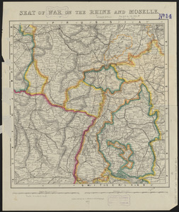
7299.
Seat of war on the Rhine and Moselle
7300.
The seat of war on the Rhine being a new map of the course of that river from Basil to Bonn with the adjacent countries
‹ Prev
Next ›
1
2
…
361
362
363
364
365
366
367
368
369
…
436
437