Toggle navigation
LMEC Home
Exhibitions
Georeferencing
Tools for Teachers
Collections
My Favorites
Sign Up / Log In
Search
Search the map portal
Map Collection
Map Collection
Map Sets
Search
Search
Search for
Search In
All Fields
Creator
Title
Subject
Place
Search All Digital Collections
Advanced Search
8343 Results
My Search
Start Over
More Like
commonwealth:js956k09s
Remove constraint More Like: commonwealth:js956k09s
Filter your Search
Place
North and Central America
5,092
United States
3,922
Suffolk (county)
1,202
Boston
1,175
Europe
963
Canada
427
Massachusetts
329
France
269
more
Place
»
Topic
Boston (Mass.)--Maps
740
United States--Maps
270
Real property--Massachusetts--Boston--Maps
198
City planning--Massachusetts--Boston--Maps
167
Massachusetts--Maps
163
Landowners--Massachusetts--Boston--Maps
142
North America--Maps--Early works to 1800
103
New England--Maps
101
more
Topic
»
Date
Date range begin
–
Date range end
Current results range from
1482
to
2023
View distribution
Creator
United States. Hydrographic Office
357
Boston Redevelopment Authority
173
O.H. Bailey & Co
148
Des Barres, Joseph F. W. (Joseph Frederick Wallet), 1722-1824
124
United States. Post Office Dept
120
Ptolemy, 2nd cent
100
Walling, Henry Francis, 1825-1888
94
Jefferys, Thomas, -1771
84
more
Creator
»
Format
Maps/Atlases
8,284
Manuscripts
215
Prints
51
Books
36
Objects/Artifacts
10
Drawings/Illustrations
8
Posters
4
Georeferenced
Yes
884
No
7,459
Collection
Norman B. Leventhal Map Center Collection
8,191
Boston and New England Maps
2,322
Urban Maps
2,057
Maritime Charts and Atlases
750
American Revolutionary War-Era Maps
638
Boston Redevelopment Authority Collection
204
Mapping Boston Collection
20
Massachusetts Real Estate Atlases
12
more
Collection
»
Available to use
No known restrictions
8,147
Creative Commons license
69
Search Constraints
Sort by relevance
relevance
title
date (asc)
date (desc)
Number of results to display per page
50 per page
10
per page
20
per page
50
per page
100
per page
View results as:
grid view
map view
Search Results
1.
Plan of estates on Suffolk St. District : belonging to the City of Boston : to be sold at public auction, Dec. 23rd 1871
2.
Plan of estates on Suffolk St. district : belonging to the City of Boston : to be sold at public auction on Saturday Dec. 16th...
3.
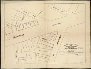
[Plan of lots in Chinatown, between Broad and Front Streets, and Beach and Orange Streets, Boston]
4.
[Plan of lots in Chinatown (Boston), between Avery and Eliot Streets, and Tremont Street and Harrison Avenue]
5.
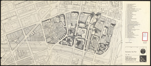
Architectural styles, Chinatown historic core, historic edge
6.
Herald Street improvements
7.
Land use New York streets - South Cove 1953
8.
Relationship of TNEMC development plan area to New York streets land assembly and redevelopment project
9.
South Cove : property status and unit ownership
10.
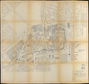
South Cove project no. Mass r- : existing land use
11.
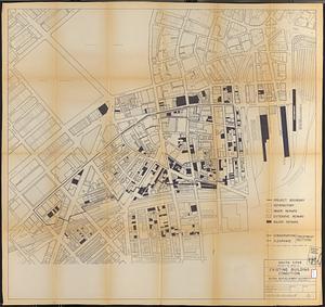
South Cove project no. Mass. r- : existing building condition
12.
South Cove property ownership 1950
13.
South Cove property ownership 1962
14.
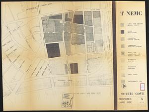
South Cove proposed land use
15.
South Cove urban renewal area Massachusetts R-92 : illustrative site plan
16.
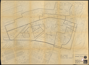
South Cove urban renewal area R-92 : zoning plan
17.
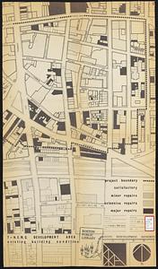
T-N.E.M.C. development area existing building condition
18.
T-N.E.M.C. properties acquired 1945-58
19.
Annexation map
20.
Atlas of the city of Boston : Boston proper : from actual surveys and official plans
21.
Atlas of the city of Boston : Boston proper and Back Bay : from actual surveys and official plans
22.
Atlas of the city of Boston : Boston proper and Back Bay : from actual surveys and official plans
23.
Atlas of the city of Boston : Boston proper and Back Bay : from actual surveys and official plans
24.
Atlas of the city of Boston : Boston proper and Back Bay : from actual surveys and official plans
25.
Atlas of the city of Boston : Boston proper and Back Bay : from actual surveys and official plans
26.
Atlas of the city of Boston : Boston proper and Back Bay : from actual surveys and official plans
27.
Atlas of the city of Boston : Boston proper and Back Bay : from actual surveys and official plans
28.
Atlas of the city of Boston : Boston proper and Roxbury : from actual surveys and official plans
29.
Atlas of the city of Boston : city proper : volume 1 : from actual surveys and official records
30.
Atlas of the city of Boston : city proper and Roxbury : from actual surveys and official plans
31.
Atlas of the city of Boston : city proper, volume one : from actual surveys and official plans
32.
Atlas of the city of Boston : city proper, volume two : from actual surveys and official plans
33.
Atlas of the city of Boston : Roxbury : from actual surveys and official plans
34.
Atlas of the county of Suffolk, Massachusetts : vol. 1st including Boston proper : from actual surveys and official records
35.
Ausicht von Boston : nach der natur aufgenommen
36.
Back Bay and Parker Hill parks : Parker Hill and Jamaica parkways : Boston and Roxbury districts
37.
Bartlett's illustrated map of Boston, or, Stranger's guide showing the public buildings, places of amusement & its'...
38.
Block map, vicinity of Faneuil Hall, Boston : embracing Custom House, Post Office Square, Fort Hill Square, and Chamber of...
39.
Boston
40.
Boston
41.
Boston
42.
Boston
43.
Boston, 1838
44.
Boston and its suburban drives
45.
[Boston and Northwestern Junction Railroad]
46.
Boston and surroundings
47.
Boston and vicinity
48.
Boston and vicinity
49.
Boston and vicinity : 1893
50.
Boston and vicinity
‹ Prev
Next ›
1
2
3
4
5
…
166
167

![[Plan of lots in Chinatown, between Broad and Front Streets, and Beach and Orange Streets, Boston]](https://bpldcassets.blob.core.windows.net/derivatives/images/commonwealth:9s161h46q/image_thumbnail_300.jpg)
![[Plan of lots in Chinatown (Boston), between Avery and Eliot Streets, and Tremont Street and Harrison Avenue]](https://bpldcassets.blob.core.windows.net/derivatives/images/commonwealth:cj82kz565/image_thumbnail_300.jpg)


![[Boston and Northwestern Junction Railroad]](https://bpldcassets.blob.core.windows.net/derivatives/images/commonwealth:x059cc74n/image_thumbnail_300.jpg)


