Toggle navigation
LMEC Home
Exhibitions
Georeferencing
Tools for Teachers
Collections
My Favorites
Sign Up / Log In
Search
Search the map portal
Map Collection
Map Collection
Map Sets
Search
Search
Search for
Search In
All Fields
Creator
Title
Subject
Place
Search All Digital Collections
Advanced Search
8772 Results
My Search
Start Over
More Like
commonwealth:js956j87z
Remove constraint More Like: commonwealth:js956j87z
Filter your Search
Place
North and Central America
6,003
United States
4,903
Massachusetts
2,149
Europe
1,396
Suffolk (county)
1,047
Boston
1,020
Canada
450
Asia
438
more
Place
»
Topic
Boston (Mass.)--Maps
590
United States--Maps
282
Massachusetts--Maps
235
Real property--Massachusetts--Boston--Maps
175
Landowners--Massachusetts--Boston--Maps
133
New England--Maps
104
North America--Maps--Early works to 1800
103
Europe--Maps
79
more
Topic
»
Date
Date range begin
–
Date range end
Current results range from
1482
to
2023
View distribution
Creator
United States. Hydrographic Office
595
O.H. Bailey & Co
148
Des Barres, Joseph F. W. (Joseph Frederick Wallet), 1722-1824
123
United States. Post Office Dept
120
Ptolemy, 2nd cent
100
Walling, Henry Francis, 1825-1888
95
Geological Survey (U.S.)
92
Jefferys, Thomas, -1771
85
more
Creator
»
Format
Maps/Atlases
8,711
Manuscripts
217
Prints
56
Books
36
Objects/Artifacts
10
Drawings/Illustrations
8
Posters
5
Ephemera
1
Georeferenced
Yes
878
No
7,894
Collection
Norman B. Leventhal Map & Education Center Collection
8,737
Boston and New England Maps
2,280
Urban Maps
2,024
Maritime Charts and Atlases
1,083
American Revolutionary War-Era Maps
639
Boston Redevelopment Authority Collection
90
Applied Geographics, Inc. Records
20
David Judkins Weaver Papers
18
more
Collection
»
Available to use
No known restrictions
8,595
Creative Commons license
51
Search Constraints
Sort by relevance
relevance
title
date (asc)
date (desc)
Number of results to display per page
20 per page
10
per page
20
per page
50
per page
100
per page
View results as:
grid view
map view
Search Results
41.
The Massachusetts interstate highway program
42.
Plan of the roads between Boston and Albany : survey'd by order of the governor in pursuance of a resolution of the General...
43.
Explorer's map & directory of the New England Coast : New London, Connecticut, to Passamaquoddy Bay, Canada : a comprehensive...
44.
A map of the colony of Rhode Island : with the adjacent parts of Connecticut, Massachusetts Bay, &c.
45.
Map of the southern part of New England : compiled for Pres't. Dwights travels
46.
Massachusetts and Rhode Island
47.
Massachusetts and Rhode Island
48.
States of Massachusetts, Rhode Island and Connecticut : base map with highways and contours
49.
States of Massachusetts, Rhode Island and Connecticut : base map with highways and contours
50.
States of Massachusetts, Rhode Island and Connecticut : shaded relief
51.
Plan of Boston
52.
The South Shore and Norfolk County, Mass
53.
Connecticut with portions of New York & Rhode Island
54.
Geographical, statistical, and historical map of Rhode Island
55.
Manuscript maps of U.S. states
56.
A map of Rhode Island
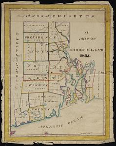
57.
A map of the State of Rhode Island
58.
Map of the State of Rhode Island and Providence Plantations
59.
Map of the State of Rhode Island, and Providence Plantations
60.
Rhode Island
‹ Prev
Next ›
1
2
3
4
5
6
7
…
438
439