Toggle navigation
LMEC Home
Exhibitions
Georeferencing
Tools for Teachers
Collections
My Favorites
Sign Up / Log In
Search
Search the map portal
Map Collection
Map Collection
Map Sets
Search
Search
Search for
Search In
All Fields
Creator
Title
Subject
Place
Search All Digital Collections
Advanced Search
8552 Results
My Search
Start Over
More Like
commonwealth:js956j15q
Remove constraint More Like: commonwealth:js956j15q
Filter your Search
Place
North and Central America
5,847
United States
4,771
Massachusetts
2,054
Europe
1,359
Suffolk (county)
1,034
Boston
1,007
Canada
448
Asia
422
more
Place
»
Topic
Boston (Mass.)--Maps
577
United States--Maps
273
Real property--Massachusetts--Boston--Maps
174
Massachusetts--Maps
160
Landowners--Massachusetts--Boston--Maps
132
North America--Maps--Early works to 1800
103
New England--Maps
99
Europe--Maps
78
more
Topic
»
Date
Date range begin
–
Date range end
Current results range from
1482
to
2023
View distribution
Creator
United States. Hydrographic Office
594
O.H. Bailey & Co
148
Des Barres, Joseph F. W. (Joseph Frederick Wallet), 1722-1824
123
United States. Post Office Dept
120
Ptolemy, 2nd cent
100
Walling, Henry Francis, 1825-1888
94
Geological Survey (U.S.)
86
Jefferys, Thomas, -1771
85
more
Creator
»
Format
Maps/Atlases
8,493
Manuscripts
214
Prints
56
Books
36
Objects/Artifacts
10
Drawings/Illustrations
8
Posters
4
Georeferenced
Yes
868
No
7,684
Collection
Norman B. Leventhal Map & Education Center Collection
8,552
Boston and New England Maps
2,203
Urban Maps
1,935
Maritime Charts and Atlases
1,081
American Revolutionary War-Era Maps
616
Boston Redevelopment Authority Collection
87
Available to use
No known restrictions
8,411
Creative Commons license
46
Search Constraints
Sort by relevance
relevance
title
date (asc)
date (desc)
Number of results to display per page
20 per page
10
per page
20
per page
50
per page
100
per page
View results as:
grid view
map view
Search Results
1.
[Plan of section of proposed Charles River Park]
2.
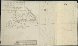
[Plan of property in the Cambridgeport marshes]
3.
Copy of an ancient plan belonging to the City (not dated probably about 1738)
4.
Copy of an old plan belonging to the city
5.
Plan of an estate in Boston belonging to Jos. Head Esqr
6.
Plan of Bishop Parker's estate Bedford Street
7.
[Plan of lots on Pine Street, Boston, between Washington and Front Streets]
8.
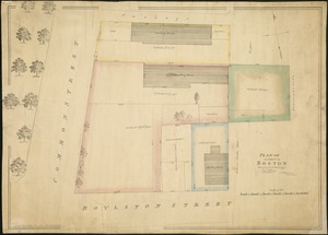
[Plan of residences on Park Street in Boston]
9.
A plan of the town dock, formerly called Bendalls Dock, in Boston, with the buildings round & flats before it
10.
[Plan of Tremont Street from Park to Boylston]
11.
[Plan of Tremont Street, from West to Boylston]
12.
Boston Harbor Mass : Charles River from Brookline Street bridge to Market Street bridge
13.
Boston Harbor, Mass : map of Charles River from Brookline Street bridge to its mouth
14.
Boston water works : map showing the several sources of supply already constructed, also the drainage areas of Lake Cochituate...
15.
Broad Canal, Cambridge : condition of retaining walls and bed of Canal, inspection for Committee on Charles River Dam, Oct. 30,...
16.
Charles River
17.
Charles River embankment : Boston district
18.
Compiled plan, showing Millers Creek and a portion of Charles River
19.
Lechmere Canal, Cambridge : condition of retaining walls and bed of canal, inspection for Committee on Charles River Dam, Nov....
20.
Map of Charles River showing principal sources of pollution
‹ Prev
Next ›
1
2
3
4
5
…
427
428
![[Plan of section of proposed Charles River Park]](https://bpldcassets.blob.core.windows.net/derivatives/images/commonwealth:x059cc51b/image_thumbnail_300.jpg)
![[Plan of property in the Cambridgeport marshes]](https://bpldcassets.blob.core.windows.net/derivatives/images/commonwealth:1257bb747/image_thumbnail_300.jpg)


![[Plan of lots on Pine Street, Boston, between Washington and Front Streets]](https://bpldcassets.blob.core.windows.net/derivatives/images/commonwealth:9s161h488/image_thumbnail_300.jpg)
![[Plan of residences on Park Street in Boston]](https://bpldcassets.blob.core.windows.net/derivatives/images/commonwealth:9s161h36g/image_thumbnail_300.jpg)
![[Plan of Tremont Street from Park to Boylston]](https://bpldcassets.blob.core.windows.net/derivatives/images/commonwealth:9s161b59r/image_thumbnail_300.jpg)
![[Plan of Tremont Street, from West to Boylston]](https://bpldcassets.blob.core.windows.net/derivatives/images/commonwealth:sn00b611k/image_thumbnail_300.jpg)


