Toggle navigation
LMEC Home
Exhibitions
Georeferencing
Tools for Teachers
Collections
My Favorites
Sign Up / Log In
Search
Search the map portal
Map Collection
Map Collection
Map Sets
Search
Search
Search for
Search In
All Fields
Creator
Title
Subject
Place
Search All Digital Collections
Advanced Search
386 Results
My Search
Start Over
More Like
commonwealth:hx11z3576
Remove constraint More Like: commonwealth:hx11z3576
Filter your Search
Place
North and Central America
346
United States
225
Canada
103
Essex (county)
24
New York
24
Louisbourg
21
Saint Lawrence River
19
Fort Edward
16
more
Place
»
Topic
United States--History--French and Indian War, 1754-1763--Maps, Manuscript--Early works to 1800
58
Louisbourg (N.S.)--Maps, Manuscript--Early works to 1800
18
Fort Edward (N.Y.)--Maps, Manuscript--Early works to 1800
16
Fort Ticonderoga (N.Y.)--Maps, Manuscript--Early works to 1800
15
Saint Lawrence River--Maps, Manuscript--Early works to 1800
15
Louisbourg (N.S.)--History--Siege, 1745--Maps, Manuscript--Early works to 1800
14
Fortification--New York (State)--Fort Edward--Maps, Manuscript--Early works to 1800
13
Fortification--New York (State)--Maps, Manuscript--Early works to 1800
12
more
Topic
»
Date
Date range begin
–
Date range end
Current results range from
1664
to
1816
View distribution
Creator
Royal United Services Institute for Defence and Security Studies
160
George, III, King of Great Britain, 1738-1820
151
George, IV, King of Great Britain, 1762-1830
150
Amherst, Jeffery Amherst, Baron, 1717-1797
128
Skinner, Monier
28
Skinner, William, 1700-1780
28
Brasier, William
16
Bastide, John Henry, approximately 1700-1770
15
more
Creator
»
Format
Maps/Atlases
369
Manuscripts
159
Drawings/Illustrations
15
Georeferenced
Yes
7
No
379
Collection
British Library Collection
376
American Revolutionary War-Era Maps
362
Boston and New England Maps
21
Library of Congress Collection
9
Urban Maps
5
Maritime Charts and Atlases
2
Norman B. Leventhal Map & Education Center Collection
1
Available to use
Creative Commons license
385
No known restrictions
1
Search Constraints
Sort by relevance
relevance
title
date (asc)
date (desc)
Number of results to display per page
20 per page
10
per page
20
per page
50
per page
100
per page
View results as:
grid view
map view
Search Results
141.
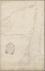
A MAP OF THE PROVINCE OF NEW-YORK, & PART OF NEW ENGLAND WITH A PART OF NEW FRANCE the whole Composed from Actual Surveys
142.
A Map Of the River MERRIMACK from the Atlantick Ocean to Pantuckett Falls describing bounds between His Maj:tys Province of New...
143.
A Map of the Sea Coasts of NEW ENGLAND According to the actual Survey made thereof BY CAP.T CYPRIAN SOUTHACK As also the...
144.
A MAP OF THE SURVEYED PARTS OF NOVA SCOTIA MDCCLVI
145.
MAP of the Western parts of the COLONY of VIRGINIA, as far as the Mississipi
146.
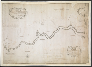
[Map of the Wilderness Road]
147.
[Map of West Florida and the Mississippi River] : John Campbell
148.
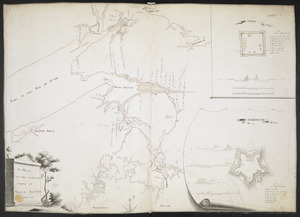
[Map showing Fort Pitt, Fort Duquesne and Fort Mercer]
149.
[Map showing Jonathan Carver's travels west of the Great Lakes.]
150.
[Map showing Jonathan Carver's travels west of the Great Lakes.]
151.
[Map showing military locations from Fort Cumberland on the River Potomac to Fort Presqu'Isle on Lake Erie]
152.
[Map showing military locations from Fort Cumberland on the River Potomac to Fort Presqu'Isle on Lake Erie]
153.
[Map showing neck of land between 'Baye francaise' and 'Baye verte']
154.
[Map showing rivers and forts in North America]
155.
[Map showing Saint John's Harbour and a proposed fort]
156.
[Map showing Saint John's Harbour with Fort William and Fort Townshend]
157.
[Map showing the attack of the French upon York in Virginia, June 1782]
158.
[Map showing the boundary line between the provinces of Massachusetts Bay and Connecticut by Woodward and Saffery in 1642 and...
159.
[Map showing the disposition of General Amhert's boats and rafts]
160.
[Map showing the location of Fort de la Presentation]
‹ Prev
Next ›
1
2
…
4
5
6
7
8
9
10
11
12
…
19
20


![[Map of the Wilderness Road]](https://bpldcassets.blob.core.windows.net/derivatives/images/commonwealth:hx11z2855/image_thumbnail_300.jpg)
![[Map of West Florida and the Mississippi River]](https://bpldcassets.blob.core.windows.net/derivatives/images/commonwealth:hx11z2898/image_thumbnail_300.jpg)
![[Map showing Fort Pitt, Fort Duquesne and Fort Mercer]](https://bpldcassets.blob.core.windows.net/derivatives/images/commonwealth:hx11z222w/image_thumbnail_300.jpg)
![[Map showing Jonathan Carver's travels west of the Great Lakes.]](https://bpldcassets.blob.core.windows.net/derivatives/images/commonwealth:hx11z299h/image_thumbnail_300.jpg)
![[Map showing Jonathan Carver's travels west of the Great Lakes.]](https://bpldcassets.blob.core.windows.net/derivatives/images/commonwealth:6108vw266/image_thumbnail_300.jpg)
![[Map showing military locations from Fort Cumberland on the River Potomac to Fort Presqu'Isle on Lake Erie]](https://bpldcassets.blob.core.windows.net/derivatives/images/commonwealth:hx11z2367/image_thumbnail_300.jpg)
![[Map showing military locations from Fort Cumberland on the River Potomac to Fort Presqu'Isle on Lake Erie]](https://bpldcassets.blob.core.windows.net/derivatives/images/commonwealth:hx11z2324/image_thumbnail_300.jpg)
![[Map showing neck of land between 'Baye francaise' and 'Baye verte']](https://bpldcassets.blob.core.windows.net/derivatives/images/commonwealth:hx11z035j/image_thumbnail_300.jpg)
![[Map showing rivers and forts in North America]](https://bpldcassets.blob.core.windows.net/derivatives/images/commonwealth:hx11z163x/image_thumbnail_300.jpg)
![[Map showing Saint John's Harbour and a proposed fort]](https://bpldcassets.blob.core.windows.net/derivatives/images/commonwealth:6108vw12v/image_thumbnail_300.jpg)
![[Map showing Saint John's Harbour with Fort William and Fort Townshend]](https://bpldcassets.blob.core.windows.net/derivatives/images/commonwealth:6108vv278/image_thumbnail_300.jpg)
![[Map showing the attack of the French upon York in Virginia, June 1782]](https://bpldcassets.blob.core.windows.net/derivatives/images/commonwealth:hx11xz51j/image_thumbnail_300.jpg)
![[Map showing the boundary line between the provinces of Massachusetts Bay and Connecticut by Woodward and Saffery in 1642 and as run in 1713]](https://bpldcassets.blob.core.windows.net/derivatives/images/commonwealth:hx11z5641/image_thumbnail_300.jpg)
![[Map showing the disposition of General Amhert's boats and rafts]](https://bpldcassets.blob.core.windows.net/derivatives/images/commonwealth:hx11xz67f/image_thumbnail_300.jpg)
![[Map showing the location of Fort de la Presentation]](https://bpldcassets.blob.core.windows.net/derivatives/images/commonwealth:hx11z0993/image_thumbnail_300.jpg)