Toggle navigation
LMEC Home
Exhibitions
Georeferencing
Tools for Teachers
Collections
My Favorites
Sign Up / Log In
Search
Search the map portal
Map Collection
Map Collection
Map Sets
Search
Search
Search for
Search In
All Fields
Creator
Title
Subject
Place
Search All Digital Collections
Advanced Search
382 Results
My Search
Start Over
More Like
commonwealth:hx11z321t
Remove constraint More Like: commonwealth:hx11z321t
Filter your Search
Place
North and Central America
341
United States
211
Canada
103
Essex (county)
24
Louisbourg
21
Saint Lawrence River
19
New York
17
Fort Edward
16
more
Place
»
Topic
United States--History--French and Indian War, 1754-1763--Maps, Manuscript--Early works to 1800
57
Louisbourg (N.S.)--Maps, Manuscript--Early works to 1800
18
Fort Edward (N.Y.)--Maps, Manuscript--Early works to 1800
16
Fort Ticonderoga (N.Y.)--Maps, Manuscript--Early works to 1800
15
Saint Lawrence River--Maps, Manuscript--Early works to 1800
15
Louisbourg (N.S.)--History--Siege, 1745--Maps, Manuscript--Early works to 1800
14
New York (State)--Maps, Manuscript--Early works to 1800
14
Fortification--New York (State)--Fort Edward--Maps, Manuscript--Early works to 1800
13
more
Topic
»
Date
Date range begin
–
Date range end
Current results range from
1664
to
1816
View distribution
Creator
Royal United Services Institute for Defence and Security Studies
160
George, III, King of Great Britain, 1738-1820
151
George, IV, King of Great Britain, 1762-1830
150
Amherst, Jeffery Amherst, Baron, 1717-1797
128
Skinner, Monier
28
Skinner, William, 1700-1780
28
Brasier, William
16
Bastide, John Henry, approximately 1700-1770
15
more
Creator
»
Format
Maps/Atlases
364
Manuscripts
155
Drawings/Illustrations
15
Objects/Artifacts
1
Georeferenced
Yes
8
No
374
Collection
British Library Collection
376
American Revolutionary War-Era Maps
358
Boston and New England Maps
21
Library of Congress Collection
6
Urban Maps
5
Maritime Charts and Atlases
2
Available to use
Creative Commons license
382
Search Constraints
Sort by date (desc)
relevance
title
date (asc)
date (desc)
Number of results to display per page
20 per page
10
per page
20
per page
50
per page
100
per page
View results as:
grid view
map view
Search Results
61.
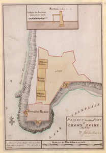
PROJECT for taking POST at CROWN POINT
62.
[Map showing Saint John's Harbour with Fort William and Fort Townshend]
63.
VIEW of BOSTON the Capital of NEW ENGLAND from Col. HATCH's House on the Road to DORCHESTER = VIEW FROM DORCHESTER NECK = VIEW...
64.
A PLAN of the SEA COAST from CAPE ELIZABETH to the ENTRANCE of SAGADAHOCK or KENNEBECK RIVER Including Casco Bay with all it's...
65.
[Coast of South Carolina, Georgia and Florida from Charleston to St. Augustine]
66.
[Coast of South Carolina, Georgia and Florida from Charleston to St. Augustine]
67.
PART of the BAY of PLACENTIA
68.
PLAN of the CITY of NEW YORK, in North America : Surveyed in the Years 1766 & 1767
69.
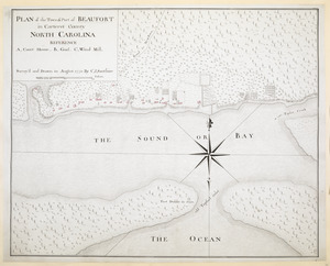
PLAN of the Town & Port of BEAUFORT in Carteret County NORTH CAROLINA
70.
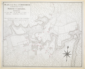
PLAN of the Town of CROSS CREEK in Cumberland County. NORTH CAROLINA
71.
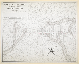
PLAN of the Town of SALISBURY in Rowan County. NORTH CAROLINA
72.
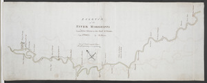
A SKETCH of the RIVER MISSISIPPI from New Orleans to the Rock of Davion
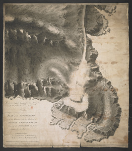
73.
[Map showing Jonathan Carver's travels west of the Great Lakes.]
74.
PLAN of the SOUTH HEAD of the Entrance into the Harbour of St IOHNS NEWFOUNDLAND Shewing the BATTERIES to be Erected theron for...
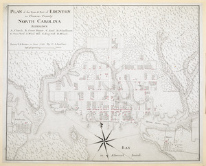
75.
PLAN of the Town & Port of EDENTON in Chowan County NORTH CAROLINA
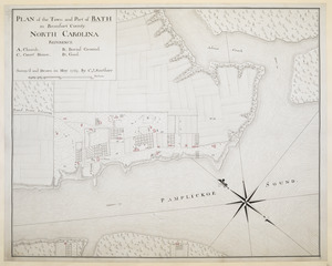
76.
PLAN of the Town and Port of BATH in Beaufort County NORTH CAROLINA
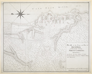
77.
PLAN of the Town and Port of BRUNSWICK in Brunswick County. NORTH CAROLINA
78.
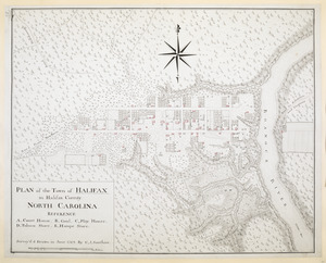
PLAN of the Town of HALIFAX in Halifax County. NORTH CAROLINA
79.
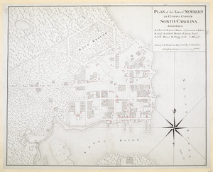
PLAN of the Town of NEWBERN in Craven County NORTH CAROLINA
80.
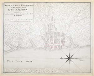
PLAN of the Town of WILLMINGTON in New Hanover County NORTH CAROLINA
‹ Prev
Next ›
1
2
3
4
5
6
7
8
…
19
20
![[Map showing Saint John's Harbour with Fort William and Fort Townshend]](https://bpldcassets.blob.core.windows.net/derivatives/images/commonwealth:6108vv278/image_thumbnail_300.jpg)
![[Coast of South Carolina, Georgia and Florida from Charleston to St. Augustine]](https://bpldcassets.blob.core.windows.net/derivatives/images/commonwealth:hx11z448f/image_thumbnail_300.jpg)
![[Coast of South Carolina, Georgia and Florida from Charleston to St. Augustine]](https://bpldcassets.blob.core.windows.net/derivatives/images/commonwealth:hx11z450g/image_thumbnail_300.jpg)
![[Map showing Jonathan Carver's travels west of the Great Lakes.]](https://bpldcassets.blob.core.windows.net/derivatives/images/commonwealth:hx11z299h/image_thumbnail_300.jpg)