Toggle navigation
LMEC Home
Exhibitions
Georeferencing
Tools for Teachers
Collections
My Favorites
Sign Up / Log In
Search
Search the map portal
Map Collection
Map Collection
Map Sets
Search
Search
Search for
Search In
All Fields
Creator
Title
Subject
Place
Search All Digital Collections
Advanced Search
522 Results
My Search
Start Over
More Like
commonwealth:g445fx66s
Remove constraint More Like: commonwealth:g445fx66s
Filter your Search
Place
North and Central America
519
United States
516
Suffolk (county)
508
Boston
507
Massachusetts
204
Roxbury
90
South End
52
Fens
47
more
Place
»
Topic
City planning--Massachusetts--Boston--Maps
417
Urban renewal--Massachusetts--Boston--Maps
253
Boston (Mass.)--Maps
142
Land use--Massachusetts--Boston--Maps
101
Roxbury (Boston, Mass.)--Maps
89
Buildings--Massachusetts--Boston--Maps
85
Real property--Massachusetts--Boston--Maps
78
Fenway (Boston, Mass.)--Maps
48
more
Topic
»
Date
Date range begin
–
Date range end
Current results range from
1832
to
2014
View distribution
Creator
Boston Redevelopment Authority
370
Bromley, George Washington
17
Bromley, Walter Scott
17
G.W. Bromley & Co.
12
Downtown Waterfront Corporation
10
Victor Gruen Associates
10
Boston (Mass.). Parks and Recreation Department
9
Sasaki Associates
6
more
Creator
»
Format
Maps/Atlases
521
Drawings/Illustrations
3
Manuscripts
1
Prints
1
Georeferenced
Yes
7
No
515
Collection
Boston and New England Maps
508
Urban Maps
493
Boston Redevelopment Authority Collection
441
Norman B. Leventhal Map & Education Center Collection
131
Massachusetts Real Estate Atlases
5
Applied Geographics, Inc. Records
2
Mapping Boston Collection
1
Available to use
No known restrictions
515
Creative Commons license
1
Search Constraints
Sort by relevance
relevance
title
date (asc)
date (desc)
Number of results to display per page
20 per page
10
per page
20
per page
50
per page
100
per page
View results as:
grid view
map view
Search Results
321.
Basement plan of terminal station at Boston, Massachusetts, for the N.Y.N.H & H. and B. & A. railroads
322.
Boston Harbor : challenges and opportunities for the 1980's
323.
Boston thorofare plan existing routes and proposals
324.
Central business district urban renewal area R-82 : sub area boundaries
325.
City of Boston topographic and planimetric survey
326.
Columbia Point feasibility survey area
327.
Contract documents for the Waterfront Park, Boston, Massachusetts : planting plan
328.
Copley Square : layout and pavement plan with tree numbers added
329.
DEM/BRA Long Wharf master plan : schematic'
330.
Downtown waterfront-Faneuil Hall urban renewal area Massachusetts R-77 : property
331.
Downtown waterfront-Faneuil Hall urban renewal area Massachusetts R-77 : property
332.
Fenway urban renewal area Massachusetts : disposition parcels
333.
Fenway urban renewal area Massachusetts : disposition parcels
334.
Fenway urban renewal area Massachusetts : building deficiences and proposed treatment area
335.
Fenway urban renewal area Massachusetts : property map
336.
Fenway urban renewal area Massachusetts : existing and proposed zoning
337.
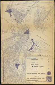
Food distribution center study : Food distribution site study
338.
FPIR/FEIR Olmsted Plaza : a redevelopment of the Sears property, 309 Park Drive/201 Brookline Avenue in the Fenway
339.
General plan : Government Center - Boston - 1959
340.
General plan of Franklin Park
‹ Prev
Next ›
1
2
…
13
14
15
16
17
18
19
20
21
…
26
27