Toggle navigation
LMEC Home
Exhibitions
Georeferencing
Tools for Teachers
Collections
My Favorites
Sign Up / Log In
Search
Search the map portal
Map Collection
Map Collection
Map Sets
Search
Search
Search for
Search In
All Fields
Creator
Title
Subject
Place
Search All Digital Collections
Advanced Search
849 Results
My Search
Start Over
More Like
commonwealth:ft84f3213
Remove constraint More Like: commonwealth:ft84f3213
Filter your Search
Place
North and Central America
833
United States
830
Boston
747
Suffolk (county)
747
Massachusetts
683
Downtown Boston
35
Boston Harbor
24
Middlesex (county)
15
more
Place
»
Topic
Boston (Mass.)--Maps
752
City planning--Massachusetts--Boston--Maps
104
Real property--Massachusetts--Boston--Maps
99
Landowners--Massachusetts--Boston--Maps
74
Massachusetts--Maps
64
Urban renewal--Massachusetts--Boston--Maps
63
Local transit--Massachusetts--Boston--Maps
49
Land use--Massachusetts--Boston--Maps
35
more
Topic
»
Date
Date range begin
–
Date range end
Current results range from
1743
to
2023
View distribution
Creator
Boston Redevelopment Authority
114
Geo. H. Walker & Co
27
Boynton, George W., d. 1884
21
MassGIS (Office : Mass.)
21
Sampson, Davenport & Co
21
Sampson, Murdock & Co
20
Bromley, George Washington
18
Bromley, Walter Scott
17
more
Creator
»
Format
Maps/Atlases
846
Manuscripts
9
Ephemera
2
Documents
1
Posters
1
Georeferenced
Yes
96
No
753
Collection
Norman B. Leventhal Map & Education Center Collection
711
Boston and New England Maps
639
Urban Maps
494
Boston Redevelopment Authority Collection
120
David Judkins Weaver Papers
98
American Revolutionary War-Era Maps
25
Mapping Boston Collection
20
Massachusetts Real Estate Atlases
12
more
Collection
»
Available to use
No known restrictions
782
Creative Commons license
34
Search Constraints
Sort by relevance
relevance
title
date (asc)
date (desc)
Number of results to display per page
20 per page
10
per page
20
per page
50
per page
100
per page
View results as:
grid view
map view
Search Results
601.
Park Plaza urban renewal area : map no. 2 land use map (existing)
602.
Park Plaza urban renewal area : map no. 1 boundary map
603.
Park Plaza urban renewal area : map no. 6 land disposal map
604.
Percent foreign-born
605.
Peremptory sale : this valuable property will positively be sold at public auction on Saturday the 29th day of April current at...
606.
Pianta della città di Boston
607.
Plan and profiles of surveys from Farm Pond in Framingham and Long Pond in Natick, for supplying water to the City of Boston
608.
Plan de Boston : cette ville est composée de quatre mille maisons, et d'environ vingt mille habitans, on compte par an jusqu'a...
609.
Plan de Boston : cette ville est composée de quatre mille maisons, et d'environ vingt mille habitans
610.
Plan de la ville de Boston et ses environs
611.
A plan for the Central Artery
612.
Plan for the diversion and enclosure of Stony Brook : to accompany report of W.H. Bradley, November 1864
613.
Plan for the occupation of flats owned by the Commonwealth in Boston Harbor
614.
Plan for the occupation of flats owned by the Commonwealth in Boston Harbor
615.
A plan of 8 lots of city land known as the Arsenal Lot : and 7 lots fronting on Providence St. to be sold at auction, on...
616.
Plan of a portion of the properties of the Long Wharf or Boston Pier & Central Wharf & Wet Dock Corporatins, showing sixteen...
617.
Plan of an estate belonging to the City of Boston to be sold by public auction on Wednesday, Sept. 14th, 1881 ... : per order...
618.
Plan of Back Bay and vicinity : prepared from surveys made under the direction of Simon Greenleaf, Joel Giles, Ezra Lincoln,...
619.
Plan of Boston
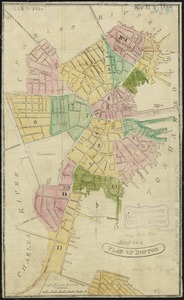
620.
Plan of Boston
‹ Prev
Next ›
1
2
…
27
28
29
30
31
32
33
34
35
…
42
43