Toggle navigation
LMEC Home
Exhibitions
Georeferencing
Tools for Teachers
Collections
My Favorites
Sign Up / Log In
Search
Search the map portal
Map Collection
Map Collection
Map Sets
Search
Search
Search for
Search In
All Fields
Creator
Title
Subject
Place
Search All Digital Collections
Advanced Search
293 Results
My Search
Start Over
More Like
commonwealth:dz010v56h
Remove constraint More Like: commonwealth:dz010v56h
Filter your Search
Place
North and Central America
226
United States
165
New York
31
Suffolk (county)
31
Boston
29
North America
27
Canada
26
Charleston (county)
10
more
Place
»
Topic
North America--Maps--Early works to 1800
18
Boston (Mass.)--History--Revolution, 1775-1783--Maps--Early works to 1800
16
Vues d'optique
10
Gibraltar--History--Siege, 1779-1783--Maps--Early works to 1800
9
New York (N.Y.)--Pictorial works--Early works to 1800
9
United States--History--French and Indian War, 1754-1763--Maps--Early works to 1800
9
United States--Maps--Early works to 1800
9
Boston (Mass.)--Pictorial works--Early works to 1800
8
more
Topic
»
Date
Date range begin
–
Date range end
Current results range from
1740
to
1799
View distribution
Creator
Faden, William, 1749-1836
33
Jefferys, Thomas, -1771
29
Le Rouge, Georges-Louis
23
Des Barres, Joseph F. W. (Joseph Frederick Wallet), 1722-1824
21
Sayer, Robert, 1725-1794
19
Korn, Christoph Heinrich, 1726-1783
10
Raspe, Gabriel Nicolaus, 1712-1785
10
Simcoe, John Graves, 1752-1806
10
more
Creator
»
Format
Maps/Atlases
251
Prints
31
Manuscripts
23
Drawings/Illustrations
9
Books
2
Georeferenced
Yes
12
No
281
Collection
Richard H. Brown Revolutionary War Map Collection at Mount Vernon
293
American Revolutionary War-Era Maps
292
Boston and New England Maps
4
Maritime Charts and Atlases
2
Urban Maps
2
Available to use
Creative Commons license
293
Search Constraints
Sort by date (desc)
relevance
title
date (asc)
date (desc)
Number of results to display per page
20 per page
10
per page
20
per page
50
per page
100
per page
View results as:
grid view
map view
Search Results
141.
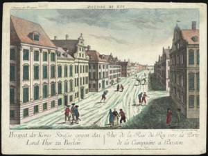
Prospect der König Strasse gegen das land thor zu Boston = : Vuë de la Rue du Roi vers la porte de la campagne a Boston
142.
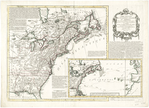
Die zerstörung der königlichen bild säule zu Neu Yorck = : La destruction de la statue royale a Nouvelle Yorck
143.
Carte de l'Amérique Septle. pour servir à l'intelligence de la guerre entre les Anglois et les insurgents
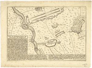
144.
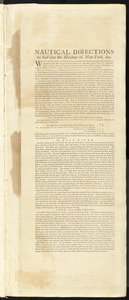
Carte des possessions angloises dans l'Amerique Septentrionale pour servir d'intelligence à la guerre presente traduite de...
145.
Carte nouvelle des posséssions angloises en Amérique : dressée pour l'intelligence de la guerre présente et divisée...
146.
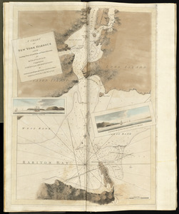
A chart of New York Harbour with the soundings views of land marks and nautical directions : for the use of pilotage
147.
Connecticut and parts adjacent
148.
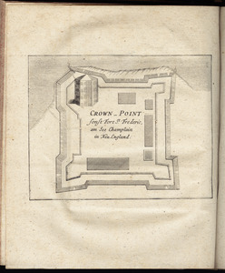
Crown Point : sonst Fort St. Frederic, am See Champlain in Neu England
149.
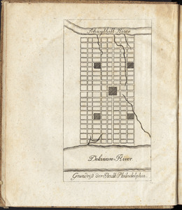
Grundriss der stadt Philadelphia
150.
Grundriss des nördlichen theils der Neujorks Insel : nebst den am 16. Novbr. 1776. eroberten Fort Washington nun das Fort...
151.
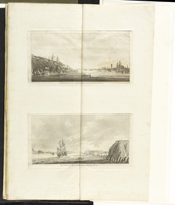
The harbour and part of the town of Havannah : The entrance of Havannah, from within the harbour
152.
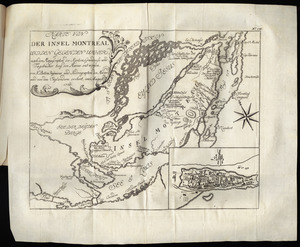
Karte von der Insel Montreal und den gegenden umher, nach den manuscripten der karten, grundrisse und tagebücher beÿ der...
153.
Karte von Neu England, Neu Yorck und Pensilvanien
154.
Krigs theatreni i America, 1777 = : seat of war in America, 1777
155.
A map of the inhabited part of Canada from the French surveys : with the frontiers of New York and New England from the large...
156.
[Map of the Siege of Mud Island Fort]
157.
Nautical directions to sail into the harbour of New-York, &c.
158.
Plan des befestigten lagers der Amerikaner bey Whitemarsh
159.
A plan of Boston in New England with its environs : including Milton, Dorchester, Roxbury, Brooklin, Cambridge, Medford,...
160.
A plan of New York Island, and part of Long Island, with the circumjacent country, as far as Dobbs's Ferry to the north, and...
‹ Prev
Next ›
1
2
…
4
5
6
7
8
9
10
11
12
…
14
15


![[Map of the Siege of Mud Island Fort]](https://bpldcassets.blob.core.windows.net/derivatives/images/commonwealth:z603vr43f/image_thumbnail_300.jpg)