Toggle navigation
LMEC Home
Exhibitions
Georeferencing
Tools for Teachers
Collections
My Favorites
Sign Up / Log In
Search
Search the map portal
Map Collection
Map Collection
Map Sets
Search
Search
Search for
Search In
All Fields
Creator
Title
Subject
Place
Search All Digital Collections
Advanced Search
8872 Results
My Search
Start Over
More Like
commonwealth:cj82m637k
Remove constraint More Like: commonwealth:cj82m637k
Filter your Search
Place
North and Central America
6,103
United States
5,019
Massachusetts
2,129
Europe
1,396
Suffolk (county)
1,217
Boston
1,190
Canada
449
Asia
438
more
Place
»
Topic
Boston (Mass.)--Maps
752
United States--Maps
282
Real property--Massachusetts--Boston--Maps
195
City planning--Massachusetts--Boston--Maps
167
Massachusetts--Maps
166
Landowners--Massachusetts--Boston--Maps
142
New England--Maps
104
North America--Maps--Early works to 1800
103
more
Topic
»
Date
Date range begin
–
Date range end
Current results range from
1482
to
2023
View distribution
Creator
United States. Hydrographic Office
595
Boston Redevelopment Authority
172
O.H. Bailey & Co
148
Des Barres, Joseph F. W. (Joseph Frederick Wallet), 1722-1824
124
United States. Post Office Dept
120
Ptolemy, 2nd cent
100
Walling, Henry Francis, 1825-1888
94
Geological Survey (U.S.)
87
more
Creator
»
Format
Maps/Atlases
8,812
Manuscripts
215
Prints
56
Books
36
Objects/Artifacts
10
Drawings/Illustrations
8
Posters
5
Georeferenced
Yes
885
No
7,987
Collection
Norman B. Leventhal Map & Education Center Collection
8,723
Boston and New England Maps
2,367
Urban Maps
2,151
Maritime Charts and Atlases
1,083
American Revolutionary War-Era Maps
638
Boston Redevelopment Authority Collection
201
Mapping Boston Collection
20
Massachusetts Real Estate Atlases
13
more
Collection
»
Available to use
No known restrictions
8,674
Creative Commons license
70
Search Constraints
Sort by relevance
relevance
title
date (asc)
date (desc)
Number of results to display per page
20 per page
10
per page
20
per page
50
per page
100
per page
View results as:
grid view
map view
Search Results
1.
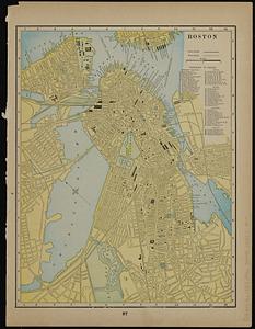
Boston
2.
Map of New York and vicinity
3.
Map showing horse rail roads and the surface steam roads with 104 stations in and around Boston : including 91 surface steam...
4.
Map showing the terminal facilities of Boston
5.
Map showing the terminal facilities of Boston
6.
Map showing the terminal facilities of Boston
7.
Plan of Boston
8.
Plan of Boston & Maine Railroad terminal division Boston, Cambridge, Somerville, Everett and Medford
9.
Plan of Boston and its vicinity showing the connection of the Grand Junction Rail Road with the Harbor and other Rail-roads
10.
Railroad map of all street and steam railroads in Boston and vicinity
11.
Skeleton plan, showing location of the Suffolk & Metropolitan rail road routes in Boston
12.
Steam railroads in Boston 1888
13.
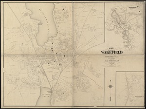
Map of the town of Wakefield Middlesex Co. Mass : from actual surveys
14.
Map of the Boston & Maine Railroad, showing its relative position & connection with other railroads
15.
Map of Boston inner harbor to accompany report under chapter 93, resolves of 1907, December 1, 1907
16.
Metropolitan district - inner section : population of cities & towns by five year periods from 1910 to 1925
17.
Atlas of Middlesex County. Vol. 2. Cities of Melrose & Woburn, towns of Bedford, Burlington, Concord, North Reading, Reading,...
18.
Back Bay urban renewal area r-47 : existing circulation
19.
Charlestown project no. Mass r-42 (GN) : existing circulation
20.
East Boston urban renewal area r-44 : proposed circulation
‹ Prev
Next ›
1
2
3
4
5
…
443
444