Toggle navigation
LMEC Home
Exhibitions
Georeferencing
Tools for Teachers
Collections
My Favorites
Sign Up / Log In
Search
Search the map portal
Map Collection
Map Collection
Map Sets
Search
Search
Search for
Search In
All Fields
Creator
Title
Subject
Place
Search All Digital Collections
Advanced Search
8662 Results
My Search
Start Over
More Like
commonwealth:cj82m439q
Remove constraint More Like: commonwealth:cj82m439q
Filter your Search
Place
North and Central America
5,881
United States
4,799
Massachusetts
2,056
Europe
1,359
Suffolk (county)
1,038
Boston
1,011
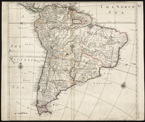
Canada
453
Asia
423
more
Place
»
Topic
Boston (Mass.)--Maps
580
United States--Maps
278
North America--Maps--Early works to 1800
180
Real property--Massachusetts--Boston--Maps
175
Massachusetts--Maps
160
Landowners--Massachusetts--Boston--Maps
133
New England--Maps
101
Europe--Maps
78
more
Topic
»
Date
Date range begin
–
Date range end
Current results range from
1482
to
2023
View distribution
Creator
United States. Hydrographic Office
594
O.H. Bailey & Co
148
Des Barres, Joseph F. W. (Joseph Frederick Wallet), 1722-1824
123
United States. Post Office Dept
120
Ptolemy, 2nd cent
100
Walling, Henry Francis, 1825-1888
94
Jefferys, Thomas, -1771
92
Geological Survey (U.S.)
86
more
Creator
»
Format
Maps/Atlases
8,603
Manuscripts
217
Prints
56
Books
36
Objects/Artifacts
10
Drawings/Illustrations
8
Posters
4
Georeferenced
Yes
872
No
7,790
Collection
Norman B. Leventhal Map & Education Center Collection
8,577
Boston and New England Maps
2,211
Urban Maps
1,940
Maritime Charts and Atlases
1,081
American Revolutionary War-Era Maps
686
Boston Redevelopment Authority Collection
87
New York Public Library Collection
36
Richard H. Brown Revolutionary War Map Collection at Mount Vernon
21
more
Collection
»
Available to use
No known restrictions
8,427
Creative Commons license
120
Search Constraints
Sort by relevance
relevance
title
date (asc)
date (desc)
Number of results to display per page
20 per page
10
per page
20
per page
50
per page
100
per page
View results as:
grid view
map view
Search Results
41.
South America
42.
South America divided into its IIII principall parts : I Spanish part: vizt. Firmland, Guiana, Peru, Chili, pt of the country...
43.
Terra Firma and the Caribbé Islands &c
44.
This map of South America, according to the newest and most exact observations
45.
To the Right Honourable, Charles Earl of Sunderland, and Baron Spencer of Wormleighton, one of Her Majesty's principal...
46.
America
47.
America
48.
America in praecipuas ipsius partes distributa ad observationes Academiae regiae scientiarum : et exquisitissimas tabulas quae...
49.
America nouiter delineata
50.
America noviter delineata
51.
America noviter delineata
52.
America Septentrionalis novissima : America Meridionalis accuratissima
53.
America, siue, India Nova : ad magnae Gerardi Mercatoris aui vniversalis imitationem in compendium redacta
54.
America with those known parts in that unknowne worlde both people and manner of buildings
55.
America with those known parts in that unknowne worlde both people and manner of buildings
56.
Americae
57.
Americae
58.
Americae mappa generalis : secundum legitimas projectionis stereographicae regulas relationesque recentissimas et observationes...
59.
Americae nova descriptio
60.
Americae nova discriptio
‹ Prev
Next ›
1
2
3
4
5
6
7
…
433
434