Toggle navigation
LMEC Home
Exhibitions
Georeferencing
Tools for Teachers
Collections
My Favorites
Sign Up / Log In
Search
Search the map portal
Map Collection
Map Collection
Map Sets
Search
Search
Search for
Search In
All Fields
Creator
Title
Subject
Place
Search All Digital Collections
Advanced Search
8162 Results
My Search
Start Over
More Like
commonwealth:cj82kz522
Remove constraint More Like: commonwealth:cj82kz522
Filter your Search
Place
North and Central America
4,912
United States
3,602
Suffolk (county)
1,026
Boston
999
Europe
962
Canada
427
France
269
Massachusetts
249
more
Place
»
Topic
Boston (Mass.)--Maps
574
United States--Maps
270
Real property--Massachusetts--Boston--Maps
174
Massachusetts--Maps
160
Landowners--Massachusetts--Boston--Maps
132
North America--Maps--Early works to 1800
103
New England--Maps
99
Europe--Maps
78
more
Topic
»
Date
Date range begin
–
Date range end
Current results range from
1482
to
2023
View distribution
Creator
United States. Hydrographic Office
357
O.H. Bailey & Co
148
Des Barres, Joseph F. W. (Joseph Frederick Wallet), 1722-1824
123
United States. Post Office Dept
120
Ptolemy, 2nd cent
100
Walling, Henry Francis, 1825-1888
94
Jefferys, Thomas, -1771
84
Geological Survey (U.S.)
82
more
Creator
»
Format
Maps/Atlases
8,103
Manuscripts
215
Prints
51
Books
36
Objects/Artifacts
10
Drawings/Illustrations
8
Posters
4
Georeferenced
Yes
869
No
7,293
Collection
Norman B. Leventhal Map Center Collection
8,162
Boston and New England Maps
2,184
Urban Maps
1,925
Maritime Charts and Atlases
750
American Revolutionary War-Era Maps
616
Boston Redevelopment Authority Collection
86
Available to use
No known restrictions
8,021
Creative Commons license
46
Search Constraints
Sort by relevance
relevance
title
date (asc)
date (desc)
Number of results to display per page
20 per page
10
per page
20
per page
50
per page
100
per page
View results as:
grid view
map view
Search Results
1.
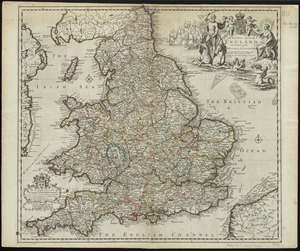
An accurate map of England and Wales with the principal roads from the best authorities
2.
England and Wales accurately delineated from the latest surveys
3.
A new most accurate & complete map of all the direct and the principal crossroads in England and Wales, carefully corrected...
4.
Occidentalior Regni Angliae districtus comprehendens principatum Walliae et Glocestriae ducatum comitatus et provincias...
5.
The roads of ye south part of Great Britain, called England and Wales : Containing all ye cities, market towns, post towns,...
6.
Le Royaume d'Angleterre : divisé selon les sept Royaumes, ou Heptarchie des Saxons, avec la Principauté de Galles, et...
7.
South Britain or England & Wales : drawn from several surveys &c. on the new projection ; corrected from astronomical...
8.
The south part of Great Britain, called England and Wales
9.
Cambriae typus
10.
Cornubia, Davonia, Somersetus, Dorcestria, Wiltonia, Glocestria, Monumetha, Glamorgan, Caermarden, Pembroke, Cardigan, Radnor,...
11.
West Morlandia, Lancastria, Cestria, Caernaruan, Denbigh, Flint, Meridionidh, Montgomery, Salpia, cum insulis Mania et Anglesey
12.
Anglesey : Wight Vectis olim ; Garnesay ; Iarsay
13.
Anglia Regnum
14.
Eboracum, Lincolnia, Derbia, Staffordia, Notinghamia, Lecestria, Rutlandia, et Norfolcia
15.
The natural shape of England with the names of rivers, seaports, sands, hills, moors, forrests, and many other remarks which...
16.
The natural shape of England with the names of rivers, seaports, sands, hills, moors, forrests, and many other remarks which...
17.
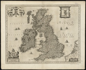
Nieuwe en perfeckte caerte van Engelandt Schotlandt en Yerlandt nieuwelyck vyt gegeven
18.
[The natural shape of England with the names of rivers, seaports, sands, hills, moors, forrests, and many other remarks which...
19.
The 100th anniversary map of Abraham Lincoln's visit to Massachusetts, September 11-23, 1848
20.
1630 shoreline
‹ Prev
Next ›
1
2
3
4
5
…
408
409