Toggle navigation
LMEC Home
Exhibitions
Georeferencing
Tools for Teachers
Collections
My Favorites
Sign Up / Log In
Search
Search the map portal
Map Collection
Map Collection
Map Sets
Search
Search
Search for
Search In
All Fields
Creator
Title
Subject
Place
Search All Digital Collections
Advanced Search
8740 Results
My Search
Start Over
More Like
commonwealth:cj82kw65q
Remove constraint More Like: commonwealth:cj82kw65q
Filter your Search
Place
North and Central America
5,961
United States
4,844
Massachusetts
2,079
Europe
1,396
Suffolk (county)
1,046
Boston
1,019
Canada
449
Asia
438
more
Place
»
Topic
Boston (Mass.)--Maps
586
United States--Maps
283
Real property--Massachusetts--Boston--Maps
175
Massachusetts--Maps
162
Landowners--Massachusetts--Boston--Maps
133
North America--Maps--Early works to 1800
103
New England--Maps
102
North America--Maps
85
more
Topic
»
Date
Date range begin
–
Date range end
Current results range from
1482
to
2023
View distribution
Creator
United States. Hydrographic Office
595
O.H. Bailey & Co
148
Des Barres, Joseph F. W. (Joseph Frederick Wallet), 1722-1824
123
United States. Post Office Dept
120
Ptolemy, 2nd cent
100
Walling, Henry Francis, 1825-1888
94
Jefferys, Thomas, -1771
87
Geological Survey (U.S.)
86
more
Creator
»
Format
Maps/Atlases
8,680
Manuscripts
215
Prints
56
Books
36
Objects/Artifacts
10
Drawings/Illustrations
8
Posters
5
Georeferenced
Yes
872
No
7,868
Collection
Norman B. Leventhal Map & Education Center Collection
8,695
Boston and New England Maps
2,233
Urban Maps
2,023
Maritime Charts and Atlases
1,083
American Revolutionary War-Era Maps
661
Boston Redevelopment Authority Collection
87
Maps from AAS
17
William L. Clements Library Collection
12
more
Collection
»
Available to use
No known restrictions
8,553
Creative Commons license
58
Search Constraints
Sort by relevance
relevance
title
date (asc)
date (desc)
Number of results to display per page
20 per page
10
per page
20
per page
50
per page
100
per page
View results as:
grid view
map view
Search Results
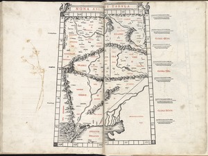
5361.
Nona Asiae tabula
5362.
Nona Asie tabula continet Ariam & Paropanisadas & Drangianam & Arachosia & Gedrosiam
5363.
Nona Europa tabula continet Iaziges Metanastas
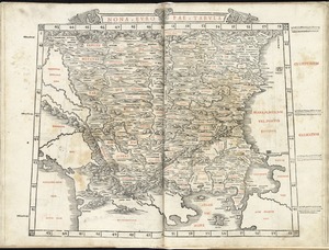
5364.
Nona Europae tabula
5365.
De Noordelyckste Zee Kusten van America van Groenland door de Straet Davis ende Straet Hudson tot Terra Neuf =...
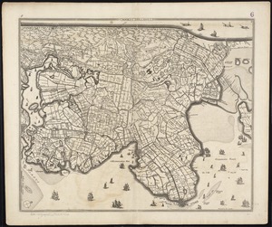
5366.
Noordt Hollandt
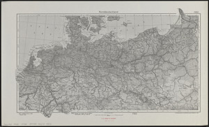
5367.
Norddeutschland
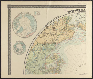
5368.
Nord-Polar-karte
5369.
Norfolk & Portsmouth Traction Company's lines are shown in red
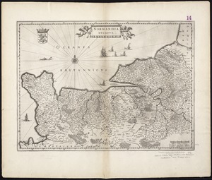
5370.
Normandia ducatus
5371.
Nortfolcia : vernacule Norfolke
5372.
North Abington, Plymouth County, Mass : looking west, 1885
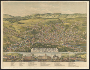
5373.
North Adams, Mass.
5374.
North America : a working map for illustrating, by coloration, the geographical distribution of life
5375.
North America : British provinces of New Brunswick, Nova Scotia, & part of Canada : compiled from recent surveys and adjusted...
5376.
North America : Florida
5377.
North America : performed under the patronage of Louis Duke of Orleans, First Prince of the Blood
5378.
North America : from the French of Mr. d'Anville, improved with the back settlements of Virginia and course of Ohio,...
5379.
North America : corrected from the observation communicated to the Royal Society at London and the Royal Academy at Paris
5380.
North America
‹ Prev
Next ›
1
2
…
265
266
267
268
269
270
271
272
273
…
436
437