Toggle navigation
LMEC Home
Exhibitions
Georeferencing
Tools for Teachers
Collections
My Favorites
Sign Up / Log In
Search
Search the map portal
Map Collection
Map Collection
Map Sets
Search
Search
Search for
Search In
All Fields
Creator
Title
Subject
Place
Search All Digital Collections
Advanced Search
8766 Results
My Search
Start Over
More Like
commonwealth:cj82kv515
Remove constraint More Like: commonwealth:cj82kv515
Filter your Search
Place
North and Central America
5,997
United States
4,912
Massachusetts
2,081
Europe
1,396
Suffolk (county)
1,046
Boston
1,019
Canada
455
Asia
438
more
Place
»
Topic
Boston (Mass.)--Maps
586
United States--Maps
282
Real property--Massachusetts--Boston--Maps
175
Massachusetts--Maps
164
Landowners--Massachusetts--Boston--Maps
133
New England--Maps
110
North America--Maps--Early works to 1800
103
New York (State)--Maps
85
more
Topic
»
Date
Date range begin
–
Date range end
Current results range from
1482
to
2023
View distribution
Creator
United States. Hydrographic Office
595
O.H. Bailey & Co
148
Des Barres, Joseph F. W. (Joseph Frederick Wallet), 1722-1824
123
United States. Post Office Dept
120
Ptolemy, 2nd cent
100
Walling, Henry Francis, 1825-1888
94
Geological Survey (U.S.)
86
Jefferys, Thomas, -1771
86
more
Creator
»
Format
Maps/Atlases
8,706
Manuscripts
218
Prints
56
Books
36
Objects/Artifacts
10
Drawings/Illustrations
8
Posters
5
Georeferenced
Yes
871
No
7,895
Collection
Norman B. Leventhal Map & Education Center Collection
8,695
Boston and New England Maps
2,233
Urban Maps
2,023
Maritime Charts and Atlases
1,083
American Revolutionary War-Era Maps
688
Boston Redevelopment Authority Collection
87
William L. Clements Library Collection
50
Maps from AAS
11
more
Collection
»
Available to use
No known restrictions
8,554
Creative Commons license
49
Search Constraints
Sort by relevance
relevance
title
date (asc)
date (desc)
Number of results to display per page
20 per page
10
per page
20
per page
50
per page
100
per page
View results as:
grid view
map view
Search Results
41.
Oil and gas fields of Pennsylvania
42.
Pennsylvania
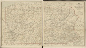
43.
Pennsylvania
44.
Post route map of the state of Pennsylvania showing post offices and the intermediate distances on mail routes in operation on...
45.
Post route map of the state of Pennsylvania showing post offices with the intermediate distances on mail routes in operation on...
46.
Rail road map of Pennsylvania
47.
Rail road map of Pennsylvania
48.
Sketch showing a feasible canal route, Allegheny River to Lake Erie.
49.
The state of Pennsylvania : reduced with permission from Reading Howells map
50.
The tourist's pocket map of Pennsylvania : exhibiting its internal improvements, roads, distances, &c
51.
Connecticut with portions of New York & Rhode Island
52.
E.P. Dutton & Co.'s railroad, steam boat & stage route map of New England, New-York and Canada
53.
Hale's map of the central & western parts of Massachusetts, with a part of New-York
54.
Map exhibiting the rail road, canal, lake and river routes from New York and Boston to the west, via Ogdensburgh, Buffalo and...
55.
Map exhibiting the rail road routes leading from Boston, to Ogdensburg and Buffalo, N.Y
56.
Map of Ho-De-No-Sau-Nee-Ga or the people of the long house : compiled 1851 by Lewis H. Morgan & Ely S. Parker a Seneca sachem...
57.
Map of Morris's Purchase or West Geneseo in the state of New York : exhibiting part of the Lakes Erie and Ontario, the...
58.
Map of New England exhibiting the rail road & telegraphic lines now in operation
59.
Map of the eastern division and branches, Erie Railway
60.
A map of the history of New York state
‹ Prev
Next ›
1
2
3
4
5
6
7
…
438
439