Toggle navigation
LMEC Home
Exhibitions
Georeferencing
Tools for Teachers
Collections
My Favorites
Sign Up / Log In
Search
Search the map portal
Map Collection
Map Collection
Map Sets
Search
Search
Search for
Search In
All Fields
Creator
Title
Subject
Place
Search All Digital Collections
Advanced Search
8706 Results
My Search
Start Over
More Like
commonwealth:cj82kp78j
Remove constraint More Like: commonwealth:cj82kp78j
Filter your Search
Place
North and Central America
5,931
United States
4,846
Massachusetts
2,079
Europe
1,396
Suffolk (county)
1,046
Boston
1,019
Canada
449
Asia
438
more
Place
»
Topic
Boston (Mass.)--Maps
586
United States--Maps
282
Real property--Massachusetts--Boston--Maps
175
Massachusetts--Maps
162
Landowners--Massachusetts--Boston--Maps
133
North America--Maps--Early works to 1800
108
New England--Maps
102
Europe--Maps
79
more
Topic
»
Date
Date range begin
–
Date range end
Current results range from
1482
to
2023
View distribution
Creator
United States. Hydrographic Office
595
O.H. Bailey & Co
148
Des Barres, Joseph F. W. (Joseph Frederick Wallet), 1722-1824
123
United States. Post Office Dept
120
Ptolemy, 2nd cent
100
Walling, Henry Francis, 1825-1888
94
Jefferys, Thomas, -1771
87
Geological Survey (U.S.)
86
more
Creator
»
Format
Maps/Atlases
8,646
Manuscripts
218
Prints
56
Books
36
Objects/Artifacts
10
Drawings/Illustrations
8
Posters
5
Georeferenced
Yes
870
No
7,836
Collection
Norman B. Leventhal Map & Education Center Collection
8,694
Boston and New England Maps
2,233
Urban Maps
2,023
Maritime Charts and Atlases
1,083
American Revolutionary War-Era Maps
627
Boston Redevelopment Authority Collection
87
Richard H. Brown Revolutionary War Map Collection at Mount Vernon
4
MacLean Collection Map Library
3
more
Collection
»
Available to use
No known restrictions
8,552
Creative Commons license
53
Search Constraints
Sort by relevance
relevance
title
date (asc)
date (desc)
Number of results to display per page
20 per page
10
per page
20
per page
50
per page
100
per page
View results as:
grid view
map view
Search Results
5521.
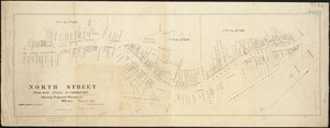
North Street from near Cross, to Commercial : showing proposed widening to 50 feet
5522.
North view of Pensacola, on the island of Santa Rosa ; Plan of the harbour and settlement of Pensacola
5523.
North western America showing the territory ceded by Russia to the United States
5524.
North western America showing the territory ceded by Russia to the United States
5525.
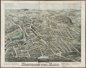
Northampton, Mass : 1875
5526.
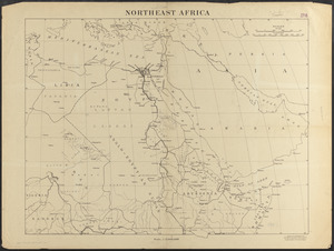
Northeast Africa
5527.
Northern Africa
5528.
Northern Alabama and Georgia
5529.
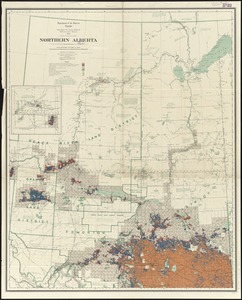
Northern Alberta : map showing disposition of lands
5530.
Northern Alberta : map showing disposition of lands
5531.
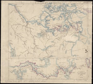
Northern America
5532.
Northern Arabia
5533.
Northern Georgia with portions of adjacent states
5534.
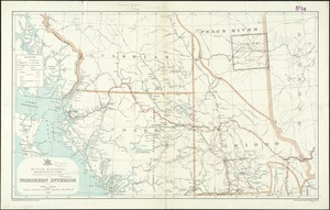
Northern interior
5535.
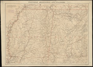
Northern Mississippi and Alabama
5536.
[Northern Mississippi and Alabama
5537.
Northern New Jersey, showing the iron-ore & limestone districts
5538.
Northern Pacific Rail Road and connections
5539.
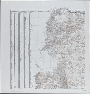
Northern part of Florida
5540.
Northern Philippines land utilization
‹ Prev
Next ›
1
2
…
273
274
275
276
277
278
279
280
281
…
435
436