Toggle navigation
LMEC Home
Exhibitions
Georeferencing
Tools for Teachers
Collections
My Favorites
Sign Up / Log In
Search
Search the map portal
Map Collection
Map Collection
Map Sets
Search
Search
Search for
Search In
All Fields
Creator
Title
Subject
Place
Search All Digital Collections
Advanced Search
8807 Results
My Search
Start Over
More Like
commonwealth:cj82kn50n
Remove constraint More Like: commonwealth:cj82kn50n
Filter your Search
Place
North and Central America
6,038
United States
4,931
Massachusetts
2,153
Europe
1,396
Suffolk (county)
1,049
Boston
1,022
Canada
458
Asia
438
more
Place
»
Topic
Boston (Mass.)--Maps
592
United States--Maps
282
Massachusetts--Maps
235
Real property--Massachusetts--Boston--Maps
175
Landowners--Massachusetts--Boston--Maps
133
New England--Maps
127
North America--Maps--Early works to 1800
103
Europe--Maps
79
more
Topic
»
Date
Date range begin
–
Date range end
Current results range from
1482
to
2023
View distribution
Creator
United States. Hydrographic Office
595
O.H. Bailey & Co
148
Des Barres, Joseph F. W. (Joseph Frederick Wallet), 1722-1824
123
United States. Post Office Dept
120
Ptolemy, 2nd cent
100
Walling, Henry Francis, 1825-1888
95
Geological Survey (U.S.)
92
Jefferys, Thomas, -1771
86
more
Creator
»
Format
Maps/Atlases
8,746
Manuscripts
217
Prints
56
Books
36
Objects/Artifacts
10
Drawings/Illustrations
8
Posters
5
Ephemera
1
Georeferenced
Yes
881
No
7,926
Collection
Norman B. Leventhal Map & Education Center Collection
8,740
Boston and New England Maps
2,284
Urban Maps
2,024
Maritime Charts and Atlases
1,083
American Revolutionary War-Era Maps
666
Boston Redevelopment Authority Collection
90
American Antiquarian Society Collection
22
David Judkins Weaver Papers
21
more
Collection
»
Available to use
No known restrictions
8,598
Creative Commons license
54
Search Constraints
Sort by relevance
relevance
title
date (asc)
date (desc)
Number of results to display per page
20 per page
10
per page
20
per page
50
per page
100
per page
View results as:
grid view
map view
Search Results
821.
Atlas of the city of New Bedford, Massachusetts : based on plans in the office of the city engineer
822.
Atlas of the city of Newton, Massachusetts : from actual surveys and official plans
823.
Atlas of the city of Newton, Massachusetts : from actual surveys and official plans
824.
Atlas of the city of Newton, Massachusetts
825.
Atlas of the city of Newton, Massachusetts : compiled from actual surveys and records
826.
Atlas of the city of Newton Massachusetts : assessors block system
827.
Atlas of the city of Newton, Middlesex Co., Massachusetts : from actual survey, official records & private plans
828.
Atlas of the city of Northampton and the town of Easthampton, Hampshire County, Massachusetts
829.
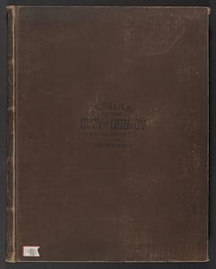
Atlas of the city of Quincy, Norfolk County, Mass. : from official plans and actual surveys
830.
Atlas of the city of Quincy, Norfolk County, Massachusetts
831.
Atlas of the city of Quincy, Norfolk County, Massachusetts
832.
Atlas of the city of Salem, Massachusetts : based on plans in the office of the City Engineer
833.
Atlas of the city of Salem, Massachusetts : from actual survey and official records
834.
Atlas of the city of Somerville, Massachusetts : from actual surveys and official plans
835.
Atlas of the city of Somerville, Massachusetts : from actual surveys and official records
836.
Atlas of the city of Springfield and the town of Longmeadow, Massachusetts : based upon, and carefully compiled from official...
837.
Atlas of the city of Worcester, Worcester County, Massachusetts
838.
Atlas of the county of Suffolk, Massachusetts : vol. 1st including Boston proper : from actual surveys and official records
839.
Atlas of the county of Suffolk, Massachusetts : vol. 2nd late city of Roxbury, now wards 13-14 and 15, city of Boston
840.
Atlas of the county of Suffolk, Massachusetts : vol. 3rd including Boston and Dorchester : from actual surveys and official...
‹ Prev
Next ›
1
2
…
38
39
40
41
42
43
44
45
46
…
440
441