Toggle navigation
LMEC Home
Exhibitions
Georeferencing
Tools for Teachers
Collections
My Favorites
Sign Up / Log In
Search
Search the map portal
Map Collection
Map Collection
Map Sets
Search
Search
Search for
Search In
All Fields
Creator
Title
Subject
Place
Search All Digital Collections
Advanced Search
8743 Results
My Search
Start Over
More Like
commonwealth:b8516277m
Remove constraint More Like: commonwealth:b8516277m
Filter your Search
Place
North and Central America
5,974
United States
4,888
Massachusetts
2,081
Europe
1,396
Suffolk (county)
1,046
Boston
1,019
Canada
455
Asia
438
more
Place
»
Topic
Boston (Mass.)--Maps
586
United States--Maps
282
Real property--Massachusetts--Boston--Maps
175
Massachusetts--Maps
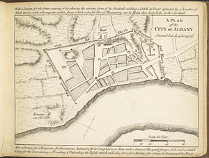
164
Landowners--Massachusetts--Boston--Maps
133
New England--Maps
109
North America--Maps--Early works to 1800
103
New York (State)--Maps
85
more
Topic
»
Date
Date range begin
–
Date range end
Current results range from
1482
to
2023
View distribution
Creator
United States. Hydrographic Office
595
O.H. Bailey & Co
148
Des Barres, Joseph F. W. (Joseph Frederick Wallet), 1722-1824
123
United States. Post Office Dept
120
Ptolemy, 2nd cent
100
Walling, Henry Francis, 1825-1888
94
Geological Survey (U.S.)
86
Jefferys, Thomas, -1771
85
more
Creator
»
Format
Maps/Atlases
8,683
Manuscripts
223
Prints
56
Books
36
Objects/Artifacts
10
Drawings/Illustrations
8
Posters
5
Georeferenced
Yes
870
No
7,873
Collection
Norman B. Leventhal Map & Education Center Collection
8,694
Boston and New England Maps
2,233
Urban Maps
2,023
Maritime Charts and Atlases
1,083
American Revolutionary War-Era Maps
665
Boston Redevelopment Authority Collection
87
William L. Clements Library Collection
28
American Antiquarian Society Collection
9
more
Collection
»
Available to use
No known restrictions
8,559
Creative Commons license
48
Search Constraints
Sort by relevance
relevance
title
date (asc)
date (desc)
Number of results to display per page
20 per page
10
per page
20
per page
50
per page
100
per page
View results as:
grid view
map view
Search Results
41.
New England and New York in 1697
42.
New York
43.
Post route map of the State of New York and parts of Vermont, Massachusetts, Connecticut, New Jersey, and Pennsylvania also the...
44.
Post route map of the State of New York and parts of Vermont, Massachusetts, Connecticut, New Jersey, and Pennsylvania also the...
45.
Post route map of the state of New York showing post offices with the intermediate distances on mail routes in operation on the...
46.
Post route map of the states of New Hampshire, Vermont, Massachusetts, Rhode Island, Connecticut, and parts of New York and Maine
47.
Rail road map of New England & eastern New York
48.
Rail road map of New England & eastern New York
49.
Scarborough's new railroad, post office, township and county map of New York with distances between stations
50.
Sherman & Smith's rail road, steam boat & stage route map of New England, New-York, and Canada
51.
The state of New York
52.
The state of New York, compiled from the best authorities
53.
The state of New York with part of the adjacent states
54.
A survey of the empire group : with a complete distance table, a compendious index of cities and post offices, with populations...
55.
A survey of the empire group : with a complete distance table, a compendious index of cities and post offices, with populations...
56.
Transportation map of New York
57.
Williams' telegraph and rail road map of the New England states, eastern protion of New York state and Canada : compiled from...
58.
Plan of Fort Frederick at Albany
59.
A plan of the city of Albany situated lat. 42, 30" long. 74
60.
Cross Roads to East Chester, and above : no 19
‹ Prev
Next ›
1
2
3
4
5
6
7
…
437
438