Toggle navigation
LMEC Home
Exhibitions
Georeferencing
Tools for Teachers
Collections
My Favorites
Sign Up / Log In
Search
Search the map portal
Map Collection
Map Collection
Map Sets
Search
Search
Search for
Search In
All Fields
Creator
Title
Subject
Place
Search All Digital Collections
Advanced Search
8942 Results
My Search
Start Over
More Like
commonwealth:9s161h05g
Remove constraint More Like: commonwealth:9s161h05g
Filter your Search
Place
North and Central America
6,173
United States
5,089
Massachusetts
2,138
Europe
1,396
Suffolk (county)
1,288
Boston
1,261
Canada
449
Asia
438
more
Place
»
Topic
Boston (Mass.)--Maps
752
United States--Maps
282
Real property--Massachusetts--Boston--Maps
253
City planning--Massachusetts--Boston--Maps
207
Landowners--Massachusetts--Boston--Maps
170
Massachusetts--Maps
166
Urban renewal--Massachusetts--Boston--Maps
114
New England--Maps
104
more
Topic
»
Date
Date range begin
–
Date range end
Current results range from
1482
to
2023
View distribution
Creator
United States. Hydrographic Office
595
Boston Redevelopment Authority
212
O.H. Bailey & Co
148
Des Barres, Joseph F. W. (Joseph Frederick Wallet), 1722-1824
124
United States. Post Office Dept
120
Ptolemy, 2nd cent
100
Walling, Henry Francis, 1825-1888
94
Geological Survey (U.S.)
87
more
Creator
»
Format
Maps/Atlases
8,882
Manuscripts
215
Prints
56
Books
36
Objects/Artifacts
10
Drawings/Illustrations
8
Posters
5
Georeferenced
Yes
885
No
8,057
Collection
Norman B. Leventhal Map & Education Center Collection
8,725
Boston and New England Maps
2,412
Urban Maps
2,195
Maritime Charts and Atlases
1,083
American Revolutionary War-Era Maps
638
Boston Redevelopment Authority Collection
244
Massachusetts Real Estate Atlases
38
Mapping Boston Collection
20
more
Collection
»
Available to use
No known restrictions
8,719
Creative Commons license
70
Search Constraints
Sort by relevance
relevance
title
date (asc)
date (desc)
Number of results to display per page
20 per page
10
per page
20
per page
50
per page
100
per page
View results as:
grid view
map view
Search Results
521.
Plan of Boston showing existing ways and owners on December 25, 1638
522.
Plan of Boston showing existing ways and owners on December 25, 1639
523.
Plan of Boston showing existing ways and owners on December 25, 1640
524.
Plan of Boston showing existing ways and owners on December 25, 1641
525.
Plan of Boston showing existing ways and owners on December 25, 1642
526.
Plan of Boston showing existing ways and owners on December 25, 1643
527.
Plan of Boston showing existing ways and owners on December 25, 1644
528.
Plan of Boston showing existing ways and owners on December 25, 1645
529.
Plan of Boston, with additions and corrections
530.
Plan of Boston, with additions and corrections
531.
Plan of Boston, with additions and corrections
532.
Plan of Boston with parts of the adjacent towns
533.
Plan of Boston with parts of the adjacent towns
534.
[Plan of boundary lines in Roxbury and the City of Boston]
535.
Plan of burnt district by fire of Nov. 9th and 10th, 1872 : showing street improvements as adopted by Board of Street...
536.
Plan of burnt district, by fire of Nov. 9th and 10th 1872 : showing street improvements as adopted by Board of Street...
537.
Plan of Charles River and Warren bridges, with the vicinity
538.
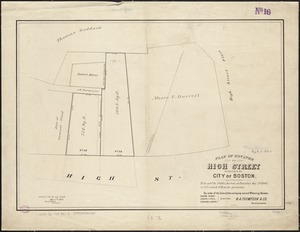
Plan of estates on High Street belonging to the City of Boston : to be sold by public auction on Thursday May 21st 1868, at 12...
539.
Plan of estates on Suffolk St. district : belonging to the City of Boston : to be sold at public auction on Saturday Dec. 16th...
540.
Plan of estates on Suffolk Street district, belonging to the City of Boston, to be sold at public auction, on Saturday, May 11,...
‹ Prev
Next ›
1
2
…
23
24
25
26
27
28
29
30
31
…
447
448


![[Plan of boundary lines in Roxbury and the City of Boston]](https://bpldcassets.blob.core.windows.net/derivatives/images/commonwealth:1257bb127/image_thumbnail_300.jpg)