Toggle navigation
LMEC Home
Exhibitions
Georeferencing
Tools for Teachers
Collections
My Favorites
Sign Up / Log In
Search
Search the map portal
Map Collection
Map Collection
Map Sets
Search
Search
Search for
Search In
All Fields
Creator
Title
Subject
Place
Search All Digital Collections
Advanced Search
8780 Results
My Search
Start Over
More Like
commonwealth:9s161f71n
Remove constraint More Like: commonwealth:9s161f71n
Filter your Search
Place
North and Central America
6,011
United States
4,929
Massachusetts
2,090
Europe
1,396
Suffolk (county)
1,131
Boston
1,104
Canada
449
Asia
438
more
Place
»
Topic
Boston (Mass.)--Maps
606
United States--Maps
282
Real property--Massachusetts--Boston--Maps
253
Landowners--Massachusetts--Boston--Maps
170
Massachusetts--Maps
162
City planning--Massachusetts--Boston--Maps
113
North America--Maps--Early works to 1800
103
New England--Maps
102
more
Topic
»
Date
Date range begin
–
Date range end
Current results range from
1482
to
2023
View distribution
Creator
United States. Hydrographic Office
595
O.H. Bailey & Co
148
Des Barres, Joseph F. W. (Joseph Frederick Wallet), 1722-1824
123
United States. Post Office Dept
120
Boston Redevelopment Authority
113
Ptolemy, 2nd cent
100
Walling, Henry Francis, 1825-1888
94
Geological Survey (U.S.)
86
more
Creator
»
Format
Maps/Atlases
8,720
Manuscripts
215
Prints
56
Books
36
Objects/Artifacts
10
Drawings/Illustrations
8
Posters
5
Georeferenced
Yes
869
No
7,911
Collection
Norman B. Leventhal Map & Education Center Collection
8,696
Boston and New England Maps
2,283
Urban Maps
2,072
Maritime Charts and Atlases
1,083
American Revolutionary War-Era Maps
616
Boston Redevelopment Authority Collection
136
Massachusetts Real Estate Atlases
35
Applied Geographics, Inc. Records
2
Available to use
No known restrictions
8,603
Creative Commons license
47
Search Constraints
Sort by relevance
relevance
title
date (asc)
date (desc)
Number of results to display per page
20 per page
10
per page
20
per page
50
per page
100
per page
View results as:
grid view
map view
Search Results
4321.
Map of the Japanese telegraph system
4322.
Map of the Jesuit missions in Huronia
4323.
A map of the King of Great Britains dominions in Germany, or, the Electorate of Brunswick-Luneburg, with its dependencies :...
4324.
A map of the kingdom of Scotland from the latest and best observations, for Mr. Tindal's Continuation of Mr. Rapin's History
4325.
Map of the lands in Mississippi ceded by the Chickasaws to the United States in 1832 and 1834
4326.
Map of the lands included in the Central Park, from a topographical survey, June 17th, 1856
4327.
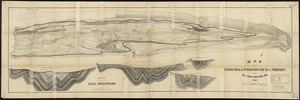
Map of the Lehigh Coal & Navigation Co.'s coal property near Mauch Chunk, Pa
4328.
Map of the line of the London and Birmingham Railway : from Euston Square Station to Stony Stratford in Buckinghamshire,...
4329.
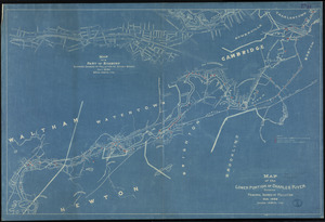
Map of the lower portion of Charles River showing principal sources of pollution
4330.
A map of the Maine coast from York Harbor to Saco Bay : reminiscent & actual
4331.
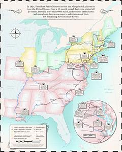
Map of the Marquis de Lafayette's 1824-1825 tour of the United States
4332.
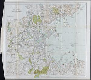
Map of the metropolitan district of Boston : showing local public reservations, and holdings of the Metropolitan Park...
4333.
Map of the metropolitan district of Boston, Massachusetts : showing the existing public reservations and such new open spaces...
4334.
Map of the metropolitan district of Boston, Massachusetts : showing local public reservations and holdings of the Metropolitan...
4335.
Map of the Metropolitan District of Boston showing local public reservations and holdings of the Metropolitan District...
4336.
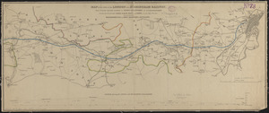
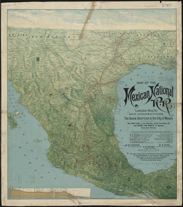
Map of the Mexican National Railway : showing also its relative position to the railway system of the United States, both as to...
4337.
Map of the Mexican National R.R "Laredo route " and connections : the scenic short line to the city of Mexico
4338.
A map of the middle British colonies in North America : first published by Mr. Lewis Evans, of Philadelphia, in 1755; and since...
4339.
A map of the middle British colonies in North America : first published by Mr. Lewis Evans, of Philadelphia, in 1755; and since...
4340.
Map of the middle states of America : comprehends New-York, New-Jersey, Pennsylvania, Delaware, and the territory N.W. of Ohio
‹ Prev
Next ›
1
2
…
213
214
215
216
217
218
219
220
221
…
438
439