Toggle navigation
LMEC Home
Exhibitions
Georeferencing
Tools for Teachers
Collections
My Favorites
Sign Up / Log In
Search
Search the map portal
Map Collection
Map Collection
Map Sets
Search
Search
Search for
Search In
All Fields
Creator
Title
Subject
Place
Search All Digital Collections
Advanced Search
8780 Results
My Search
Start Over
More Like
commonwealth:9s161f31p
Remove constraint More Like: commonwealth:9s161f31p
Filter your Search
Place
North and Central America
6,011
United States
4,929
Massachusetts
2,090
Europe
1,396
Suffolk (county)
1,131
Boston
1,104
Canada
449
Asia
438
more
Place
»
Topic
Boston (Mass.)--Maps
606
United States--Maps
282
Real property--Massachusetts--Boston--Maps
253
Landowners--Massachusetts--Boston--Maps
170
Massachusetts--Maps
162
City planning--Massachusetts--Boston--Maps
113
North America--Maps--Early works to 1800
103
New England--Maps
102
more
Topic
»
Date
Date range begin
–
Date range end
Current results range from
1482
to
2023
View distribution
Creator
United States. Hydrographic Office
595
O.H. Bailey & Co
148
Des Barres, Joseph F. W. (Joseph Frederick Wallet), 1722-1824
123
United States. Post Office Dept
120
Boston Redevelopment Authority
113
Ptolemy, 2nd cent
100
Walling, Henry Francis, 1825-1888
94
Geological Survey (U.S.)
86
more
Creator
»
Format
Maps/Atlases
8,720
Manuscripts
215
Prints
56
Books
36
Objects/Artifacts
10
Drawings/Illustrations
8
Posters
5
Georeferenced
Yes
868
No
7,912
Collection
Norman B. Leventhal Map & Education Center Collection
8,696
Boston and New England Maps
2,284
Urban Maps
2,073
Maritime Charts and Atlases
1,083
American Revolutionary War-Era Maps
616
Boston Redevelopment Authority Collection
136
Massachusetts Real Estate Atlases
35
Applied Geographics, Inc. Records
2
Available to use
No known restrictions
8,604
Creative Commons license
46
Search Constraints
Sort by relevance
relevance
title
date (asc)
date (desc)
Number of results to display per page
20 per page
10
per page
20
per page
50
per page
100
per page
View results as:
grid view
map view
Search Results
2101.
Decima Asiae tabula
2102.
Decima et ultima Europae tabula
2103.
Decima Europe tabula continent Macedonia et Epirum et Achaiam & Peloponesum
2104.
Dedication of the Army and Navy Monument, Sept. 17, 1877
2105.
Deering, Cumberland County, Maine : 1886
2106.
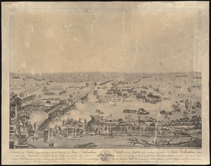
Defeat of the British army 12,000 strong under the command of Sir Edward Packenham in the attack of the American lines defended...
2107.
Delaware
2108.
Delaware and Maryland
2109.
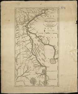
Delaware, from the best authorities
2110.
Delaware, from the best authorities
2111.
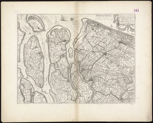
Delflandia, Schielandia, et insulae trans Mosam illis objacentes ut sunt Voorna, Overflackea, Goerea, Yselmonda, etc
2112.
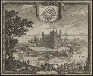
Delineatio arcis Cronenburgensis quam sereniss. rex Sueciae amplioribus munimentis cingere fecit A. 1659
2113.
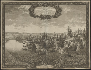
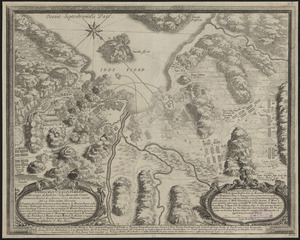
Delineatio eorum quæ d. 10 Nouemb. anno 1658 ad Landscoronam gesta sunt cum Dan Hollandis juncti nauium aliquod demersione...
2114.
Delineatio Fortalitij Polonorum ad Lysouiam, quod a serenissimo principe Palatino Adolpho Iohanne Supremo Duce militiae...
2115.
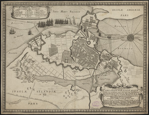
Delineatio geometrica urbis Haffniæ Daniæ regum sedis, ut et munitionum nuper exstructarum, castelli quoq. et suburbiorum, uti...
2116.
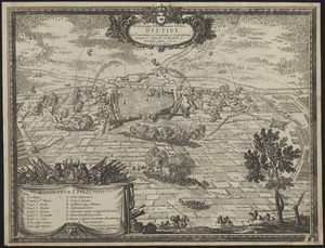
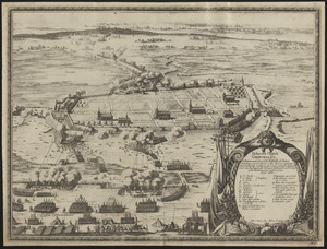
Delineatio obsidionis urbis Stetini in Pomerania à Cesareanis et Confoederatis incaeptae d. Septemb. et derelictae d. Novemb....
2117.
Delineatio oppidi Grijpswaldæ in Pommerania, uti ea d. 20 Septemb. ab Electore Brandeburgico una cum Caesareis et alijs...
2118.
Delineatio oppidi Halldae in Norwegia ab Exell. Dn. Campi Marescallo Comite Laurentio Kagge, d. 21. Ianuar, 1660 obsidione...
2119.
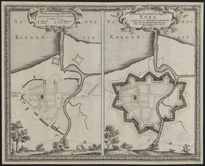
Delineatio oppidi Köeg ante quam novis operibus muniretur anno 1659 ; delineatio geometrica oppidi Köeg eo statu, quo post...
2120.
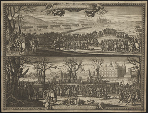
Delineatio Pompæ qua Ser. Sueciæ Rex a Ser. Daniæ Rege exceptus et in arcem Fridericiburgum deductus fuit. die 3 Martij an....
‹ Prev
Next ›
1
2
…
102
103
104
105
106
107
108
109
110
…
438
439