Toggle navigation
LMEC Home
Exhibitions
Georeferencing
Tools for Teachers
Collections
My Favorites
Sign Up / Log In
Search
Search the map portal
Map Collection
Map Collection
Map Sets
Search
Search
Search for
Search In
All Fields
Creator
Title
Subject
Place
Search All Digital Collections
Advanced Search
8246 Results
My Search
Start Over
More Like
commonwealth:9g54xm78m
Remove constraint More Like: commonwealth:9g54xm78m
Filter your Search
Place
North and Central America
4,995
United States
3,827
Suffolk (county)
1,105
Boston
1,078
Europe
963
Canada
427
France
269
Massachusetts
265
more
Place
»
Topic
Boston (Mass.)--Maps
594
United States--Maps
270
Real property--Massachusetts--Boston--Maps
252
Landowners--Massachusetts--Boston--Maps
169
Massachusetts--Maps
160
City planning--Massachusetts--Boston--Maps
105
North America--Maps--Early works to 1800
103
New England--Maps
99
more
Topic
»
Date
Date range begin
–
Date range end
Current results range from
1482
to
2023
View distribution
Creator
United States. Hydrographic Office
357
O.H. Bailey & Co
148
Des Barres, Joseph F. W. (Joseph Frederick Wallet), 1722-1824
123
United States. Post Office Dept
120
Boston Redevelopment Authority
109
Ptolemy, 2nd cent
100
Walling, Henry Francis, 1825-1888
94
Bromley, George Washington
89
more
Creator
»
Format
Maps/Atlases
8,187
Manuscripts
215
Prints
51
Books
36
Objects/Artifacts
10
Drawings/Illustrations
8
Posters
4
Georeferenced
Yes
869
No
7,377
Collection
Norman B. Leventhal Map Center Collection
8,163
Boston and New England Maps
2,228
Urban Maps
1,969
Maritime Charts and Atlases
750
American Revolutionary War-Era Maps
616
Boston Redevelopment Authority Collection
130
Massachusetts Real Estate Atlases
39
Available to use
No known restrictions
8,066
Creative Commons license
46
Search Constraints
Sort by relevance
relevance
title
date (asc)
date (desc)
Number of results to display per page
50 per page
10
per page
20
per page
50
per page
100
per page
View results as:
grid view
map view
Search Results
151.
Atlas of the city of Boston : volume 6, West Roxbury
152.
Atlas of the city of Boston : vol. 5, Dorchester, Mass.
153.
Atlas of the city of Boston : East Boston
154.
Atlas of the city of Boston : Roxbury
155.
Atlas of the city of Boston : Boston proper and Back Bay
156.
Atlas of the city of Boston : West Roxbury
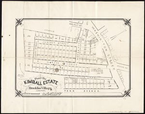
157.
Atlas of the city of Boston : South Boston
158.
Atlas of the city of Boston : ward 26 Hyde Park
159.
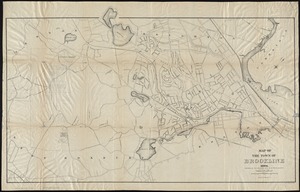
Atlas of the city of Boston : Dorchester
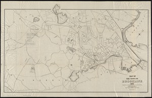
160.
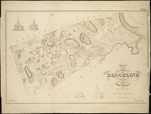
Atlas of the city of Boston : Roxbury
161.
Atlas of the city of Boston : Boston proper and Back Bay
162.
Atlas of the city of Boston : Boston proper and Back Bay
163.
Atlas of the county of Suffolk, Massachusetts, vol. 1 : including Boston proper
164.
Atlas of the county of Suffolk, Massachusetts, vol. 2 : late city of Roxbury, now wards 13-14 and 15, city of Boston
165.
Atlas of the county of Suffolk, Massachusetts, vol. 3 : including South Boston and Dorchester
166.
Atlas of the county of Suffolk, Massachusetts, vol. 4 : including East Boston, city of Chelsea, Revere and Winthrop
167.
Atlas of the county of Suffolk, Massachusetts, vol. 5 : West Roxbury, now ward 17, Boston
168.
Atlas of the county of Suffolk, Massachusetts, vol. 6 : including the late city of Charlestown, now wards 20, 21, 22 City of...
169.
Mattapan project : property map
170.
Plans of estates of William C. Barstow
171.
South Cove : property status and unit ownership
172.
Plan of the Kimball Estate in Brookline Village : June 2nd 1873
173.
Brookline Water Works : profile of main pipe from engine house to reservoir
174.
Brookline Water Works : source, line of supply and distribution
175.
Corey Hill Terraces, Brookline
176.
Map of the cities of Boston, Cambridge, Somerville and Chelsea, and the town of Brookline with parts of Newton, Malden and...
177.
Map of the town of Brookline : 1894
178.
Map of the town of Brookline : 1893
179.
Map of the town of Brookline, Mass : surveyed in 1844 by order of the Town Authorities
180.
Preliminary plan for the extension of Commonwealth Avenue along Beacon Street Brookline : showing connection with Chestnut Hill...
181.
Preliminary plan for widening Beacon Street from the Back Bay district of Boston to the public pleasure ground at Chestnut Hill...
182.
Preliminary plan for widening Chestnut Hill Avenue
183.
The town of Brookline : 1896
184.
Trees in Brookline, Massachusetts
185.
Boston urban wilds : ownership
186.
Historical map of the north and central parts of Old Boston : with explanatory key
187.
Plan accompanying the proposal made to the City of Boston by the Commissioners on Boston Harbor and the Back Bay Octr. 20, 1854...
188.
Plan of Boston showing existing ways and owners on December 25, 1630
189.
Plan of Boston showing existing ways and owners on December 25, 1630
190.
Plan of Boston showing existing ways and owners on December 25, 1631
191.
Plan of Boston showing existing ways and owners on December 25, 1632
192.
Plan of Boston showing existing ways and owners on December 25, 1633
193.
Plan of Boston showing existing ways and owners on December 25, 1634
194.
Plan of Boston showing existing ways and owners on December 25, 1635
195.
Plan of Boston showing existing ways and owners on December 25, 1635
196.
Plan of Boston showing existing ways and owners on December 25, 1635
197.
Plan of Boston showing existing ways and owners on December 25, 1636
198.
Plan of Boston showing existing ways and owners on December 25, 1637
199.
Plan of Boston showing existing ways and owners on December 25, 1638
200.
Plan of Boston showing existing ways and owners on December 25, 1639
‹ Prev
Next ›
1
2
3
4
5
6
7
8
…
164
165