Toggle navigation
LMEC Home
Exhibitions
Georeferencing
Tools for Teachers
Collections
My Favorites
Sign Up / Log In
Search
Search the map portal
Map Collection
Map Collection
Map Sets
Search
Search
Search for
Search In
All Fields
Creator
Title
Subject
Place
Search All Digital Collections
Advanced Search
8162 Results
My Search
Start Over
More Like
commonwealth:9g54xm249
Remove constraint More Like: commonwealth:9g54xm249
Filter your Search
Place
North and Central America
4,911
United States
3,602
Suffolk (county)
1,026
Boston
999
Europe
963
Canada
426
France
269
Massachusetts
249
more
Place
»
Topic
Boston (Mass.)--Maps
574
United States--Maps
270
Real property--Massachusetts--Boston--Maps
174
Massachusetts--Maps
160
Landowners--Massachusetts--Boston--Maps
132
North America--Maps--Early works to 1800
103
New England--Maps
99
Europe--Maps
78
more
Topic
»
Date
Date range begin
–
Date range end
Current results range from
1482
to
2023
View distribution
Creator
United States. Hydrographic Office
357
O.H. Bailey & Co
148
Des Barres, Joseph F. W. (Joseph Frederick Wallet), 1722-1824
122
United States. Post Office Dept
120
Ptolemy, 2nd cent
100
Walling, Henry Francis, 1825-1888
94
Jefferys, Thomas, -1771
84
Geological Survey (U.S.)
82
more
Creator
»
Format
Maps/Atlases
8,103
Manuscripts
215
Prints
51
Books
36
Objects/Artifacts
10
Drawings/Illustrations
8
Posters
4
Georeferenced
Yes
869
No
7,293
Collection
Norman B. Leventhal Map Center Collection
8,162
Boston and New England Maps
2,184
Urban Maps
1,925
Maritime Charts and Atlases
749
American Revolutionary War-Era Maps
615
Boston Redevelopment Authority Collection
86
Available to use
No known restrictions
8,021
Creative Commons license
46
Search Constraints
Sort by date (desc)
relevance
title
date (asc)
date (desc)
Number of results to display per page
20 per page
10
per page
20
per page
50
per page
100
per page
View results as:
grid view
map view
Search Results
7681.
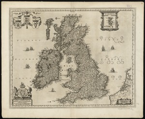
Nieuwe en perfeckte caerte van Engelandt Schotlandt en Yerlandt nieuwelyck vyt gegeven
7682.
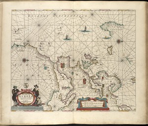
Pas-kaart van Europa met een gedeelte van de kust van Africa tot aen Cabo Verde
7683.
Huquang, Kiangsi, Che Kiang, ac Fokien : provin: sivae praefecture Regni Sinen:s, versus Vulturnum, in plaga inter Orientem ac...
7684.
Syriae sive Soriae : nova et accurata descriptio
7685.
Africae antiquae, et quarundam Europae, Asiaeque adiacentium regionum
7686.
Africæ, described, the manners of their habits and buildings, newly done into English
7687.
America : with those known parts in that unknowne worlde both people and manner of buildings discribed and inlarged
7688.
Asia : with the islands adioyning described, the atire of the people, & townes of importance, all of them newly augmented
7689.
Biscaia, Alava, et Guipuscoa Cantabriae veteris partes
7690.
Europ, and the cheife cities contayned therin, described; with the habits of most kingdoms now in use
7691.
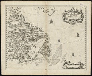
Extrema Americae versus Boream, ubi Terra Nova, Nova Francia, adjacentiaque
7692.
Geldria ducatus, et Zutfania comitatus
7693.
Insula Gaditana, vulgo Isla de Cadiz
7694.
Insula S. Laurentii, vulgo Madagascar
7695.
Insulae Promontorii Viridis, Hispanis, Issas Cabo Verde, Belgis, De Soute Eylanden
7696.
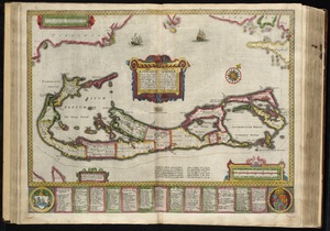
Mappa aestivarum insularum, alias Barmudas dictarum, ad ostia Mexicani aestuarij jacentium in latitudine graduum 32 minutorum...
7697.
Mappa aestivarum insularum, alias Barmudas dictarum, ad ostia Mexicani aestuarij jacentium in latitudine graduum 32 minutorum...
7698.
Mappa æstivarum insularum alias Bermudas dictarum, ad ostia Mexicani æstuary iacentium in latitudine graduum 32 minutorum 25 ab...
7699.
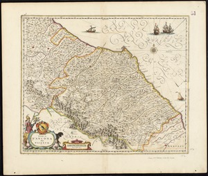
Marca d'Ancona olim Picenum
7700.
A new and accurat map of the world : drawne according to ye truest descriptions latest discoveries & best observations yt have...
‹ Prev
Next ›
1
2
…
381
382
383
384
385
386
387
388
389
…
408
409