Toggle navigation
LMEC Home
Exhibitions
Georeferencing
Tools for Teachers
Collections
My Favorites
Sign Up / Log In
Search
Search the map portal
Map Collection
Map Collection
Map Sets
Search
Search
Search for
Search In
All Fields
Creator
Title
Subject
Place
Search All Digital Collections
Advanced Search
8720 Results
My Search
Start Over
More Like
commonwealth:8336h344w
Remove constraint More Like: commonwealth:8336h344w
Filter your Search
Place
North and Central America
5,951
United States
4,869
Massachusetts
2,083
Europe
1,396
Suffolk (county)
1,048
Boston
1,021
Canada
456
Asia
438
more
Place
»
Topic
Boston (Mass.)--Maps
588
United States--Maps
282
Real property--Massachusetts--Boston--Maps
175
Massachusetts--Maps
164
Landowners--Massachusetts--Boston--Maps
133
New England--Maps
127
North America--Maps--Early works to 1800
103
Europe--Maps
79
more
Topic
»
Date
Date range begin
–
Date range end
Current results range from
1482
to
2023
View distribution
Creator
United States. Hydrographic Office
595
O.H. Bailey & Co
148
Des Barres, Joseph F. W. (Joseph Frederick Wallet), 1722-1824
123
United States. Post Office Dept
120
Ptolemy, 2nd cent
100
Walling, Henry Francis, 1825-1888
94
Geological Survey (U.S.)
86
Jefferys, Thomas, -1771
86
more
Creator
»
Format
Maps/Atlases
8,660
Manuscripts
215
Prints
56
Books
36
Objects/Artifacts
10
Drawings/Illustrations
8
Posters
5
Georeferenced
Yes
871
No
7,849
Collection
Norman B. Leventhal Map & Education Center Collection
8,698
Boston and New England Maps
2,238
Urban Maps
2,023
Maritime Charts and Atlases
1,083
American Revolutionary War-Era Maps
633
Boston Redevelopment Authority Collection
87
American Antiquarian Society Collection
9
David Judkins Weaver Papers
4
more
Collection
»
Available to use
No known restrictions
8,556
Creative Commons license
50
Search Constraints
Sort by relevance
relevance
title
date (asc)
date (desc)
Number of results to display per page
20 per page
10
per page
20
per page
50
per page
100
per page
View results as:
grid view
map view
Search Results
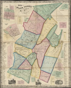
3461.
Map of Beverly
3462.
Map of Blair County, Pennsylvania : from special surveys
3463.
Map of Bohemia, Pensacola Bay, Florida
3464.
Map of Boston
3465.
Map of Boston : from the latest surveys
3466.
Map of Boston
3467.
Map of Boston : showing health districts and undrained and filled land
3468.
Map of Boston
3469.
Map of Boston : engraved expressly for Clark's Boston blue book
3470.
Map of Boston
3471.
Map of Boston : Dec. 1, 1908
3472.
Map of Boston
3473.
Map of Boston
3474.
Map of Boston
3475.
Map of Boston : showing health districts and undrained and filled land
3476.
Map of Boston : showing freight and passenger depots, grain elevators, steamboat wharves, etc
3477.
Map of Boston
3478.
Map of Boston 1862 : photographically reduced from the plans of James Slade, City Engineer : with all the latest improvements :...
3479.
Map of Boston, 1865 : photographically reduced from the city engineer's plans, with all the latest improvements, a complete...
3480.
Map of Boston 1872
‹ Prev
Next ›
1
2
…
170
171
172
173
174
175
176
177
178
…
435
436