Toggle navigation
LMEC Home
Exhibitions
Georeferencing
Tools for Teachers
Collections
My Favorites
Sign Up / Log In
Search
Search the map portal
Map Collection
Map Collection
Map Sets
Search
Search
Search for
Search In
All Fields
Creator
Title
Subject
Place
Search All Digital Collections
Advanced Search
8752 Results
My Search
Start Over
More Like
commonwealth:8049g9473
Remove constraint More Like: commonwealth:8049g9473
Filter your Search
Place
North and Central America
5,983
United States
4,900
Massachusetts
2,085
Europe
1,396
Suffolk (county)
1,048
Boston
1,021
Canada
460
Asia
438
more
Place
»
Topic
Boston (Mass.)--Maps
588
United States--Maps
282
Real property--Massachusetts--Boston--Maps
175
Massachusetts--Maps
166
Landowners--Massachusetts--Boston--Maps
133
New England--Maps
127
North America--Maps--Early works to 1800
103
New York (State)--Maps
85
more
Topic
»
Date
Date range begin
–
Date range end
Current results range from
1482
to
2023
View distribution
Creator
United States. Hydrographic Office
595
O.H. Bailey & Co
148
Des Barres, Joseph F. W. (Joseph Frederick Wallet), 1722-1824
123
United States. Post Office Dept
120
Ptolemy, 2nd cent
100
Walling, Henry Francis, 1825-1888
94
Geological Survey (U.S.)
86
Jefferys, Thomas, -1771
86
more
Creator
»
Format
Maps/Atlases
8,692
Manuscripts
217
Prints
56
Books
36
Objects/Artifacts
10
Drawings/Illustrations
8
Posters
5
Georeferenced
Yes
872
No
7,880
Collection
Norman B. Leventhal Map & Education Center Collection
8,698
Boston and New England Maps
2,239
Urban Maps
2,023
Maritime Charts and Atlases
1,083
American Revolutionary War-Era Maps
665
Boston Redevelopment Authority Collection
87
William L. Clements Library Collection
26
Maps from AAS
14
more
Collection
»
Available to use
No known restrictions
8,557
Creative Commons license
50
Search Constraints
Sort by relevance
relevance
title
date (asc)
date (desc)
Number of results to display per page
20 per page
10
per page
20
per page
50
per page
100
per page
View results as:
grid view
map view
Search Results
141.
Vereinigte Staaten von Nord-Amerika in 6 blattern, bl. 3
142.
Williams' telegraph and rail road map of the New England states, eastern portion of New York state and Canada
143.
15 lots of 440a each in Great Lot no. 4 of Macomb purchase : 6600 acres within 2 miles of the St. Lawrence Turnpike & 1/2 mile...
144.
1st. sheet of De Witt's state-map of New York
145.
An accurate map of New York in North America from a late survey
146.
A chorographical map of the northern department of North-America : drawn from the latest and most accurate observations
147.
Four wood lots in no 3
148.
Fragment of map showing two small fortifications
149.
French draught of Lake Champlain & Lake George with remarks of an English prisoner who return'd from Quebec to Fort Edward by...
150.
The Johnans. Turner farm
151.
M. Progues wood land
152.
A map of a piece of land surveyd for Peter Coem in lot no 3 belonging the Henry Livingston esqr & laid down from a scale of 10...
153.
Map of Genessee Lands
154.
A map of lot no 1 in the Hardenbergh Patent
155.
A map of New York showing counties, manors, townships, and estates, ca. 1778
156.
A map of New York showing counties, manors, townships, and estates, ca. 1778
157.
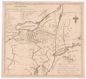
[Map of parts of Pennsylvania, New York and New Jersey]
158.
A Map of the country between Crown Point and Ford Edward
159.
A map of the middle states of North America, shewing the position of the Geneseo country comprehending the counties of Ontario...
160.
A map of the state of New York
‹ Prev
Next ›
1
2
…
4
5
6
7
8
9
10
11
12
…
437
438


![[Map of parts of Pennsylvania, New York and New Jersey]](https://bpldcassets.blob.core.windows.net/derivatives/images/commonwealth:6108vt40m/image_thumbnail_300.jpg)