Toggle navigation
LMEC Home
Exhibitions
Georeferencing
Tools for Teachers
Collections
My Favorites
Sign Up / Log In
Search
Search the map portal
Map Collection
Map Collection
Map Sets
Search
Search
Search for
Search In
All Fields
Creator
Title
Subject
Place
Search All Digital Collections
Advanced Search
1051 Results
My Search
Start Over
More Like
commonwealth:7h14cw76j
Remove constraint More Like: commonwealth:7h14cw76j
Filter your Search
Place
North and Central America
1,047
United States
1,042
Suffolk (county)
1,027
Boston
1,026
Massachusetts
724
Roxbury
53
South End
45
Downtown Boston
40
more
Place
»
Topic
Boston (Mass.)--Maps
752
City planning--Massachusetts--Boston--Maps
366
Urban renewal--Massachusetts--Boston--Maps
234
Real property--Massachusetts--Boston--Maps
131
Land use--Massachusetts--Boston--Maps
99
Buildings--Massachusetts--Boston--Maps
86
Landowners--Massachusetts--Boston--Maps
76
Local transit--Massachusetts--Boston--Maps
59
more
Topic
»
Date
Date range begin
–
Date range end
Current results range from
1743
to
2023
View distribution
Creator
Boston Redevelopment Authority
355
Geo. H. Walker & Co
27
Boynton, George W., d. 1884
21
Sampson, Davenport & Co
21
Sampson, Murdock & Co
20
Bromley, George Washington
18
Bromley, Walter Scott
17
Lufkin, Richard F. (Richard Friend)
17
more
Creator
»
Format
Maps/Atlases
1,051
Manuscripts
9
Prints
1
Georeferenced
Yes
99
No
952
Collection
Boston and New England Maps
870
Urban Maps
769
Norman B. Leventhal Map & Education Center Collection
630
Boston Redevelopment Authority Collection
403
American Revolutionary War-Era Maps
25
Mapping Boston Collection
20
Massachusetts Real Estate Atlases
12
William L. Clements Library Collection
10
more
Collection
»
Available to use
No known restrictions
983
Creative Commons license
34
Search Constraints
Sort by relevance
relevance
title
date (asc)
date (desc)
Number of results to display per page
20 per page
10
per page
20
per page
50
per page
100
per page
View results as:
grid view
map view
Search Results
41.
Metropolitan Transit Authority system route map
42.
Street railways of Boston and vicinity Jan. 1914
43.
T 1980 system map
44.
T system map : 1978-1979
45.
T system map
46.
Tracks operated by the Boston Elevated Railway Company January 1916
47.
The 1976 proposed regional open space plan
48.
Plan of portion of park system from Common to Franklin Park : including Charles River Basin, Charlesbank, Commonwealth Avenue,...
49.
Back Bay urban renewal area r-47 : community facilities & circulation plan
50.
Back Bay urban renewal area r-47 : existing circulation
51.
Charlestown project no. Mass r-42 (GN) : existing circulation
52.
East Boston urban renewal area r-44 : proposed circulation
53.
East Boston urban renewal area r-44 : existing circulation
54.
The Harbor Park system
55.
Parker Hill-Fenway urban renewal area r-48 : proposed circulation
56.
Parker Hill-Fenway urban renewal area r-48 : existing circulation
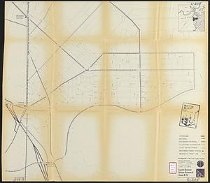
57.
South Boston urban renewal area r-51 : proposed circulation
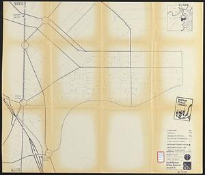
58.
South Boston urban renewal area r-51 : existing circulation
59.
1630 shoreline
60.
Major transportation system : Boston region MAPC area
‹ Prev
Next ›
1
2
3
4
5
6
7
…
52
53