Toggle navigation
LMEC Home
Exhibitions
Georeferencing
Tools for Teachers
Collections
My Favorites
Sign Up / Log In
Search
Search the map portal
Map Collection
Map Collection
Map Sets
Search
Search
Search for
Search In
All Fields
Creator
Title
Subject
Place
Search All Digital Collections
Advanced Search
1102 Results
My Search
Start Over
More Like
commonwealth:7h14cw669
Remove constraint More Like: commonwealth:7h14cw669
Filter your Search
Place
North and Central America
1,098
United States
1,093
Suffolk (county)
1,078
Boston
1,077
Massachusetts
768
Roxbury
59
South End
56
Fens
41
more
Place
»
Topic
Boston (Mass.)--Maps
752
City planning--Massachusetts--Boston--Maps
418
Urban renewal--Massachusetts--Boston--Maps
253
Real property--Massachusetts--Boston--Maps
136
Land use--Massachusetts--Boston--Maps
102
Buildings--Massachusetts--Boston--Maps
95
Landowners--Massachusetts--Boston--Maps
79
Local transit--Massachusetts--Boston--Maps
58
more
Topic
»
Date
Date range begin
–
Date range end
Current results range from
1743
to
2023
View distribution
Creator
Boston Redevelopment Authority
388
Geo. H. Walker & Co
27
Boynton, George W., d. 1884
21
Sampson, Davenport & Co
21
Sampson, Murdock & Co
20
Bromley, George Washington
18
Bromley, Walter Scott
17
Lufkin, Richard F. (Richard Friend)
17
more
Creator
»
Format
Maps/Atlases
1,101
Manuscripts
9
Drawings/Illustrations
3
Prints
1
Georeferenced
Yes
98
No
1,004
Collection
Boston and New England Maps
922
Urban Maps
822
Norman B. Leventhal Map & Education Center Collection
681
Boston Redevelopment Authority Collection
449
American Revolutionary War-Era Maps
25
Mapping Boston Collection
20
Massachusetts Real Estate Atlases
12
William L. Clements Library Collection
10
more
Collection
»
Available to use
No known restrictions
1,034
Creative Commons license
34
Search Constraints
Sort by relevance
relevance
title
date (asc)
date (desc)
Number of results to display per page
20 per page
10
per page
20
per page
50
per page
100
per page
View results as:
grid view
map view
Search Results
361.
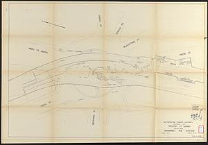
Tremont St. subway Boston, Mass. Haymarket Sq. Station
362.
Utility map, Washington Park project r-24
363.
Washington Park urban renewal area : building deficiencies
364.
Washington Park urban renewal area : existing land use
365.
Washington Park urban renewal area : building deficiencies
366.
Washington Park urban renewal area : building conditions
367.
Washington Park urban renewal area : treatment sections
368.
Washington Park urban renewal area : proposed treatment sections
369.
Washington Park urban renewal area : report on feasibility of placing utility services underground
370.
Washington Park urban renewal area Massachusetts r-24 : property map acquisitions
371.
Washington Park urban renewal area Massachusetts r-24 : property map acquisitions
372.
Washington Park urban renewal area r-24 : proposed treatment section boundaries
373.
Washington Park urban renewal area r-24 : zone district changes plan
374.
Washington Park urban renewal area r-24 : property map
375.
Washington Park urban renewal area r-24 : buildings with deficiencies
376.
Washington Park urban renewal area r-24 : building condition
377.
Washington Park urban renewal area r-24 : proposed zoning plan
378.
Washington Park urban renewal area r-24 : existing zoning
379.
660 Wakulah St., Roxbury
380.
Allston-Brighton open space plan site inventory
‹ Prev
Next ›
1
2
…
15
16
17
18
19
20
21
22
23
…
55
56