Toggle navigation
LMEC Home
Exhibitions
Georeferencing
Tools for Teachers
Collections
My Favorites
Sign Up / Log In
Search
Search the map portal
Map Collection
Map Collection
Map Sets
Search
Search
Search for
Search In
All Fields
Creator
Title
Subject
Place
Search All Digital Collections
Advanced Search
528 Results
My Search
Start Over
More Like
commonwealth:7h14cw448
Remove constraint More Like: commonwealth:7h14cw448
Filter your Search
Place
North and Central America
525
United States
522
Suffolk (county)
515
Boston
514
Massachusetts
215
Roxbury
54
Fens
51
South End
49
more
Place
»
Topic
City planning--Massachusetts--Boston--Maps
418
Urban renewal--Massachusetts--Boston--Maps
253
Boston (Mass.)--Maps
168
Land use--Massachusetts--Boston--Maps
101
Buildings--Massachusetts--Boston--Maps
81
Real property--Massachusetts--Boston--Maps
56
Fenway (Boston, Mass.)--Maps
55
Roxbury (Boston, Mass.)--Maps
50
more
Topic
»
Date
Date range begin
–
Date range end
Current results range from
1835
to
2020
View distribution
Creator
Boston Redevelopment Authority
369
Massachusetts Bay Transportation Authority
12
Downtown Waterfront Corporation
10
Victor Gruen Associates
10
Boston (Mass.). Parks and Recreation Department
8
Boston Elevated Railway Company
8
General Drafting Company
8
Lufkin, Richard F. (Richard Friend)
8
more
Creator
»
Format
Maps/Atlases
527
Drawings/Illustrations
3
Manuscripts
1
Prints
1
Georeferenced
Yes
7
No
521
Collection
Boston and New England Maps
485
Urban Maps
468
Boston Redevelopment Authority Collection
442
Norman B. Leventhal Map & Education Center Collection
142
Available to use
No known restrictions
526
Creative Commons license
1
Search Constraints
Sort by relevance
relevance
title
date (asc)
date (desc)
Number of results to display per page
20 per page
10
per page
20
per page
50
per page
100
per page
View results as:
grid view
map view
Search Results
21.
[Map of Boston, showing surface lines, proposed elevated lines, connecting surface lines and route of subway
22.
South End urban renewal area project Mass. r-56 : site preparation contract no. 16 street lighting and drainage
23.
Government Center project no. Mass. r-35 : proposed land use map
24.
Government Center project no. Mass. r-35 : subway adjustments plan
25.
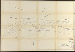
Tremont St. subway Boston, Mass. Haymarket Sq. Station
26.
Cooperative housing : Whitney Street
27.
Atlas of the city of Boston : Roxbury : from actual surveys and official plans
28.
Atlas of the city of Boston : Roxbury : from actual surveys and official plans
29.
Atlas of the city of Boston : Roxbury : from actual surveys and official plans
30.
Atlas of the city of Boston : Roxbury : from actual surveys and official plans
31.
Atlas of the city of Boston : Roxbury, Mass. : volume three : from actual surveys and official records
32.
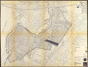
Fenway urban renewal area : blighted areas
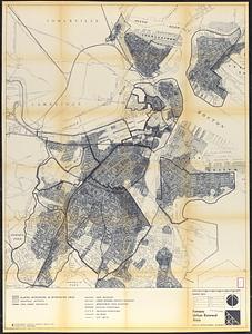
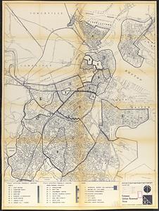
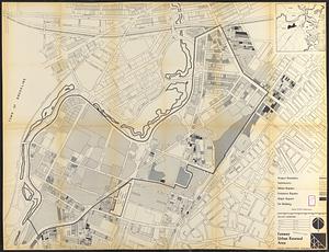
33.
Fenway urban renewal area : locality map
34.
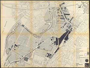
Fenway urban renewal area : existing land use
35.
Fenway urban renewal area : building conditions
36.
Fenway urban renewal area : treatment areas
37.
Fenway urban renewal area Massachusetts : disposition parcels
38.
Fenway urban renewal area Massachusetts : disposition parcels
39.
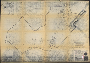
Fenway urban renewal area Massachusetts : building deficiences and proposed treatment area
40.
Fenway urban renewal area Massachusetts : property map
‹ Prev
Next ›
1
2
3
4
5
6
…
26
27