Toggle navigation
LMEC Home
Exhibitions
Georeferencing
Tools for Teachers
Collections
My Favorites
Sign Up / Log In
Search
Search the map portal
Map Collection
Map Collection
Map Sets
Search
Search
Search for
Search In
All Fields
Creator
Title
Subject
Place
Search All Digital Collections
Advanced Search
514 Results
My Search
Start Over
More Like
commonwealth:7h14cw20p
Remove constraint More Like: commonwealth:7h14cw20p
Filter your Search
Place
North and Central America
511
United States
508
Suffolk (county)
501
Boston
500
Massachusetts
197
Roxbury
90
South End
51
Fens
47
more
Place
»
Topic
City planning--Massachusetts--Boston--Maps
418
Urban renewal--Massachusetts--Boston--Maps
253
Boston (Mass.)--Maps
136
Land use--Massachusetts--Boston--Maps
101
Roxbury (Boston, Mass.)--Maps
89
Buildings--Massachusetts--Boston--Maps
85
Real property--Massachusetts--Boston--Maps
77
Fenway (Boston, Mass.)--Maps
48
more
Topic
»
Date
Date range begin
–
Date range end
Current results range from
1832
to
2003
View distribution
Creator
Boston Redevelopment Authority
369
Bromley, George Washington
17
Bromley, Walter Scott
17
G.W. Bromley & Co.
12
Downtown Waterfront Corporation
10
Victor Gruen Associates
10
Boston (Mass.). Parks and Recreation Department
8
Sasaki Associates
6
more
Creator
»
Format
Maps/Atlases
513
Drawings/Illustrations
3
Manuscripts
1
Prints
1
Georeferenced
Yes
6
No
508
Collection
Boston and New England Maps
502
Urban Maps
487
Boston Redevelopment Authority Collection
441
Norman B. Leventhal Map & Education Center Collection
124
Massachusetts Real Estate Atlases
4
Applied Geographics, Inc. Records
1
Mapping Boston Collection
1
Available to use
No known restrictions
508
Creative Commons license
1
Search Constraints
Sort by relevance
relevance
title
date (asc)
date (desc)
Number of results to display per page
20 per page
10
per page
20
per page
50
per page
100
per page
View results as:
grid view
map view
Search Results
201.
Illustrative re-use site plan for the regional core
202.
Illustrative site plan : Government Center
203.
Illustrative site plan : a proposal for community review South End/Lower Roxbury development policy
204.
Illustrative site plan : South End urban renewal area, Massachusetts r-56
205.
Illustrative site plan : a proposal for community review South End/Lower Roxbury development policy
206.
Index to planning districts
207.
Inner belt, Southwest Expressway
208.
Jamaica Plain urban renewal area r-49 : building conditions
209.
Jamaica Plain urban renewal area r-49 : existing population density
210.
Jamaica Plain urban renewal area r-49 : existing and proposed community facilities
211.
Jamaica Plain urban renewal area r-49 : proposed land use
212.
Jamaica Plain urban renewal area r-49 : existing land use
213.
Jamaica Plain urban renewal area r-49 : proposed circulation
214.
Jamaica Plain urban renewal area r-49 : existing circulation
215.
Jamaica Plain urban renewal area r-49 : proposed treatment and title I projects
216.
Land use New York streets - South Cove 1953
217.
Locality map
218.
Long Wharf DEM/BRA master plan : master plan scheme
219.
Long Wharf DEM/BRA master plan : proposed dredging scheme
220.
Long Wharf phase II illustrative plan
‹ Prev
Next ›
1
2
…
7
8
9
10
11
12
13
14
15
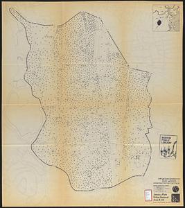
…
25
26