Toggle navigation
LMEC Home
Exhibitions
Georeferencing
Tools for Teachers
Collections
My Favorites
Sign Up / Log In
Search
Search the map portal
Map Collection
Map Collection
Map Sets
Search
Search
Search for
Search In
All Fields
Creator
Title
Subject
Place
Search All Digital Collections
Advanced Search
8699 Results
My Search
Start Over
More Like
commonwealth:7h14b5116
Remove constraint More Like: commonwealth:7h14b5116
Filter your Search
Place
North and Central America
5,930
United States
4,848
Massachusetts
2,079
Europe
1,396
Suffolk (county)
1,046
Boston
1,019
Canada
449
Asia
438
more
Place
»
Topic
Boston (Mass.)--Maps
586
United States--Maps
282
Real property--Massachusetts--Boston--Maps
175
Massachusetts--Maps
162
Landowners--Massachusetts--Boston--Maps
133
North America--Maps--Early works to 1800
103
New England--Maps
102
Europe--Maps
79
more
Topic
»
Date
Date range begin
–
Date range end
Current results range from
1482
to
2023
View distribution
Creator
United States. Hydrographic Office
595
O.H. Bailey & Co
148
Des Barres, Joseph F. W. (Joseph Frederick Wallet), 1722-1824
123
United States. Post Office Dept
119
Ptolemy, 2nd cent
100
Walling, Henry Francis, 1825-1888
94
Geological Survey (U.S.)
86
Jefferys, Thomas, -1771
85
more
Creator
»
Format
Maps/Atlases
8,639
Manuscripts
215
Prints
56
Books
36
Objects/Artifacts
10
Drawings/Illustrations
8
Posters
5
Georeferenced
Yes
869
No
7,830
Collection
Norman B. Leventhal Map & Education Center Collection
8,694
Boston and New England Maps
2,233
Urban Maps
2,023
Maritime Charts and Atlases
1,083
American Revolutionary War-Era Maps
621
Boston Redevelopment Authority Collection
87
William L. Clements Library Collection
5
Available to use
No known restrictions
8,552
Creative Commons license
47
Search Constraints
Sort by relevance
relevance
title
date (asc)
date (desc)
Number of results to display per page
20 per page
10
per page
20
per page
50
per page
100
per page
View results as:
grid view
map view
Search Results
1.
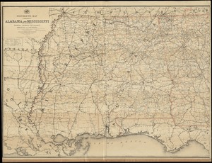
Post route map of the states of Alabama and Mississippi with adjacent parts of Florida, Georgia, Tennessee, Arkansas and...
2.
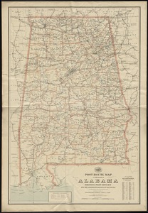
Post route map of the State of Alabama showing post offices with the intermediate distances on mail routes in operation on the...
3.
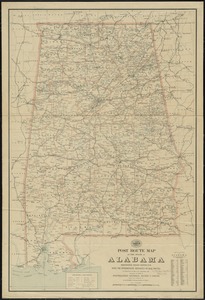
Post route map of the state of Alabama showing post offices with the intermediate distances on mail routes in operation on the...
4.
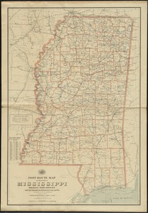
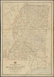
Post route map of the state of Mississippi showing post offices with the intermediate distances on mail routes in operation on...
5.
Post route map of the state of Mississippi showing post offices with the intermediate distances on mail routes in operation on...
6.
Map of Louisiana, Mississippi and Alabama : constructed from the latest authorities
7.
Mississippi Territory and Georgia
8.
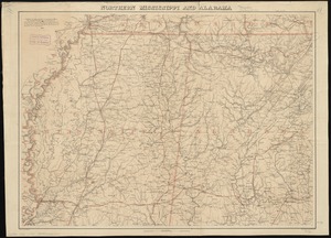
Northern Mississippi and Alabama
9.
[Northern Mississippi and Alabama
10.
Carte composée des differens ouvrages de messieurs les ingenieurs qui ont eté à Louisiane, avec les renvois alphabetiques de...
11.
A map of part of West Florida done under the direction of the honourable John Stuart esqr: & by him humbly inscribed to his...
12.
The country of So red the rose, by Stark Young, Scribners
13.
From Vicksburg to New Orleans
14.
Map of a part of Louisiana and Mississippi, illustrating the operations of the U.S. Forces in the Department of the Gulf
15.
Map of the lands in Mississippi ceded by the Chickasaws to the United States in 1832 and 1834
16.
Scarborough's new county and post office map of Louisiana and Mississippi : with complete index giving population and location...
17.
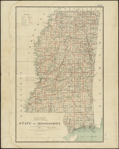
State of Mississippi
18.
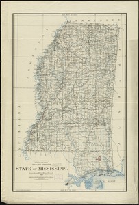
State of Mississippi
19.
Alabama
20.
Map of Alabama, showing location of property owned by the Fort Payne Coal & Iron Company
‹ Prev
Next ›
1
2
3
4
5
…
434
435